At the 2015 NYGeoCon in Albany, I presented a paper focusing on several GIS applications which often support and justify GIS/geospatial development at the local level. I refer to these applications and program areas as the “GIS Common Core” and it was my intent to use the presentation as a starting point to expand the discussion further as part of this blog.
While some of the GIS Common Core program areas are not new to the discussion, several factors have contributed to elevating these day-to-day GIS functional areas to the mainstay of local government geospatial efforts. Though these factors and opportunities vary greatly across the state, some of the more obvious reasons why “GIS Common Core” applications are becoming the foundation of local government programs include:
- Improved large-scale spatial data integration across key business applications (assessment-inspections-permitting-public safety-utilities)
- Better address standardization as a result of E911 implementation
- Significant improvements on the integration between GIS and AutoCAD technologies
- Establishing capacity to fulfill ongoing/permanent regulatory and reporting requirements (MS4)
- Broad deployment of software programs in which using/collecting/maintaining X,Y data is implicit and available by default; GIS/geospatial is often no longer considered an “optional” feature
- Leveraging flexible, easy-to-use browser-based applications which are accessible in a wide range of environments, particularly in the growing government mobile work force. A work force which expects maps anywhere anytime.
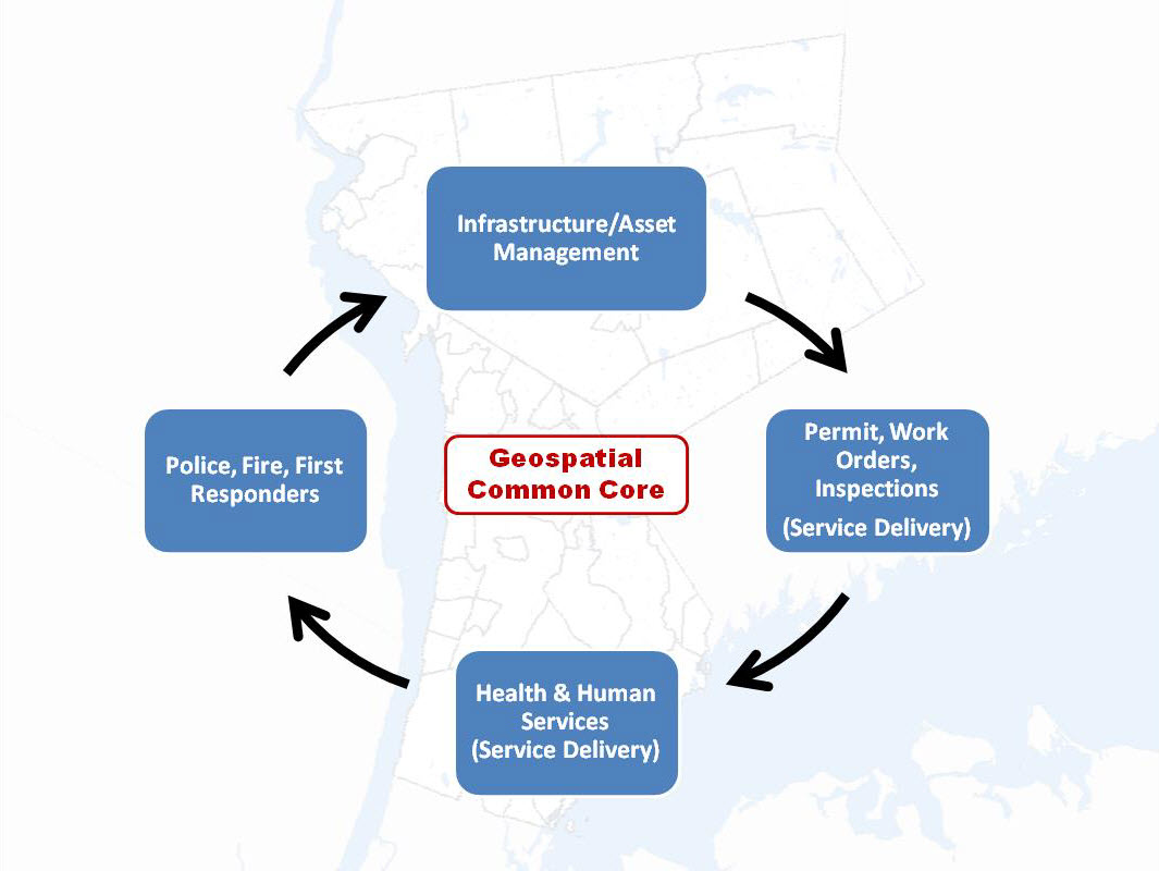
“GIS Common Core” application areas in New York State local governments