
While the recent statewide GIS conference in Lake Placid featured several presentations and vendor displays in emerging areas of geospatial development across the Empire State, one presentation – and an interactive one no less – was certainly one of the most refreshing and welcomed. Why’s that, you ask? Well, consider the following: (1) it contains no technical jargon or software programming speak, fancy charts or diagrams, (2) has connections to the educational community, (3) applicable anywhere in the Empire State, (4) absolutely and completely different, and (5) suitable for all ages – Rated “G”! Yes, the New York Giant Traveling Map which was presented by Susan B. Hoskins, Senior Extension Associate at Cornell University.
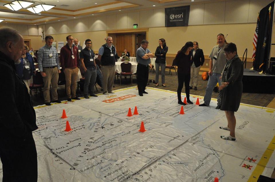
Susan B. Hoskins demonstrates use of the NYS Giant Traveling Map to conference attendees during 2017 GeoCon in Lake Placid. Note: No shoes allowed – the geoenabled version of the game Twister?
The Map
In celebration of the 30th anniversary of state geographic alliances, National Geographic produced a Giant Traveling Map for each state. Two copies were gifted to the New York Geographic Alliance in 2016 headed by Timothy McDonnell, geosciences faculty at Monroe Community College in Rochester. Since then the New York 4-H Geospatial Sciences program has gotten involved to help promote the map in 4-H programs and classrooms statewide. The 4-H Geospatial Science and Technology Program, within Cornell Cooperative Extension, provides educator professional development in GPS, GIS and the tools of remote sensing. The geography lessons learned on the Giant Traveling Map are fundamental to using technology in map making. Many youth and adult mentors take these skills and technology lending library and apply them to community mapping projects.
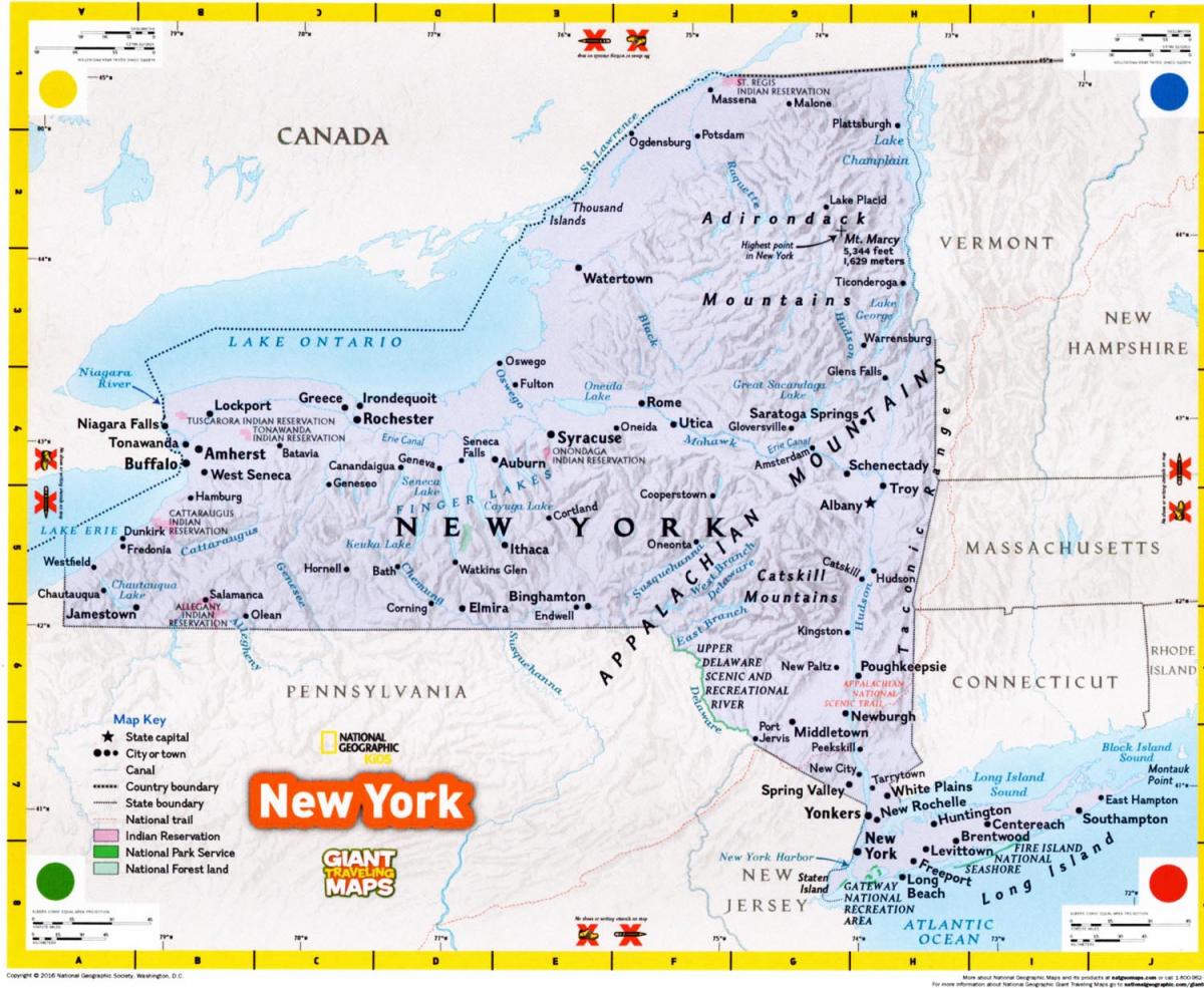
The Giant Traveling Map of New York, measures 15 X 20 feet and includes major cities, water bodies, mountains, Indian Reservations and National Parks.
The map “kit” comes complete with a curriculum of six activities that help youth explore map features and symbols, grids, map scale, orientation and direction, and the basics of Geographic Information Systems. Props included in the kit are orange cones for marking points, yellow plastic chain, blue yarn and a ball of string to map “linear features, a compass rose and map legends. Teachers and users of the map can determine how far is it from New York City to Albany by comparing one’s foot to the scale bar and walk along the Hudson River. Or finding the Erie Canal? Follow the canal path from Albany to B-uf-fa-lo-ooo, just like the song.
To date, the following schools and organizations have hosted the Map: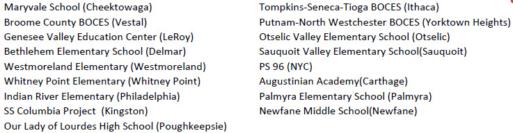
Additionally, McDonnell states: “The Map can be used in middle schools to support 7th Grade curriculums for social studies which includes New York history and geography”. The Geographic Alliance maintains other resources specifically designed for middle school including The Atlas of New York: Legacies of the Erie Canal and Lessons for the Atlas of New York. More information can be found under the Resources link on their website.
The Map Travels to Westchester County
After the Lake Placid conference, the Map traveled to Solomon Schechter elementary school in White Plains where it was used by 4th grade teacher Amy Sroka who expressed accolades after having used the map.. After a week in the classroom, one of Ms. Sroka’s students commented:
“ I learned a bunch of names of different towns and cities. It was really fun trying to find the locations of a lot of the places. While I was studying the map, I discovered that there are actually so many more mountains in New York State than I had thought there were…I really enjoyed the map!”
If your school, family gathering, or organization is interested in using the Map, contact Tim McDowell at the New York Geographic Alliance. It is also available for sale through National Geographic for $750.