10 Questions: ChatGPT for New York State GIS

I thought I was going to get out in front of all the ChatGPT for GIS discussion for the New York State GIS community, but that turned out to be off by a magnitude of sorts.  YouTube is already replete with ChatGPT for GIS tutorials and if we wait until next week there will probably be another ChatGPT alternative.  (I found the Matt Forrest YouTube video a good ChatGPT for GIS intro – actually formed a question after one of his examples).  Even Amazon jumped into the frey recently with their Amazon Bedrock option.  Take your pick, Bing Chat, Chatsonic, YouChat, Google Bard (available via a waiting list) and a whole host of others on the market in 2023. 

No, the robots aren’t taking over and I suspect we won’t see any of the early Terminator Cyberdyne Systems androids applying for your local GIS Analyst position anytime soon – though it might be a solution for those long dreadful digitizing jobs in the cart lab.  One way or another, Chatbot AI technology is definitely here to stay, evolve, and become another piece of the geospatial toolbox.  

Nothing specific or implied in any the questions.  Just random chains of thought though it does take a little getting used to putting the questions together vs. a basic Google search.  And it does seem to help to refresh and ask the same question twice – or even three times – to get more detailed results.  Never was a programmer, so a little short on questions in that space.

A lot here.  Actually 17 questions in all.  Straight copy and paste. Skim through as you want – find a topic/question you might be interested in.  There are tons more which could have been included.

Without any further adieu, my first machine interview: 

eSpatiallyNewYork:  What freshwater fish datasets are best for mapping fish population based on water depth in the Great Lakes?

ChatGPT:  There are several freshwater fish datasets that can be useful for mapping fish populations based on water depth in the Great Lakes. Here are a few options:

  1. Great Lakes Acoustic Telemetry Observation System (GLATOS) – This dataset provide information on the movements and behaviors of tagged fish in the Great Lakes.  It includes data on depth, temperature, and location, which can be used to create maps of fish populations based on water depth.
  2. Great Lakes Fishery Commission (GLFC) – The GLFC maintains a database of fish populations in the Great Lakes.  This dataset includes information on fish specifies, size, and location, which can be used to map fish population based on water depth.
  3. Great Lakes Environmental Database (GLENDA) – GLENDA is a comprehensive database of environmental data for the Great Lake region.  It includes information on water depth,  temperature, and environmental factors that can be used to map fish populations.
  4. USGS Great Lakes Science Center – The USGS Great Lakes Science Center conducts research on fish populations in the Great Lake and maintains a database of fish surveys.  This dataset includes information on fish species, abundance, and location which can be used to map fish populations based on water depth.

Ultimately, the best freshwater fish dataset for mapping fish populations based on water depth in the Great Lakes will depend on the specific research question and the type of analysis being conducted.

eSpatiallyNewYork:  To what degree of accuracy can I map features from New York State orthophotography?

ChatGPT:  The degree of accuracy with which you can map features from New York State orthophotography depends on various factors such as the resolution of the imagery, the accuracy of the ground control points used for georeferencing, and the skill and expertise of the analyst.

New York State orthophotography typically has a resolution ranging from 0.5 to 1 meter, which means that individual features such as buildings, roads, and other infrastructure can be identified and mapped with a reasonable level of accuracy. However, mapping smaller features such as individual trees, shrubs, or small structures may be more challenging, as these features may not be visible at this resolution.

The accuracy of mapping also depends on the quality of the georeferencing. The accuracy of the ground control points used for georeferencing should be of a similar or higher resolution than the orthophotography itself. This ensures that the imagery is correctly aligned with the ground, allowing for accurate measurements and mapping.

The skill and expertise of the analyst are also critical factors in the accuracy of mapping features from orthophotography. A trained analyst with experience in image interpretation and feature extraction techniques can accurately identify and map features with a high degree of accuracy.

Overall, mapping features from New York State orthophotography can provide a reasonable degree of accuracy for larger features such as buildings, roads, and other infrastructure. However, mapping smaller features may require higher resolution imagery or other sources of data. It is always important to validate and verify the accuracy of the mapping results through ground truthing and other quality control measures.

Continue reading

Campus Planning and Geospatial Technologies at UAlbany

GIS used in many areas alongside engineering and architectural applications

College and university campuses are the home for a vast amount of geospatial data covering both the natural and built environments.  Whereas at the beginning of geospatial era there was a clear and defined digital divide – GIS vs. CAD –  today these technologies have evolved to be used and managed together almost seamlessly.  In this space since the early 2000’s we’ve seen the evolution of the Building Information Model (BIM) in along with drone, GPS, and laser scanning technologies serving as a means to capture and generate additional types of geospatial data both indoor and outdoor.  GIS concepts are also important elements integrated into Enterprise Asset Management (EAM), Computer-Aided Facilities Management (CAFM) and Computerized Maintenance Management System (CMMS) solutions.

Built around the geospatial framework which also includes standards for both data collection and data management, GIS applications in campus settings are leveraged by both GIS specialists and engineers alike.  Common program areas include covering areas such as master plan support, space programming, work order management, asset management, emergency management, real estate and portfolio management, environmental and regulatory compliance, and site selection studies among others.

While traditional GIS and engineering software applications such as ArcGIS and AutoCAD support much of the outdoor mapping, facility managers increasingly use a more indoor specific software programs such as Revit, Autodesk BIM 360 Ops, Cartegraph, and ESRI’s relatively new entry into this space ArcGIS Indoors, among others.   In reality, automated systems at large facilities involve a combination of the programs noted above and often also integrate other monitoring and SCADA systems.   If you are new to GIS and geospatial applications to the campus setting, here is a good overview presentation.

Campus Planning at UAlbany

Many of these geospatial-related disciplines intersect directly – and indirectly-  in the Office of Campus Planning at UAlbany which is charged with the overall planning of physical space on campus (indoor and outdoor), capital and operating funding, and supporting the strategic plan of the University.   The office currently has a team of eight which includes Jessie Pellerin who serves as GIS and Signage and Wayfinding Manager.

Jessie is involved with several elements of GIS data collection and cartographic products associated with the UAlbany facilities for the uptown, downtown, and Alumni Quad campuses – including the production of hardcopy maps which are still an important communications and outreach component for visitors and students new to campus.   Nearly all of her day-to-day work is done with ArcGIS Pro.  Field data collection is normally supported with Collector for ArcGIS on an iPad and for offline viewing.

Jessie produces all of the UAlbany maps using just ArcGIS Pro without the use or addition of any desktop publishing software

With regard to above and underground features on, the 500-acre uptown camps, she helps manage a GIS database which includes 122 emergency blue light phone locations, 16.5 miles of storm sewer pipes and 760 catch basin, 6.4 miles of sanitary sewer pipes, 1500 light poles and 12 miles of roads among dozens of other features. Jessie also oversees individual data collection projects conducted by vendors such as the campus wide light poles and irrigation system.   She serves as the ArcGIS Online Administrator for the Office supporting and maintaining several customized viewers for 50 staff across campus in specific work program areas.

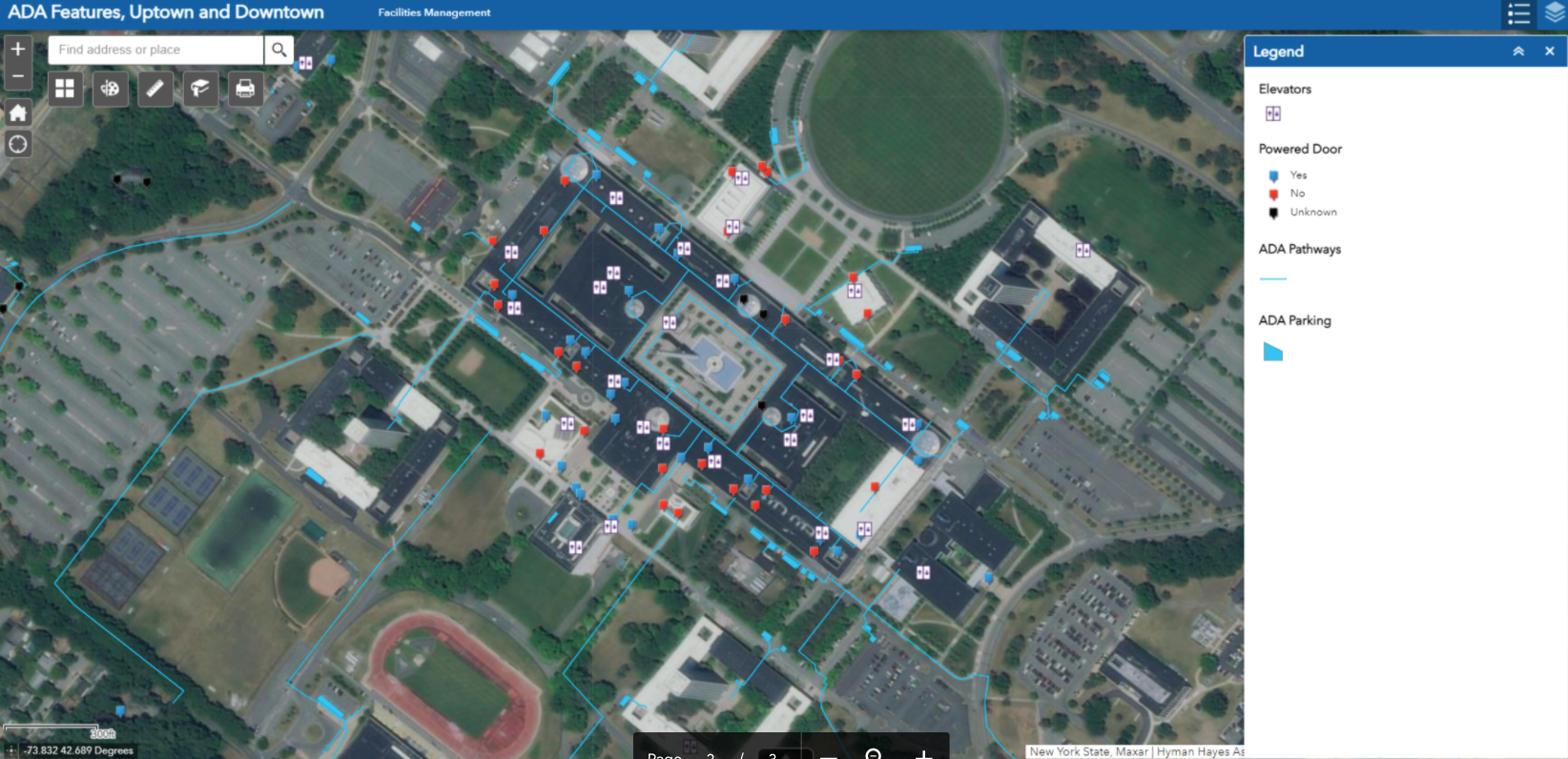
One of internal AGOL viewers Ms. Pellerin supports focuses on the locations of accessibility features on the Uptown and Downtown Campus. Pop-ups include more information for each feature. Data was developed from a campus-wide accessibility study.

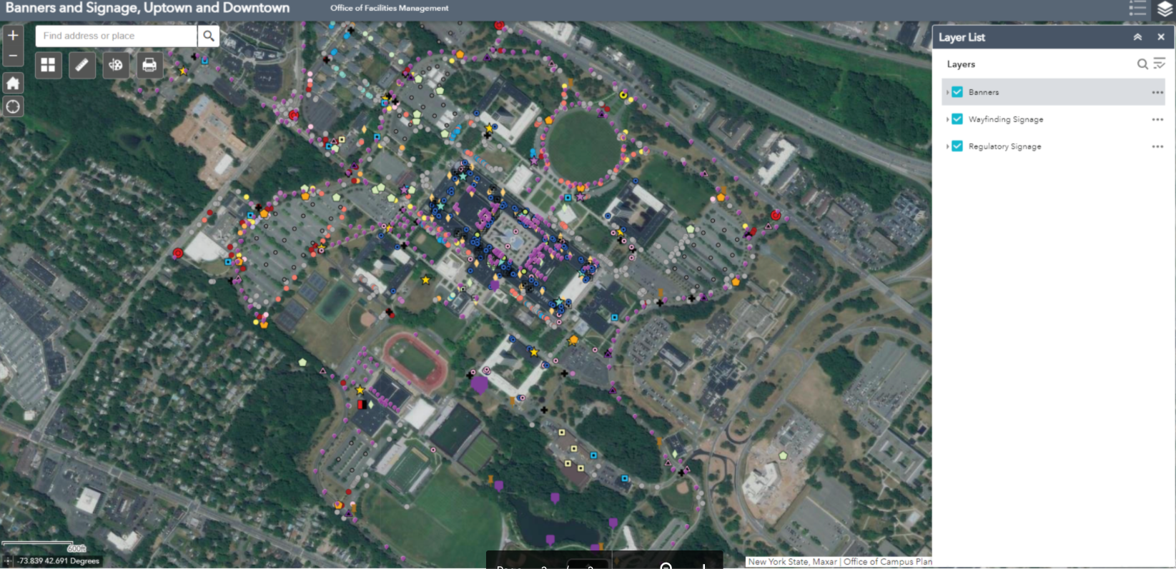
Another viewer shows the location of the exterior wayfinding and regulatory signage and banners on campus. With over 500 exterior wayfinding signs, 750 regulatory signs, and 550 banners, GIS has been essential in keeping track of sign content and condition for aiding in preventative maintenance, site planning, and branding initiatives. Both of the above viewers were built with Web App Builder.

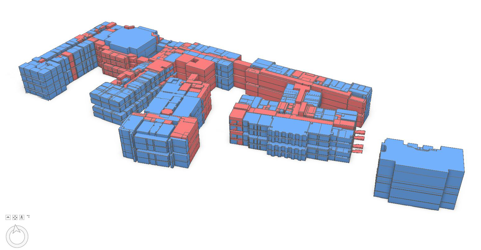
An example of how space planning is supported using GIS at UAlbany. This graphic shows a 3D visualization of assignable space on the Downtown Campus

As part of supporting the university’s COVID-19 response, Jessie assisted with others by using combining mapped sewer line and manhole data with the occupancy count of each of the residential dorms, to determine the optimal locations for the waste water testing sites in 2020. There ended up being six manholes selected (out of the 282 on campus). Maps were shared with other stakeholders in the project.    

As it relates to campus settings, GIS use is growing and being used more often in buildings and facilities planning by campus staff” notes Stu Rich, Director, Buildings and Infrastructure at Cartegraph.  Initially, as outdoor GIS concepts and technology were beginning to be applied to the indoor environments, cost was often a barrier to get started in building BIM and interior models for many organizations.  “Those barriers are beginning to change” Rich further adds, “While precision indoor mapping will always require higher-end instrumentation, recent products such as MagicPlan and IndoorVu, as well as falling software prices, are making interior mapping and data capture more affordable for large facilities management programs.   All of these products and technologies are now broadly used in facilities management and integrated with GIS applications.”

Recognizing the importance and growth of using digital data both in-house and with the numerous engineering companies performing work on campus, both the Office of Campus Planning and the Office of Architecture, Engineering, & Construction Management (AECM) have developed digital data standards for BIM, GIS, and AutoCAD.

Summary

Large campus facilities such as SUNY Albany bring together the intersection of several geospatial technologies.  Individually each seemingly used or applied for one specific purpose (and often at varying levels of spatial accuracy) but when mashed together in a just web viewer, provide easy access to a wide range of authoritative digital content for decision-makers. Sure signs of the growing maturity and acceptance of geospatial technologies.

Contact:

Ms. Jessie L. Pellerin
GIS and Signage and Wayfinding Manager
Office of Campus Planning
University at Albany, State University of New York
jpellerin@albany.edu

Geospatial Business Spotlight: Maine Technical Source

NY Locations:     787 Old Sergeant Palmateer Way, Wappingers Falls NY
                              2634 James Street, Syracuse NY

Website:               www.mainetechnical.com 

Employees:          18

Established:         1973


The Company:

Maine Technical Source (MTS) sells, services, and supports high-end instrumentation for the geospatial industry as well as the surveying, engineering, and construction sectors throughout New England.  New York State offices are located at 787 Old Sergeant Palmateer Way in Wappingers Falls, & 2634 James Street in Syracuse. 

Gus MacDonald started the company over 45 years ago and more than half of the MTS employees have been with the company for more than fifteen years.  In June 2017, Stuart MacDonald purchased the company with a commitment to continuing the legacy of meeting customer needs.   Maine Technical Source employees are singularly focused on providing exemplary customer service.

MTS is a member of the New York State Association of Professional Land Surveyors (NYSAPLS).  

Products and Technology:

MTS provides a wide range of traditional industry products as well as state-of-the-art components now available in emerging and laser scanning technologies.  A complete listing of products can be found as part of the MTS online catalog.  

Illustrative products common to the geospatial, BIM and AEC applications include:

Field Mapping

Leica Zeno Mobile is a complete tool for high accuracy field data capture with the simplicity of an Android app.  Managing assets has never been easier via it’s intuitive user interface and functionality.  Users can export collected data to the PC as shape files, ASCII or KMZ, either in classic way via cable, USB or using the cloud with Dropbox. The app also comes pre-loaded with aerial imagery.  Learn more about Leica Zeno GIS technology via online training videos here.

UAV Solutions

MTS offers complete UAV solutions for the surveying, mapping and construction industries enabling fast and flexible data collection.  Systems capture, process and analyze millions of data points depicting highly accurate spatial information of the natural and built environment.   One of MTS’s more popular drone solutions is the DJI Phantom 4 RTK which is one the most compact and accurate low altitude mapping UAV devices. 

The Leica Aibot SX focuses on UAV data capture in the surveying geomapping, and asset  disciplines enabling users to create orthophotos, point clouds, and 3D models for cadastral survey and data collection. Leica Aibot CX focuses on UAV data capture in the construction industry providing up-to-date views over construction projects and earthmovings.  It also opens opportunities for daily progress documentation, stockpile monitoring and resource tracking to increase efficiency.

WingtraOne Gen II is a vertical take-off and landing (VTOL) sUAS for mapping of small and large areas.  It utilizes a high resolution Sony DSLR camera platform and post-processing kinematic(PPK) to provide precise geotagging of the images.  As a VTOL drone it can take off and land like a quad-copter and then transition into level flight as a fixed wing.  With the high-resolution camera it can fly missions higher and faster than a quadcopter with outstanding ground sampling distance (GSD) results.

MTS is a Pix4Dmapper reseller which is the the leading photogrammetry software for professional drone mapping.  Users can capture RGB, thermal, or multispectral images with any camera.  Pix4Dmapper’s photogrammetry algorithms transform  ground or aerial images in digital maps and 3D models. 


Field Tablets

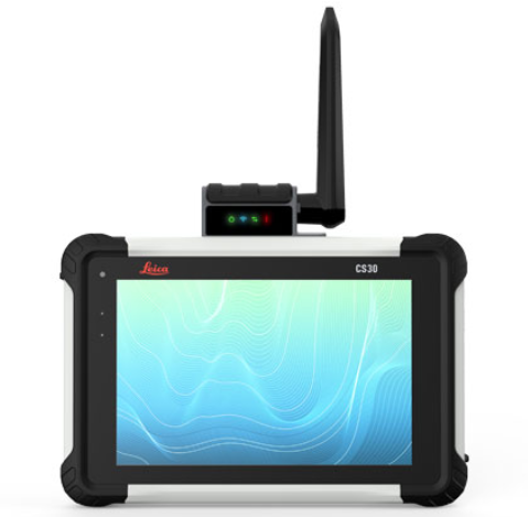
Leica CS30 Data Collector is the best of both worlds – light weight (1.67 lbs) and compact yet with a screen size (7”) big enough for use all day long.  Equipped with an LCD IPS screen to provide an optimal color clarity, as well as a much improved and increased viewing angle. The unit also has an ambient light sensor for improved visibility in all lighting conditions.  Portable to fit into a field bag or typical pickup truck glove box.  Other similar devices MTS offers include the Carlson RT4 and the Sokkia SHC6000

Laser Scanners

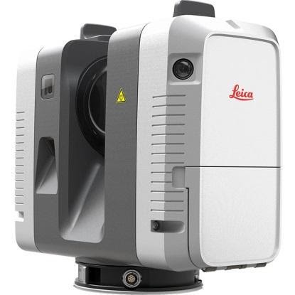
MTS focuses on providing and supporting Leica Systems laser scanning technology including the new highly portable RTC360.  Intuitive and designed for maximum productivity, this unit efficiently combines the RTC360 high-performance 3D laser scanner, a Leica Cyclone FIELD 360 mobile-device app or automatically registering scans in real time, and the Leica Cyclone REGISTER 360 office software.  Depending on the specific application area of use, MTS also offers HDS software for integration into the AutoCAD, Revit, and MicroStation platforms among others.  Here is a RTC360 video

For a complete listing of all MTS products, visit their website.  

Contact:

Stuart MacDonald, President smacdonald@mainetechnical.com
Bill Treadwell, GIS Sales btreadwell@mainetechnical.com
Brad Beeler, Wappingers Falls brad.beeler@mainetechnical.com
David Filipski, Syracuse dfilipski@mainetechnical.com

Geospatial Business Spotlight: Woodard & Curran

Location:                      Rye Brook, New York (Other Locations Nationwide)

Website:                       Rye Brook & Corporate

Employees:                 30 Rye Brook Office / 1,200 Nationwide

Established:                1979

The Company

Woodard & Curran is a privately held, national integrated engineering, science, and operations company. It was founded in 1979 by  Frank Woodard and Al Curran with a mission to provide a safe and enjoyable place to work with opportunity, integrity, and commitment, and to attract talented people. Woodard & Curran experts are devoted to their work which is reflected in exemplary project and program results for both public and private clients. Through a multidisciplinary approach, Woodard & Curran strives to solve clients’ technical and business problems, routinely finding unique and cost effective solutions for their clients.

Geospatial Software and Technologies:

A registered ESRI Business Partner, Woodard and Curran’s geospatial team offers the following services:

  • Needs Assessment & Implementation Planning
  • ArcGIS Online (AGOL) Configuration & Management
  • ArcGIS Enterprise Planning & Implementation
  • Paper to Digital Conversion
  • Data Standards Development
  • Field Data Collection
  • Data Integration
  • Database Design & Administration
  • Map Production
  • Web GIS Development
  • Mobile Application Development
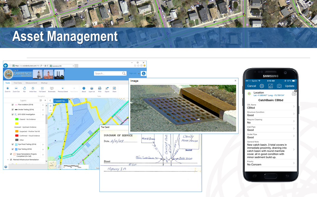
  • Asset Management Planning and Implementation
  • Computerized Maintenance Management System (CMMS) Integration
  • GIS and GPS Training

Geospatial Products and Services:

Woodard & Curran’s geographic information system (GIS) experts leverage the latest technologies to transform outdated data management processes into practical, efficient, and effective solutions for public and private clients. As a registered ESRI Business Partner, Woodard & Curran uses ArcGIS Online’s powerful platform to optimize spatial data through web maps and workflow specific applications for internal or public use. Woodard & Curran customized ESRI’s ArcGIS Online and Portal environments  provide clients with secure permission-based access for individual users to view, edit, or analyze data. Specific geospatial programs supported include:

ArcGIS Online Jumpstart Program

Focusing on the ArcGIS Online framework, Woodard & Curran provides customized, certified GIS professional assistance to organizations getting started with AGOL by offering:

    • Initial setup and configuration of an ArcGIS Online environment;
    • Prioritizing web maps and applications;
    • Instructions on setup, configuration, and use of web maps and applications;
    • Ongoing training for those responsible for managing AGOL environment

 GIS Enterprise Solutions

Woodard & Curran offers professional services for the full suite of ESRI ArcGIS products including ArcGIS Desktop, ArcGIS Enterprise, and ArcGIS Online along with extensions and add-ons. Such client services are offered on premise or remotely depending on the nature of the GIS professional services being provided. This work includes support for GIS needs assessments, data conversion & migration, and design & implementation of new GIS environments for clients just starting out with GIS. For clients with more mature GIS environments, Woodard & Curran professional staff also provide advanced GIS Strategy and Planning, System Integrations, or Advanced System Architecture and Design Services.

Field Data Collection Solutions

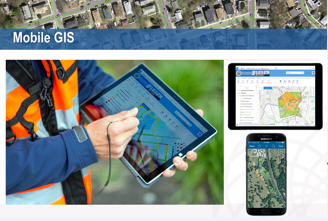
Woodard & Curran’s geospatial experts help clients identify, configure, and implement a variety of field and mobile data collection solutions.  Field data collection can include the inventory or field verification of assets using mobile technologies including smart phones, tablets, and Global Positioning System (GPS) devices. Depending on the needs of the project, information can be collected with varying degrees of location accuracy ranging from sub-meter to centimeter. Mobile data collection applications, such as ESRI Field Maps and Survey 123, and GPS solutions allow for accurate updates to be made in the field for real-time data management.

Mobile data collection is a “must-have” app for the engineering disciplines. Woodard & Curran designs and deploys a wide variety across many platforms.

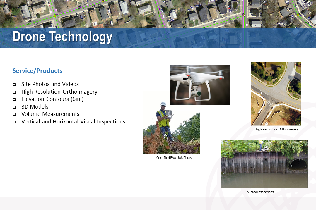
Woodard & Curran’s GIS experts also offer drone services to access terrain or infrastructure that may be too vast or pose safety concerns with numerous FAA certified small unmanned aircraft system (sUAS) and drone pilots.  Drones produce high resolution orthoimages, elevation contours, three-dimensional and land use analysis, volume measurements, planimetric maps, and vertical or horizontal visual measurements.

Woodard & Curran has FAA licensed UAS operators which help support many types of field data collection projects. Drones are increasingly being used to access sites which are either inaccessible or unsafe for field workers to get to.

Asset Management Technology

While asset management (AM) plans operate on a long-term vision, these plans rely on hundreds of daily dynamic inputs. And keeping track of these data points and life-cycle strategies requires a comprehensive AM technology program.

AM technology applications must be chosen carefully because they will store critical asset information, administer aspects of maintenance process and provide critical information to users when needed. These applications should fit both current and future needs, while providing the functionality necessary to maintain critical assets effectively. In supporting geospatial applications in this space, Woodard & Curran leverages business intelligence (BI) software, such as Microsoft PowerBI and ArcGIS Dashboards, to connect, integrate, analyze, and present business key performance indicator (KPI) data.

Woodard and Curran’s geospatial asset management strategy is integrated with organizational business programs such as Business Intelligence (BI) and Data Analytics and Enterprise Asset Management Systems (EAMS).

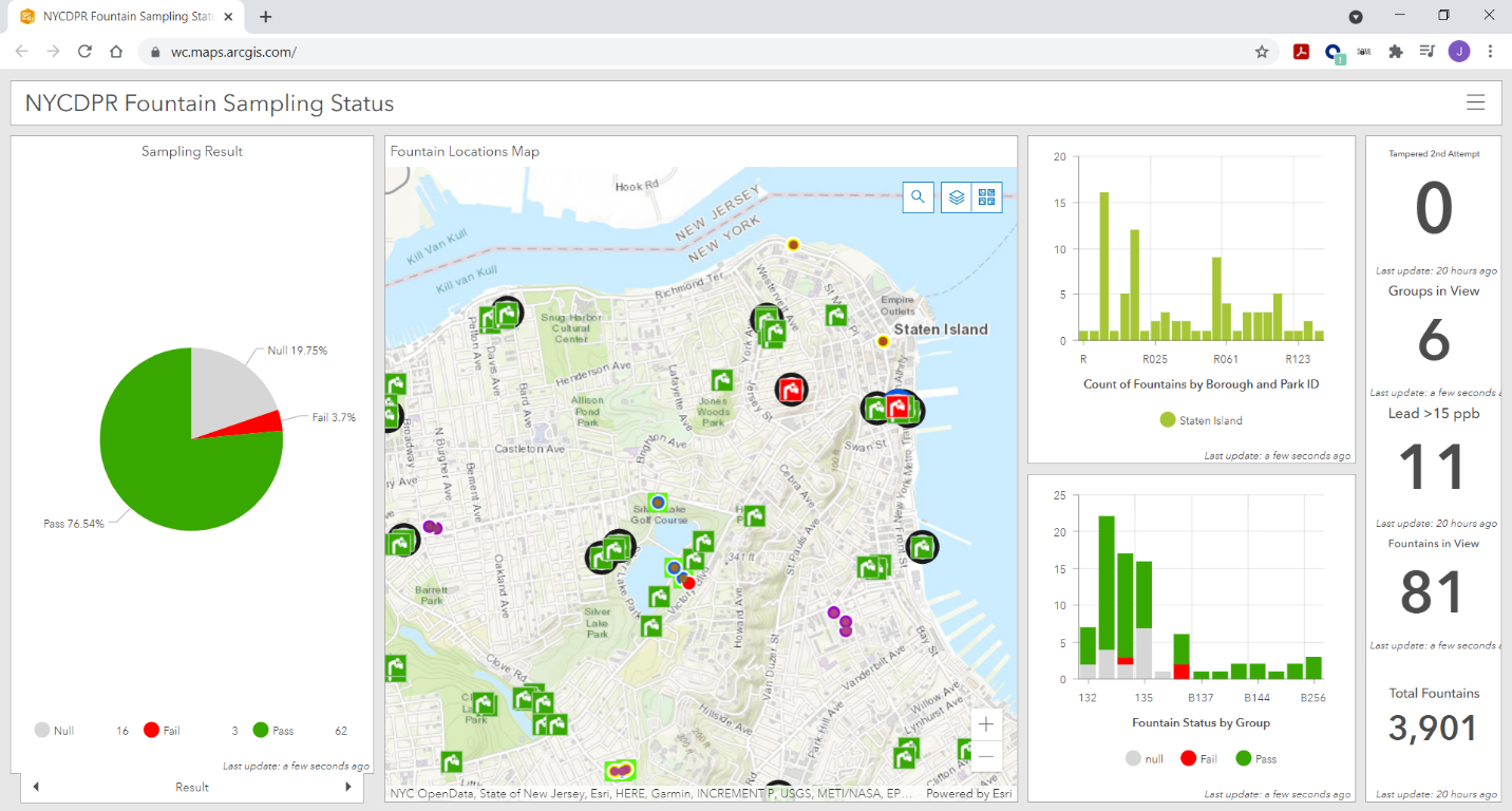
Testing Public Water Fountains for NYC Parks

New York City Department of Parks and Recreation (NYC Parks) retained Woodard & Curran to test for sources of lead in approximately 3,500 interior and exterior public drinking water fountains. While the initial proposal estimated eight weeks, the city wanted to fast-track the project with sampling beginning the first week of May 2019 and wrapping within five weeks. With the help of robust existing GIS data for the exterior fountains, Woodard & Curran’s field teams were able to meet this expedited timeline.

GIS data was analyzed to create groupings of fountain sites, organize workflow, and improve efficiency as six teams were deployed six days a week to reach nearly 900 public parks across the city’s five boroughs. Field staff were equipped with mobile devices to use GIS-compatible applications ArcGIS Collector and Survey 123 for real-time recording of sampling progress, asset information, and results reporting. The technology helped managed the need to cordon off each fountain for 8 to 18 hours, return to collect a sample after stagnation, and then a 30-second to one-minute flush sample. This also enabled field staff to build out GIS data for the approximately 500 interior fountains that were not previously listed in the client’s GIS. As the sampling progressed, the real-time collection of information on mobile devices fed into a public interactive map on the NYC Parks website.

Woodard & Curran mapped and took water samples at over 3,500 water fountains across the five boroughs in New York City in 2019.  The effort added many new features which where previously not included in the drinking fountain inventory.

Workflow & Data Accessibility for Town of Cortlandt, New York

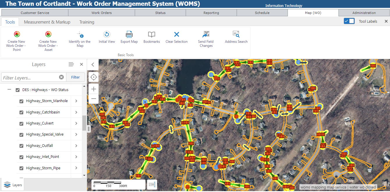
To improve efficiency across municipal departments that relied on information about physical assets, the town of Cortlandt sought to enhance its GIS program. Woodard & Curran worked with the town to identify specific ways to strengthen their GIS program, targeting data quality and work order management as areas of significant opportunity. By focusing on the quality and integrity of data, GIS experts helped develop a public web GIS platform. To further leverage the technology, a work order management system with mapping interface was developed for staff, which allows them to generate and close out work orders while still in the field. All data from the work order system is available to managers, enabling them to see emerging trends and improve planning efficiency.

The Town of Cortlandt (NY) Work Order Management System (WOMS) provides town staff easy access to important municipal work orders (previous, current and pending) covering several operational programs and departments.

Contact:

Anthony Catalano, Senior Principal acatalano@woodardcurran.com
Jake Needle, GIS Program Manager jneedle@woodardcurran.com

10 Questions: Peter Carlo

From my level, it’s a rare occurrence any more running into someone in the geospatial field when I can make reference to Arc/INFO and AML (ARC Macro Language) without him or her giving me a big blank stare. A testament to how long we have both been around.    One of those individuals is Peter Carlo, who works for the New York City Department of Parks and Recreation in the forestry division having worked in the geospatial field for over thirty years.  Yes, learning the ropes at the dawn of GIS with command line Arc/INFO and one of the most senior GIS professionals in the vast New York City government GIS user community.  I was fortunate to catch up with him recently to discuss some of the highlights of his long career in the Big Apple.

eSpatiallyNewYork: Maybe a little of your background and where you are originally from?

Carlo:  I was born in the northern Bronx.  In my early years, the family moved to southern Vermont.  After graduating high school I briefly attended Castleton College in Rutland, VT, though eventually returned to New York City to attend Lehman College in the early 1990’s and enrolled in the geography department.  Since then I’ve lived in a couple places in the metro-NYC area but now live with my family on Long Island.

eSpatiallyNewYork:  What is your current responsibility(s) with NYC Parks Department?

Carlo: I am currently the GIS Supervisor at NYC Parks I.T. division.  Our team is made up of  six GIS specialist and our primary goal is to administer the Parks GIS central geodatabase and to support geospatial projects throughout the Agency.  These projects range from configuring Survey123 mobile data efforts to writing data ETL’s (extract/transfer/load) to our central data warehouse.

eSpatiallyNewYork: So geography at Lehman College in the early 1990s.  Where did it go from there?

Carlo: Yes, I really found the passion for GIS technology at Lehman College.  In 1991 or so I had the opportunity to build an ESRI “enterprise” GIS at the GIS lab at Lehman.  Everything from backend data to an ARC/INFO front end access.  I found a passion in setting up hardware and software solutions while configuring components like digitizing tables and then spending hours digitizing contour maps of the Bronx geology.

Soon after graduation from Lehman, I was hired by the NYC Parks Department Forestry Division and started working on the (first) 1995 street tree survey dataset, which was done by associating a tree location with an street address.  At that time, the Parks Departments Forestry offices where located in each of the five boroughs and were managing their own tree data in a disk operating system (DOS) program called Tree Manager.  I also worked with the Parks I.T. Division to setup the our first central geodatabase using SQL Server and ArcSDE.  Working with Lehman College interns we were able to map out all park athletic facilities, playgrounds and comfort stations.  This data still serves as the foundation for the Parks geodatabase.  (Editor Note:  An entirely different read on its own is the effort behind the New York City Street Survey program.  The most recent 2015 tree survey, which is coordinated by NYC Parks,  inventoried nearly 700,000 trees in the five boroughs.  Read here for more details.) 

eSpatiallyNewYork: In this capacity what are some of your current projects?

Carlo: We are currently working with our Forestry division to deploy an interagency Survey123 application that will be used during storm events.  It will be the second version of this solution.  The application will stream 311 hazardous tree request (like tree downs and limb downs) to potentially over 300 field inspectors made up of Parks, FDNY and DSNY staff to name a few. A large part of our work is making our GIS data interoperable with legacy software/data solutions.  We also participate in integrating spatial data and functions into new business and software solutions.

eSpatiallyNewYork:  Do you have a “favorite” GIS project you’ve worked on while in the NYC Parks department?

Carlo:  I would say working (about 10 years ago) on Forestry’s first mobile storm response application.  It was called Storm Mobile.  It worked on the thick IBM Toughbook tablets utilizing wireless and GPS technology, 311 integration and data from the 2005 Tree Census. That was all new stuff for us and everything worked just fine.  I made some lifelong friends during that experience and learned so much.  A majority of our mobile application use smart phones and tablets with AGPS.  However, there are some teams that use Trimble units when needed.

eSpatiallyNewYork: NYC Parks Department is an ESRI shop – what about other software programs, hardware components in your office?

Carlo:  We are using Infor EAM (Enterprise Asset Management) for a work order management software.  This is highly integrated with our central GIS database.  We also have a new group of data scientists who are utilizing open source GIS tools at a high level. Currently the Agency has over 200 ArcGIS Desktop Pro installation, Multiple SQL/SDE central data repositories and an internal data warehouse that serves as a point of access.  A lot of our ArcGIS Desktop/Pro users utilize extensions such as Spatial Analysis, Workflow Manager and Geostatistical Analyst.  We are also using Cyclomedia Street Smart and Pictometry oblique photos.

Parks is currently on a path to migrate over to a more web GIS approach to spatial data access.  We’ve been moving over to Enterprise ArcGIS 10.8 by utilizing ArcGIS Server and ArcGIS portal to build web apps, Survey123 and Collector solutions.  Around the ArcGIS Online (AGOL) framework.  This has allowed us to streamline workflows and make GIS data more accessible to non-GIS specialists.  Overall, spatial data has increasingly become more integrated throughout the Department data footprint – it is just going to continue to grow.

eSpatiallyNewYork: What other NYC departments do you work the most closely with in GIS/geospatial efforts?

Carlo: The Parks Department works closely with many of the other City Agency GIS units.  We often share data with NYPD, FDNY, OEM and DoITT.  I think interagency data and resource sharing is the next big thing for all NYC Government GIS units.  I finally imagine a central GIS data portal coming together, where all city agencies can upload standardized data that could serve as a central data store for Agencies System of records. It’s kind of the next step from the Open Data portal.  Beyond the geospatial perspective the Parks Department maintains an impressive list of partners in doing work with throughout the city system..

eSpatiallyNewYork: What’s the next big “geospatial thing” in NYC Parks?

Carlo:  I would say that it is data interoperability, web GIS and the move to cloud solutions.  For my team it’s going to be about quickly standing up “no code” data collection and analytical tools that will empower end users (subject matter experts) without them having to be GIS experts.

eSpatiallyNewYork:  Are you involved on any level contributing to the NYC Open Data portal?

Carlo: My specific unit isn’t directly involved in publishing to the portal but NYC Parks as a whole contributes significantly.  Right now I believe there are close to 100 NYC Parks datasets available.

eSpatiallyNewYork: Yankees or Mets?

Carlo:  BIG TIME YANKEE FAN!  I remember watching the Yankees during the Bronx Zoo era!

Contact:

Peter Carlo
GIS Supervisor
NYC Parks I.T. division
peter.carlo@parks.nyc.gov
https://www.nycgovparks.org/services/forestry

D.I.Y MS4: Erie County

The County’s Homegrown Application Provides Mapping and Data Collection Support to the Multi-Agency Western New York Stormwater Coalition

While the  Municipal Stormwater Sewer System (MS4) regulatory program may be taking a back seat in focus to COVID-19 across Empire State governments in 2020, compliance efforts nonetheless continue in the background.  The DEC program has seen governments responding to meet annual submission requirements in a variety of ways ranging from full vendor supported solutions, hybrid approaches of using in-house resources and commercial-off-the-shelf (COTS) products, while others have built the solution totally in-house.  Aka Do-it-Yourself (DIY).

One such MS4 DIY organization is Erie County which provides administrative and technical support to the Western New York Stormwater Coalition (WNYSC) which has a broad geographic footprint.  Erie County took the stormwater management regional lead in western New York in 1999 when it became apparent both Erie and Niagara Counties would be required to come in compliance with the United States Environmental Protection Agency (U.S. EPA) Phase II Stormwater requirements. Recognizing much of the MS4 General Permit was general in context of most permit requirements being the same for all governments, the Coalition was created in 2003 as a means to share work such as public education and outreach, development of policies and procedures, employee training – and mapping.  While the Coalition is not an official Erie County government agency, it is housed administratively inside County offices.

Erie County MS4 Support 

Initial development of the program started in 2012 by the current Director of Erie County’s Office of GIS, Lisa Matthies-Wiza, who was part of a team that designed databases, field applications, and quality assurance plans to manage data collection.  This was facilitated through a series of grants through NYSDEC and partnerships with Erie County and Buffalo State College provided to the Coalition.

More recently, support to the Coalition’s MS4 compliance efforts has been Michael Ruffino who came to the County in March of 2019.  Prior to Erie County, he had experience in the use of ArcGIS Online (AGOL) Survey123 and Collector in Chautauqua County where he was able to incorporate similar apps for the environmental health department septic systems and water supply inspections.  Currently Erie County hosts all of the GIS data and hardware/software infrastructure for the entire WNYSC program.

Continue reading

Geospatial Business Spotlight: Bergmann (GIS Services and Solutions)

Company Name:               Bergmann (GIS Services and Solutions)

Location:                               Rochester, NY

Website:                                bergmannpc.com

Employees:                        400+

Established:                      1980

Bergmann is a full service, multi-disciplinary design firm employing a wide range of professionals and practitioners in the geospatial  industry.  The company represents four decades of a culture built on the work of client-focused experts. Its core business segments include Transportation Systems, Civil Works, Building Design, Land Development, Community Planning & Design, and Program Services.  Within these areas, Bergmann’s rich portfolio of work features everything from restoration of historical landmarks, to the comprehensive bridge and highway design, to waterfront master planning.  Specific client geospatial support services include:

  • Client Consulting: enterprise strategy, system planning & GIS coordination.
  • Implementation & Support: architecture design, system configuration & optimization & technical support.
  • Software Development: software extensions (ArcGIS & Geocortex), custom solutions (web/mobile/desktop) & system integration.
  • Data Services: database design, data development, and management & data migration.

The Bergmann GIS Services team is a nationally recognized leader in the field of Geographic Information Systems (GIS).  Project Managers, GIS developers, GIS analysts, and 3D Design Specialists offer clients advanced and unique technical skillsets to solve complex information challenges. The company focuses on building strong, collaborative partnerships with clients to create applications, data, and workflows which bring efficiencies and value.

Continue reading

10 Questions / Preguntas: Daniel Munoz

Daniel Munoz, GIS Manager, Orange County GIS Division, has been an integral part of the Orange County GIS program for over twenty years and involved in geospatial initiatives in municipalities across the county as well.  Somewhat atypical of how other county programs across the Empire State originally evolved, Daniel led implementation of the countywide effort from its beginning from inside the Orange County Water Authority and later on overseeing development into key enterprise programs in the areas of Real Property Tax Services and Emergency Services.  With Spanish being his native language, I also asked Daniel to offer any thoughts/ideas on how to expand and provide geospatial tools to the growing Spanish speaking populations across the Empire State. In further supporting this issue, this eSpatiallyNewYork post is published in both Spanish and English.

Daniel Muñoz, Gerente del SIG, Condado de Orange División de SIG, ha sido una parte integral del programa SIG del Condado de Orange por más de veinte años y también ha participado en iniciativas geoespaciales en los municipios del condado. Un poco diferente de cómo evolucionaron estos programas en otros condados en el Empire State, Daniel dirigió la implementación de los esfuerzos del condado desde el inicio en el Departamento de Agua del Condado de Orange y luego supervisó el desarrollo de programas claves en las áreas de Servicios de Impuestos de Bienes Inmuebles y Servicios de Emergencia. Como el español es su lengua materna, también le pedí a Daniel que ofreciera conceptos / ideas sobre cómo expandir y proporcionar herramientas geoespaciales a las crecientes poblaciones de habla hispana a través del Empire State. Para respaldar aún más esta situación, esta publicación de eSpatiallyNewYork es disponible tanto en español como en inglés.

1.  eSpatiallyNewYork: Let’s start from the beginning.  Where are you originally from and when/how did you end up in Orange County government?

Munoz:  Here is the short story! I’m originally from Mexico City where I earned my Professional Engineer (P.E.) stripes.   I graduated as an industrial engineer from the Autonomous Metropolitan University of Mexico City and initially worked as computer system analyst for an international kitchen appliance company. I was fine with reading English and working with computers programing languages, but struggled with conversational English.  Since I had friends in the city,   I decided to move to Boston, Massachusetts to learn English.  While there I met a woman from Orange County which I married and ultimately moved to Orange County.

eSpatiallyNewYork:  Empecemos por el principio.  De donde eres originalmente y cuando o como terminaste en el gobierno del Condado de Orange?

Munoz: Esta es la historia corta! Soy originario de la Ciudad de México donde obtuve mi titulo de Ingeniero.   Me gradué de Ingeniero Industrial  de la Universidad Autónoma Metropolitana de la Ciudad de México inicialmente trabaje de Analista de Sistemas de Computación para una compañía internacional de electrodomésticos de cocina.  No tenia problemas leyendo ingles y trabajando con lenguajes de programación de computadoras, pero me costaba trabajo el inglés conversacional. Decidí mudarme a Boston, Massachusetts para aprender inglés ya que tenia amigos en esa ciudad. Allí conocí a una mujer del Condado de Orange con la que me casé y finalmente me mudé al Condado de Orange.

2.  eSpatiallyNewYork: What were your earliest Orange County GIS efforts?

Munoz:  I started with the Orange County Water Authority (OCWA) which is a “cousin” of county government.  My title then was digital systems analyst, which in hindsight, was “being in  the right place at the right time”. When I moved here, Orange County had not developed an E-911 system, but OCWA had started gathering  various databases and integrated computer mapping technology to create a county wide Geographic Information System.  Which ultimately led to  OCWA starting  to  serve a significant  supporting role in developing the new computerized E-911 system.  It was during this time I developed my own passion for GIS technology.   Since then I have learned about and worked in the fields of emergency management, planning, tax mapping, public works, and many other areas of county government.  We are providing and integrating data for all services!

eSpatiallyNewYork: ¿Cuáles fueron tus primeros esfuerzos de SIG en el Condado de Orange?

Munoz:  Comencé trabajando para Orange County Water Authority (OCWA) la cual es un agencia del gobierno del Condado de Orange.  Mi título entonces era analista de sistemas digitales, en retrospectiva, fue “estar en el lugar correcto en el momento adecuado”. Cuando me mude aquí, El Condado de Orange no había desarrollado el Sistema E-911, OCWA había comenzado a recopilar varias bases de datos y tecnología integrada de mapeo por computadora para crear un Sistema de Información Geográfica para todo el condado.  Lo que finalmente llevó a que OCWA comenzara a desempeñar un importante papel de apoyo en el desarrollo del nuevo sistema computarizado E-911. Fue durante este tiempo que desarrollé mi propia pasión por la tecnología SIG. Desde entonces, he aprendido y trabajado en los campos de gestión de emergencias, planificación, asignación de impuestos, obras públicas y muchas otras áreas del gobierno del condado. ¡Estamos proporcionando e integrando datos para todos tipo de servicios!

3.  eSpatiallyNewYork: Do you remember the version of ARC/INFO you got started with and what ESRI products are you using today?

Munoz:  Oh boy.  I do and this really dates  me!   My GIS experience didn’t start with ARC/INFO, I started with ArcView 1.0 with option to update to 1.0a.  I still have the box almost intact with the 5¼” installation floppy disks (picture below). We did most of the work with ArcCAD an ESRI plugin for AutoCAD. My first interaction with ARC/INFO was at Version 7. Nowadays we try to keep up to date as much as possible but avoiding the “bleeding edge”. We are in the process of moving our full enterprise GIS to V 10.6.1. I use the full ArcGIS suite including  ArcServer and  ArcMap with the following extensions:  Network Analyst, Spatial Analyst and 3D Analyst.   I have tried ArcGIS Pro but still has some issues.  As far as the web environment, I created all of our websites with the old ESRI flash builder and have started to update them with Web AppBuilder.
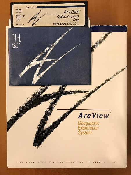
Like many others across the state, Daniel got his start with desktop ArcView software.  Still an ESRI favorite to seasoned GIS professionals.

eSpatiallyNewYork:  ¿Recuerdas la versión de ARC/INFO con la cual comenzaste y que productos de ESRI usasactualmente?

Munoz:  Ay Caramba! Recuerdo bien y revela cuanto tiempo ha pasado! Mi experiencia en SIG no comenzó con ARC/INFO, comencé con ArcView 1.0 con la opción de actualizar a 1.0a. Todavía tengo la caja casi intacta con los discos de instalación de 5¼ ” (imagen abajo). La mayor parte del trabajo fue echo con ArcCAD una extensión de ESRI para AutoCAD. Mi introducción con ARC/INFO fue en la versión 7.0. Hoy en día tratamos de mantenernos actualizados tanto como sea posible, pero evitamos estar a la “vanguardia”. Estamos en el proceso de actualizar nuestro completo SIG a la versión 10.6.1. Uso el paquete completo de ArcGIS, incluyendo ArcServer y ArcMap con las siguientes extensiones: Network Analyst, Spatial Analyst y 3D Analyst. He tratado ArcGIS Pro pero todavía tiene algunos problemas. Entorno de la web, construí  todas nuestras paginas de web con la antigua tecnología de flash pero ya comencé a actualizarlos con la tecnología de Web AppBuilder.

4.  eSpatiallyNewYork: You left GIS  for a while to take another position in County Information Technology –  but then came back to GIS.  Tell us about that.

Munoz:  For me,  GIS & IT always go hand to hand.  While working  for the County,  I always found myself splitting my work projects between GIS & IT.  At the beginning of my career in order to build a better GIS program I had to build a better IT infrastructure.   During this time, I obtained a Windows & Network professional certification. Having this expanded  IT background gave me the opportunity to move to an IT Director position which at the time was a good professional advancement for me.   Two years ago, the County decided to upgrade the County’s  GIS and I was asked  to be part of the team to interview  candidates and  proposals. Going through this process reminded me how much I enjoyed geospatial technology so I made the decision to move back to managing the Orange County GIS program.

eSpatiallyNewYork:  Dejaste el SIG por un tiempo para tomar otra posición en el departamento de Información Tecnología del Condado – pero luego regresaste al SIG. Platícanos a cerca de esto.

Munoz:  Para mí, el SIG & la IT siempre van de la mano. Mientras trabajaba para el Condado, siempre me encontraba dividiendo mi tiempo y proyectos de trabajo entre SIG y IT. Al comienzo de mi carrera, para construir un mejor sistema de SIG tuve que construir una mejor infraestructura de IT. Durante este tiempo, obtuve una certificación profesional de Windows y Redes. Teniendo esta experiencia ampliada en IT me dio la oportunidad de cambiarme a un puesto de director de IT, lo que en ese momento fue un buen avance profesional para mí. Hace dos años, el Condado decidió actualizar el SIG del Condado y me pidieron que formara parte del equipo para entrevistar a los candidatos y sus propuestas. Ser parte de este proceso me recordó lo mucho que disfrutaba la tecnología geoespacial, así que tomé la decisión de regresar a dirigir el SIG del Condado de Orange.

5.  eSpatiallyNewYork: So which areas of County government are the biggest users of geospatial technology?

Munoz:  Definitely Emergency Services!   They have three divisions working  24×7 using and creating data everyday.  Second would be the Planning Department and following very close the Department of Public Works.

eSpatiallyNewYork:  Entonces, ¿Qué áreas del gobierno del Condado tiene los mayores usuarios de tecnología geoespacial?

Munoz:  Definitivamente el departamento de Servicios de Emergencia! Este departamento tiene tres divisiones que  trabajan 24×7 usando y creando datos todos los días. Segundo sería el Departamento de Planificación y siguiéndolo muy de cerca el Departamento de Obras Públicas.

6.  eSpatiallyNewYork:  The County still offers hardcopy maps, shapefiles, and other products for download.  How has this changed, if at all, over the years?

Munoz:  It seems that technology is always driving the associated GIS changes.  The GIS offices are quieter these days as the phones don’t ring as much.  We use to answer the phone constantly to take requests, return calls to inform the caller their  request had been completed.  Today, our online automated GIS request website has taken care of many of these issues.   Individuals can create accounts, make  mapping or data requests, and be notified when the request has been fulfilled with instructions on how to obtain the request.  The website also has an area for data downloads and can notify registered users when County data layers have been updated by our staff.

eSpatiallyNewYork:  El Condado todavía ofrece mapas impresos, shapefiles y otros productos para descargar. ¿Cómo ha cambiado esto, si es que ha cambiado, con los años?

Munoz:  Parece que la tecnología siempre está impulsando los cambios asociados al SIG. Las oficinas de SIG son más silenciosas en estos días ya que los teléfonos no suenan tanto. Solíamos contestar el teléfono constantemente para recibir pedidos, devolver llamadas a nuestros usuarios para informarles que su pedido esta completo. Hoy en día, nuestro sitio de web tiene un sistema de pedidos automatizados y se ocupa de muchos de estos problemas. Las personas pueden crear cuentas, realizar pedidos de mapas o datos y recibir notificaciones automatizadas cuando el pedido se haya cumplido e instrucciones sobre cómo obtenerlo. El sitio web también tiene un área para descarga de datos y puede notificar a los usuarios registrados cuando nosotros actualizamos las bases de datos del Condado.

7.  eSpatiallyNewYork: Any integration with the AutoCAD environment?

Munoz:  Currently, a  small group of engineers from DPW and the tax mapping division are the only ones that still use AutoCAD.  Some years ago the tax mappers started to maintained the parcel boundaries from their tax maps in  an enterprise database with AutoCAD.  As  previously mentioned, our current  GIS upgrade project includes moving the full tax map maintenance program  to our ArcGIS environment.  Stay tuned!

eSpatiallyNewYork:  ¿Alguna integración con el programa de AutoCAD?

Munoz:  Actualmente, solo un pequeño grupo de ingenieros de el Departamento de Obras Públicas y la división de mapas de cadastro son los únicos que todavía utilizan AutoCAD. Hace algunos años, los mapas de cadastro se comenzaron a mantener a través de una base de datos con AutoCAD. Como se mencionó anteriormente, nuestro proyecto actual de actualización del SIG incluye mover el programa de mantenimiento de mapas de cadastro a nuestro sistema de ArcGIS. ¡Mantente al tanto!

8.  eSpatiallyNewYork:  As GIS Manager, what are your biggest challenges today?

Munoz:  I would have to say staffing.  Believe it or not in the last two years I have had to replace the GIS technician positions four times.  While each time each person has been  a competent young professional,  It seems to me the new generation of GIS technicians wants to keep moving on with the next opportunity for advancement.  As opposed to staying in one place for while and building a career in one place.   I find myself training people to see them gone within  6 – 12 months.   A huge challenge!

eSpatiallyNewYork:  Como Gerente de SIG, ¿cuáles son tus mayores desafíos hoy?

Munoz:  Tendría que decir que es el personal. Lo creas o no, en los últimos dos años he tenido que reemplazar las posición de técnico en SIG cuatro veces. Cada vez la persona ha sido un joven profesional competente, pero me parece que la nueva generación de técnicos en SIG siempre anda buscando la próxima oportunidad de avance. A diferencia de permanecer en un lugar por un tiempo y construir una carrera en ese lugar. Me encuentro entrenando personas para que desaparezcan en los próximos 6 – 12 meses. ¡Un gran reto!

9.  eSpatiallyNewYork: What’s the next big geospatial thing in Orange County?

Munoz:  The County is finalizing the Orange County Shared Services Property Tax Savings Plan.  One section in particular reads:

The County of Orange will offer geographic information services (GIS) to any and all of its 43 municipalities. This will include all cartography and geographic data services such as map development, maintenance and printing.

Coordinating and standardizing 43 municipalities will be our biggest project and will keeps us busy for a good while.  I’m hoping for staff continuity!

eSpatiallyNewYork:  ¿Cuál es la próxima gran cosa geoespacial en el Condado de Orange?

Munoz:  El Condado está finalizando el Plan de Servicios Compartidos de Ahorro de Impuestos de la Propiedad del Condado de Orange. Una sección en particular dice:

El Condado de Orange ofrecerá servicios de información geográfica (SIG) a todos y cada uno de sus 43 municipios. Esto incluirá todos los servicios de cartografía y servicio de datos geográficos, como el desarrollo de mapas, el mantenimiento y la impresión.

Coordinar y estandarizar 43 municipios será nuestro mayor proyecto y nos mantendrá ocupados por un buen rato. ¡Espero y el personal sea continuo entonces!

10.  eSpatiallyNewYork:  You are of Hispanic background.  Do you have any thoughts or ideas on how GIS technology could be extended to the regional Spanish speaking population?  Where and how would you start?

Munoz:  The beauty of GIS is that it can help everyone in so many ways.  But the challenge continues to be building applications which are relevant, accessible, and easy to use.  Research show that Hispanics are less likely to have an internet connection at home.  Hispanics are early technology adopters, and Hispanics are mobile-first community. These statements contradict each other a bit but it is because the Hispanic demographic is young. Based on this information I would focus available resources to build, design and post GIS apps in Spanish on mobile platforms (cell phones and tablets) where we know Hispanics are spending their time. These early adopters will spread the message among their social groups faster than any other method.

eSpatiallyNewYork:  Eres de origen hispano. ¿Qué piensas o que ideas tienes sobre cómo la tecnología de Sistemas de Información Geográfica (SIG) podría extenderse a la población regional de habla hispana? ¿Dónde y cómo empezarías?

Munoz:  Lo bonito del SIG es que ayuda a todos, pero debemos asegurarnos de distribuirlo a ellos. Las investigaciones demuestran que los Hispanos tienen la menor probabilidad de tener una conexión de internet en casa, los Hispanos adoptan la tecnología tempranamente y son una comunidad que usan los dispositivos móviles primero. Estas declaraciones se contradicen un poco, pero es debido a que la demografía hispana es joven. Basado en esta información yo pondría todos los recursos disponibles en crear, diseñar y publicar aplicaciones de SIG en plataformas móviles (teléfonos celulares y tabletas) donde sabemos que los Hispanos pasan la mayoría de su tiempo. Estos pioneros difundirán el mensaje atreves de sus redes sociales más rápido que cualquier otro método.

2019 Westchester GIS User Group Meeting

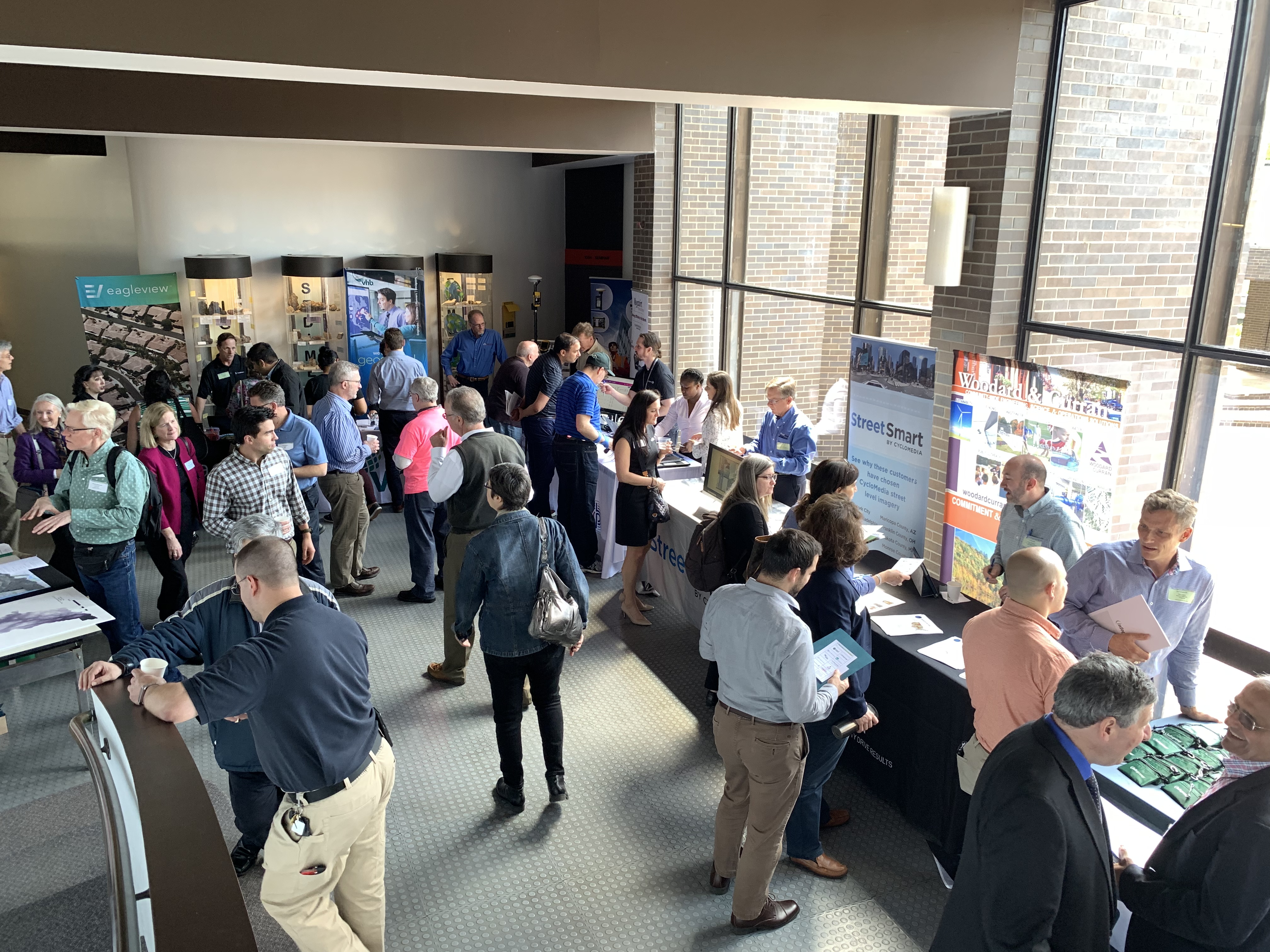
Making it the largest annual event to date, nearly 200 individuals attended the 2019 Westchester GIS User Group Meeting May 16th at Purchase College. The annual event included a diverse mixture of user presentations and demonstrations for attendees representing local and county government, utilities, nonprofits,  business and industry, and academia (both college and high school programs). Faculty and facility support from the College’s Environmental Studies program and sponsorship from twelve vendors again helped enable the Westchester County GIS community to meet and discuss the countywide geospatial agenda.  And by virtue of the venue, promoting SUNY GIS educational opportunities as well.   It was a great GIS day for all attending and participating.

As the day progressed, nearly 200 registrants assembled as part of the 2019 Westchester GIS User Group Meeting at Purchase College. The main lecture auditorium was filled to capacity with standing room only by mid-morning.

2019 Agenda and Speakers

While the 2018 agenda had a specific theme, this year’s agenda was intended to be more diverse covering a wide range of topics including health and human services, pavement management systems, oblique imagery applications, training workshops, forestry inventories, public safety, mapping and visualizing the human brain, the 2020 Census, and a special presentation by ESRI focusing on accessing the County’s new planimetric datasets via web services.

Session I:  Allison McSpedon and Jeff Worden from the Westchester County Continuum of Care Partnership for the Homeless led the day off with a presentation focusing on the use of mobile technology as part of the annual Homeless Point in Time (PIT) Count taken in January 2019.  This was followed by Nancy Birnbaum, Manager of Software Architecture, Westchester County Dept. of Information Technology who presented the new Westchester County Online Community Mental Health Directory.

Managers from the Continuum of Care Partnership for the Homeless detailed the pros and cons on the use of mobile data collection technology as part of the January 2019 count. They anticipate even better results and ease of use when deployed in the next count.

Andrew Reinmann, Advanced Science Research Center, Graduate Center of CUNY and Department of Geography, Hunter College followed with the use of geospatial tools as part of the Westchester County Forestry Inventory: Mapping and Ecosystem Services Assessment.  The morning session ended with a series of lightning talks highlighting the use of the County’s new oblique imagery.

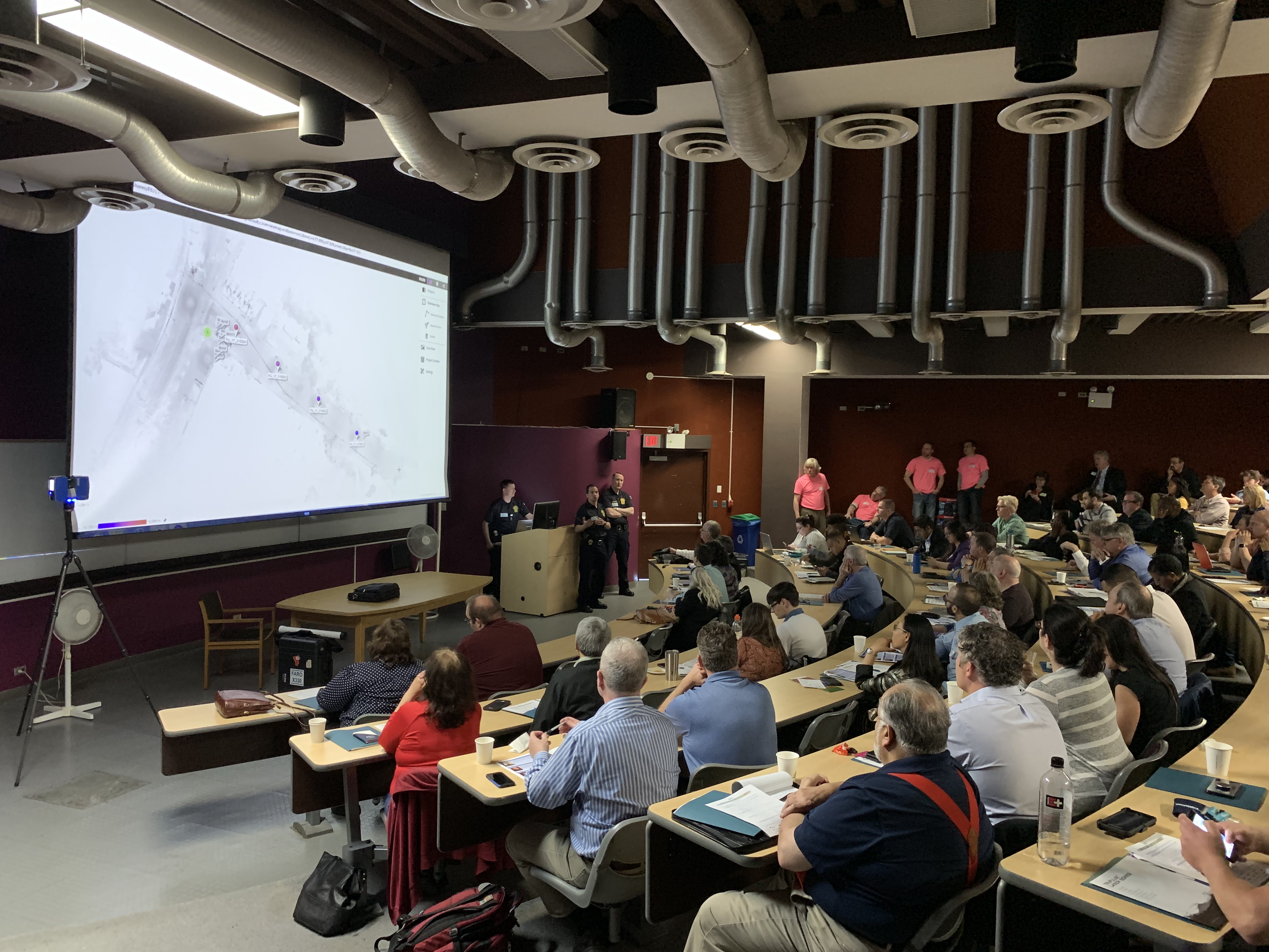
Session II: After intermission, VHB and staff from Westchester County Dept. of Public Works and Transportation discussed the new Smart Asset Management and Inventory System (SAMIS) application which was followed by an excellent demonstration on the use of Laser Scanning technology by the Westchester County Police Forensic Investigations Unit.  Patrick Gahagan, Technical Analyst at ESRI finished the morning session discussing advancements in civil engineering and surveying integration between the Autodesk and ESRI platforms.

Detectives from the County Police Forensic Unit captivated the audience on the use of laser scanning in crime scene investigations. GIS staff is now working with the Forensic Unit on integrating laser scanning data into the enterprise GIS environment.

Session III:  After lunch – and an audience participation session of GeoJeopardy – Jonathan A. N. Fisher, Ph.D., Director of the nearby Neurosensory Engineering Lab at the  New York Medical College in Valhalla provided an overview of his project called Neurodome which centers on the mapping of the human brain with an assortment of technology and visualization tools.   Daniel Wickens, Solution Engineer from ESRI then gave two overviews on “What’s New with ArcGIS Field Apps and ArcGIS Online.”  Concurrently in separate locations training classes were offered on how to use the new online CONNECTExplorer oblique imagery viewer and the ESRI “Explore Future Climate Change” tutorial.

Session IV:  The last section of the agenda was brief and included an update on mapping efforts association with the 2020 Census by Margaret Baker, Geographer, from the U.S. Census Bureau Manhattan office.  The final presentation by Westchester County GIS staff included the latest developments and anticipated upgrades to the Westchester County GIS website including the scheduled launch of the Westchester GIS Geospatial Gateway

Individual meeting presentations can be accessed and downloaded using this link.

The U.S. Census Bureau is ramping up for the 2020 Census and has a variety of mapping and geospatial products in their toolbox. GIS technology is essential in helping identify areas which have had low counts and responses.

Little Things Make it Work

I’ve written before about the small details which we believe enable the Annual Westchester GIS User Group Meeting to continue to be successful – and we’re the first to admit there is always the element of luck.  Even the weather matters.  To the extent possible, elements such as keeping the content and speakers “Westchester” focused, minimal –  if any –  registration fees, lots of time for interaction with the sponsors on the exhibit floor, and the centrally located venue at Purchase College – all matter. One of the ironies, and downsides, of having the show on a college campus in mid-to-late May is that spring semester is already over and students have fled campus.  However,  there is normally a handful attending looking for summer or full-time work and passing out resumes.    The naturally lighted vendor area in the Natural Sciences Building, albeit small, adds to the personal “feel” of the show.    Easy access and plenty of parking is also essential.  And don’t forget lots of proactive outreach to the professional organizations and societies  we work with on a day-to-day basis:  police/fire, engineering, surveying, public works, assessors, nonprofits, and the planning community.   The added message here is to encourage consultants which are supporting local governments across the county – to attend the meeting.  To learn more about accessing and leveraging Westchester County GIS products and services and how this improves service and cost efficiencies to municipalities they serve.   Individually, any of these items listed above may seem trivial,  but they all add up in delivering a show that will bring the same people back next year.

The exhibit floor was busy (and loud!) during breaks with all vendors noting interaction with attendees was good and productive. All attendees can complete a Vendor Bingo Card and be eligible for a raffle prize at the end of the day. This year’s prize was a vendor donated iPad!

Summary

Over the next couple weeks, conference organizers will be sending out a survey to both attendees and vendors to gather more detailed information on the various elements (presentations, speakers, refreshments/breaks, vendor interaction/feedback, facility issues and the like) of the show.  This information will help guide decisions about content and any changes that may need to be made, if any, about the structure of the show.

Staff will take a few months off and begin planning for the 2020 show in the fall of this year.  In doing so, we look forward to the continued relevance and position of the Westchester GIS User Group Meeting in promoting countywide geospatial development and use.

10 Questions: Rochelle Harris, President, New York State Assessors Association

Rochelle Harris, IAO, is the current President of the 900-member New York State Assessors Association which represents government assessors and industry representatives across the Empire State.  She currently serves as an assessor in both Madison and Chenango Counties.

eSpatiallyNewYork: You work in both Madison (Hamilton) and Chenango (Sherburne and North Norwich) Counties.  When did you begin to see computer mapping and technology changes in your offices?

 Harris:  I began to notice changes in 2009 – particularly in Chenango County – when a new County Real Property Tax Director was hired.  It was the first time that we were able to overlay aerial photography on top of the digital tax maps.

eSpatiallyNewYork: New York State Assessment Community Enterprise System (ACES) looks like a big deal – aka RPSV5.  How is this program moving along and the discussion within the Association?

Harris:  We are waiting for direction and an updated timetable from ORPTS.  There are also many pilot counties and municipalities which provide updates on progress and any issues. We will be holding training classes when the time comes.

eSpatiallyNewYork:  Do you feel there would be a benefit for more “GIS/computer mapping” training for the statewide assessor community?  Could better engagement with the GIS community improve this in anyway?

Harris: More education can never be a bad thing. Absolutely anything we can do to work together with another agency or organization makes all our lives more efficient. Our current training opportunities can be found on our website which is updated often.

eSpatiallyNewYork: Are you familiar with the New York State GIS Association?

 Harris: I actually am.  Keith Ducette, who is a GIS Technician with Onondaga County, introduced me to the organization and its programs.

eSpatiallyNewYork: Does the Assessors’ Association have anything like a GIS Work Group or GIS Committee?

Harris:  Currently, we do not, but if there is ever an overhaul or a reason to have one, we can create a special committee, or ask for volunteers for temporary projects such as ACES.

eSpatiallyNewYork: Has the Association ever approached the State to support/fund statewide capture of oblique (i.e., Pictometry/Eagleview) imagery?

Harris: No we have not, although it’s a great idea. There is a state senator trying to pass legislation for a cycle bill in which she suggests updating imagery and access to it.  We currently have access to oblique imagery in both Chenango and Madison Counties.

eSpatiallyNewYork:  With regard to data sharing – the conflict of “giving” digital assessment/tax parcel data away vs. “selling it” continues.  A mix across the state.   Does the Association have a position on this?

Harris:  My personal position, I have no problem giving the information for personal use but anyone who wants it for commercial and financial gain should pay for it.  We as an association do not have a position on this.  Chenango County offers a subscription service for the data while Madison County sells tax parcel data in file format.

eSpatiallyNewYork:  Do you anticipate any RPSV5 or any mapping items to be part of the Association’s 2019 Legislative Agenda? Revisions to 9NYCRR Part 189?

Harris:  We are working on our agenda and so far nothing on either issue though revising Part 189 would be a great idea.  The maps are cumbersome and in all three of my offices I am running out of places to store them.  I could mention this to our legislative chair and see if it is something we may be able to add to the agenda or suggest to one of the Senators we work with.

eSpatiallyNewYork: How are assessor’s “automating” in-field assessment work? What are some of the new technology tools?

Harris: I think when we get ACES  there will be much more opportunity to work with the program in the field as it will be mobile friendly and able to incorporate oblique imagery.  There are also digital tools to measure and draw new construction.  I know quite a few Assessor who solely use pictometry and the measuring tool on there.

eSpatiallyNewYork:  I see that you reference Josette Polzella on the President’s Page.  She was an early and vocal advocate of GIS in Westchester County going back to the late 1990s.     Tell me about your relationship with her.

Harris: Josette, was one of my very first mentors.  She was a wonderful person always willing to help and go the extra mile to help. We moved away from the Hudson Valley in 1988 and we lost touch.  We found each other on Facebook in around 2009 or so and picked right up where we left off. She sponsored me to take the IAO exam in 2010 and was there when I was installed – it meant the world to me. The world is a lot less bright without her in it.