D.I.Y MS4: Erie County

The County’s Homegrown Application Provides Mapping and Data Collection Support to the Multi-Agency Western New York Stormwater Coalition

While the  Municipal Stormwater Sewer System (MS4) regulatory program may be taking a back seat in focus to COVID-19 across Empire State governments in 2020, compliance efforts nonetheless continue in the background.  The DEC program has seen governments responding to meet annual submission requirements in a variety of ways ranging from full vendor supported solutions, hybrid approaches of using in-house resources and commercial-off-the-shelf (COTS) products, while others have built the solution totally in-house.  Aka Do-it-Yourself (DIY).

One such MS4 DIY organization is Erie County which provides administrative and technical support to the Western New York Stormwater Coalition (WNYSC) which has a broad geographic footprint.  Erie County took the stormwater management regional lead in western New York in 1999 when it became apparent both Erie and Niagara Counties would be required to come in compliance with the United States Environmental Protection Agency (U.S. EPA) Phase II Stormwater requirements. Recognizing much of the MS4 General Permit was general in context of most permit requirements being the same for all governments, the Coalition was created in 2003 as a means to share work such as public education and outreach, development of policies and procedures, employee training – and mapping.  While the Coalition is not an official Erie County government agency, it is housed administratively inside County offices.

Erie County MS4 Support 

Initial development of the program started in 2012 by the current Director of Erie County’s Office of GIS, Lisa Matthies-Wiza, who was part of a team that designed databases, field applications, and quality assurance plans to manage data collection.  This was facilitated through a series of grants through NYSDEC and partnerships with Erie County and Buffalo State College provided to the Coalition.

More recently, support to the Coalition’s MS4 compliance efforts has been Michael Ruffino who came to the County in March of 2019.  Prior to Erie County, he had experience in the use of ArcGIS Online (AGOL) Survey123 and Collector in Chautauqua County where he was able to incorporate similar apps for the environmental health department septic systems and water supply inspections.  Currently Erie County hosts all of the GIS data and hardware/software infrastructure for the entire WNYSC program.

Continue reading

The Art of Geospatial Collaboration: Allegany State Park Interactive Viewer

Cattaraugus County and Allegany State Park Share Resources and Vision

While GIS as a shared service as part of Governor Cuomo’s County-Wide Shared Services Initiative (CWSSI) has yet to take hold in a broad context across local governments in the  Empire State,  the statewide GIS community does have a great example to highlight how local governments can collaborate with a state agency in sharing geospatial technology.  Case in point:   The Allegany State Park Interactive Map viewer.

Located in Cattaraugus County in western New York abutting the Pennsylvania state line and  north of the Allegheny National Forest, Allegany State Park was created in 1921 and encompasses nearly 64,800 acres.   A major western New York State tourist attraction – the park averages  1.5 million annually – the park offers a wide range of four-reason recreation activities and lies within the Alleghany Highlands Forests ecoregion.   The idea of a joint effort between  Cattaraugus County and Allegany State Park online map viewer idea goes back as far as 2010 as part of a discussion between Daniel T.  Martonis, who at the time was GIS Manager for the County and Tom Livak who was then Director of Economic Development, Planning & Tourism.

The initial viewer was more emergency services focused with the collection of infrastructure data and intended for use by park staff only – nothing external.  Most of the data was collected by Dan and Tom, including Chris Holewinski – the current Cattaraugus GIS Manager – using various Trimble GPS units as well as utilizing old engineering maps.  The trio even brought out metal detectors to pick up the locations of pipes.   At the time, Dan was building web mapping applications with ArcIMS that Dan mentions was not “people friendly” and was ultimately discontinued by ESRI.  Along the way, though, both Dan and Tom knew they were beginning to frame a web mapping product which would be of great value to both the County and ASP.  ArcGIS Online began to emerge as a more functional and adaptable web mapping platform providing additional opportunities for the two government programs to build upon what had been started.

The ASP viewer represents the ongoing collaboration between Cattaraugus County and Allegany State Park. It provides easy to use access to a facility, environmental, and cultural data including historic aerial photography.

Continue reading

Shared Services: Opportunities for Local Government GIS

More than a couple years ago, Linda Rockwood, who at the time was running Mohawk Valley GIS, mentioned to the NYS GIS community that she was at a local meet and greet with regional elected officials and mentioned the “GIS” word to one of NYS’s congressional representatives in attendance.  To her amazement – and dismay –  she found out the representative had a very limited awareness or understanding of GIS.

Linda’s encounter certainly wasn’t the first of its kind and I’m sure there have been numerous similar incidents in our respective corners of the state since then.  GISers gingerly starting a conversation on the broad benefits and applications of geospatial technology to government and elected officials – only to see the focus wander quickly. Maybe two or three minutes into the discussion when comparisons to Google Maps normally kick-in and/or there is eye contact with the next constituent and thinking moves to that conversation.

Unfortunately, the message – and the collective mission – seems to continue to get lost and there is recent anecdotal evidence to suggest there is still a long way to go in context of recognizing and embracing geospatial technology in NYS local governments (county, city, town, and village) as part of an increasingly important government program area:  Shared Services.

New York State Shared Services Program

Those working throughout the local government ranks should be on some level familiar with the shared services buzzword.  It’s the talk among government officials and for legitimately good reasons.  Look no further than Governor Cuomo’s commitment of $225 million in the FY 2019 Executive Budget to continue the County-Wide Shared Services Initiatives (CWSSI). The $225 serves as matching funds for a one-time match for actual and demonstrable first-year savings achieved by the Shared Services Panels through new actions implemented during calendar year 2018.  School districts, boards of cooperative services (BOCES), fire districts, fire protection districts, and special improvement districts have the option to participate as well.    The current shared services initiative augments the existing NYS Department of State Local Government Efficiency (LGe) Program – which by the way formerly known as the Shared Municipal Services Incentives program –  “provides technical assistance and competitive grants to local governments for the development of projects that will achieve savings and improve municipal efficiency through shared services, cooperative agreements, mergers, consolidations and dissolutions.”

New York State Shared Services Initiative web page

There are many recognized barriers to implementing shared services across NYS governments though as the concept evolves, governments continue to try and find ways to consolidate services in specific areas such as municipal justices, zoning and code enforcement, construction/building/maintenance inspections, and in the establishment of health care consortiums to name only a few.   That said, it’s worthy to note the limited number of GIS-centric shared services proposals submitted by both the New York State Association of Counties (NYSAC) and  New York Council of Mayors (NYCOM). Specifically:
Continue reading

10 Questions: Dale Morris

Dale Morris is one of New York State’s most recognized and senior GIS statesmen.  With a distinguished civil service career spanning 38 years, he has contributed significantly to the NYS GIS community in many capacities to say the least of directing one of the most established GIS programs in the state at Erie County – and its far reaching influence in western New York.  Ten questions seemed like a slight to an individual with such a body of professional work, so the eSpatiallyNewYork editorial team gave him permission to push it to 15 questions. Or something like that.  Enjoy.

eSpatiallynewyork:  How long have you been with Erie County?

Morris:  I’ve been in the Department of Environment and Planning since 1981. Prior to this I worked as a Planner for the Town of Amherst, NY and before that the Erie and Niagara Counties Regional Planning Board. I graduated from Cornell University with a Master’s Degree in Regional Planning in 1977.

eSpatiallynewyork:  When did you start doing GIS work?

Morris:   Working initially as a Planner for Erie County presented  many opportunities for making and using maps. In the 1980s we were still using Mylar, zipatone, and Leroy Lettering Sets for making maps, which is tedious, time consuming, and not easy to change. I began to investigate the world of digital mapping, which was still in its beginnings as a desktop product. I started with the DOS version of MapInfo. I recall how amazed we all were that we could do something as simple as draw the County and municipal boundaries on-screen. Looking back on it now it all seems so rudimentary!  Regardless of how basic it was, my Division became known for our ability to make computer drawn maps. At that time there wasn’t much concern about the database behind the maps- it was enough to be able to draw and edit maps digitally rather than by hand.

As desktop mapping grew in popularity through the 1990s a number of County departments began independently looking into it. This usually resulted in them calling me to ask for advice or data. Of course, this also meant that everyone was using different systems, and at that time it made exchanging data between systems very difficult or impossible. It was a classic case of disjointed silos of data and applications.

A change in County administration in the late 1990s brought new management in our department, and I was challenged to prepare a white paper for moving the County further forward into the digital mapping world. I proposed creating a new County Division that would be empowered to centralize decisions relating to geospatial technology (by then we could use terms like “geospatial” without getting blank stares!). The Office of Geographic Information Services (OGIS) was born in 2001, and I have been the Director since then. So for me personally, my career started with both feet in the urban planning field, then a gradual shift to one foot in planning and one in digital mapping, and then finally both feet in GIS. I do very little “typical” planning anymore, even though OGIS is part of the Planning Division.

While OGIS is an Office within the Department of Environment and Planning, only a portion of our work is related to this department. We work very closely with our IT shop to maintain and operate the County’s GIS technology infrastructure, and with other departments and outside agencies who either use our enterprise GIS technology or who need direct assistance with their mapping needs.

eSpatiallynewyork:  What’s the relationship between your office and Niagara County?

Morris:  We have a formal Intermunicipal Agreement (IMA) with Niagara County for GIS Services. The agreement is for a five year period and we are well into the second of these five-year agreements. Erie County hosts Niagara County’s geospatial data and provides on-line mapping services to Niagara County. The two counties are connected by a high-speed microwave link, which operates very well. In essence, Niagara County is simply like any other Erie County department that taps into the Erie County enterprise GIS network. In addition to providing Niagara County this service for a fee, the IMA provides a framework for backup of GIS data between the two counties, and as well defines a GIS “mutual aid” protocol for sharing of GIS resources and staff in the event of an emergency.
Continue reading

NextGen NYS Geospatial: Expanding the Profession

Based on the support of many long standing contributors, vendors, and returning individuals, the NYGeoCon 2013 meeting in Saratoga Springs, November 12-13, was considered a success.  Looking forward to future conferences and similar outreach efforts within the state, many could argue there is much optimism within the professional geospatial community – particularly with the NYS GIS Association at the helm – for continued growth and presence of the GIS profession across the Empire State.   However, unless new members are recruited from professions which are currently not part of the “staple” of the Association membership (government/public agencies, software companies, photogrammetry, academia, and civil engineering disciplines), such optimism may be tempered based a combination of recent industry and business reports, metrics, and employment trends.   Consider the following:

Government Job Growth Weakest:  A December 2013 Governing Magazine article notes that while private employment may finally be ready to accelerate, “state and local government job growth continues to be among the weakest of any industry”.  Translation:   Much of the future geospatial development – most likely at all levels of government in the Empire State – will increasingly be vendor/contractor based. While it is anticipated that existing government GIS programs in the Empire State will find a means to continue on some level, current government budgets and tax cap spending limits, suggest that new or expanding government geospatial programs will occur at a decreasing rate.    And few in government administrative or management level GIS positions across the state would probably be unable to argue otherwise. 

Minimal Technology Sector Growth:    A recent Praxis Strategy Group market report entitled “The Surprising Cities Creating the Most Tech Jobs” offers current statistics on employment trends in industries normally associated with technology, such as software, engineering and computer programming services. The article also presents numbers of workers in other industries which are classified as being in STEM occupations (science, technology, engineering and mathematics-related jobs).   Though the study considers only MetroNYC – and not the entire state – the findings are still somewhat troubling as the NYC ranked 36th on the national scale – only slightly ahead of metro Buffalo (43rd) and Rochester (45th).  Since 2001, New York City’s tech industry growth has been a paltry 6% while the number of STEM related jobs has fallen 4%.  The chances of New York City – or others parts of the state for that matter – of becoming a major tech center are handicapped not only by high costs and taxes, but a distinct lack of engineering talent. On a per capita basis, the New York area ranks 78th out of the nation’s 85 largest metro areas, with a miniscule 6.1 engineers per 1,000 workers, one seventh the concentration in California’s Silicon Valley. (Buffalo and Rochester statistics in this regard may be better though were not available as part of the article).

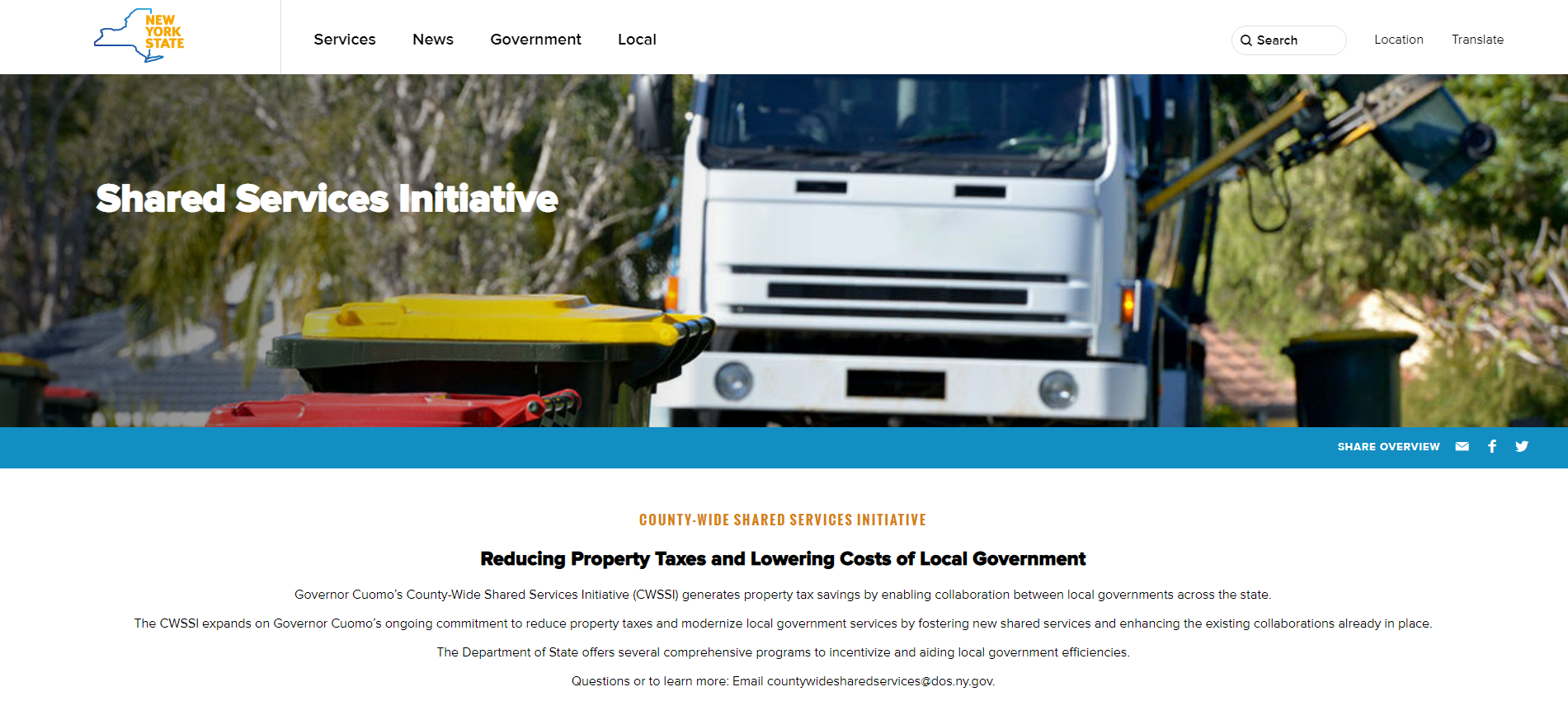
Shared Services Still Struggles:  For a technology which presents incredible opportunities for public organizations to share computing infrastructure, replicate (or share) identical mapping applications, cost-share on similar geospatial data development projects, or jointly exploit new Cloud-based programs – Information Technology (IT) shared services – and by extension GIS – have yet to be broadly implemented across the Empire State.  An August 2013 report prepared by the Cornell University found that while Shared Services programs in areas such as transportation, public safety, and recreation/social services continue to show promise, only eight-percent (8%) of the nearly 946 New York State government agencies surveyed in the study were engaged in Shared Services IT projects.

Growth Outside the GIS Mainstream:  An illustrative series of 2013 global market study reports by TechNavio forecasts steady GIS growth in disciplines which currently do not have a significant presence in many statewide conferences and programs or the NYS GIS Association.  Largely outside of government, and certainly not normally considered “tech jobs”,  these key industries  include banking and financial services, real estate, retail,  telecommunications, and utilities – all of which have significant corporate presence in the Empire State.  Many of these same industries were also identified as “GIS growth sectors” – including banking, insurance, law enforcement, business, healthcare, and finance – as part of a Geospatial Job Market panel discussion at the 2012 Association of American Geographers annual meeting.

Long term sustainability of the GIS profession in the Empire State requires the continued expansion and recruitment of industries which to date, have not had a strong visible presence in statewide GIS programs and activities.    Such opportunities exist by engaging these disciplines –  health care, retail, real estate, insurance and banking, and telecommunications, to name a few –  in local and regional GIS events,  NYS GIS Association professional development programs, or conversely, by attending and participating in industry trade shows and annual conferences held here in New York State (i.e., National Retail Federation,  NYC Real Estate Expo,  Annual NYS Commercial Real Estate Conference, NYS Association of Health Care Providers, and NY Bankers Association as well as many others).

Long term growth and influence of the NYS Geospatial profession should be considered extremely promising though will need to be based on a broader mix of disciplines and practitioners.