Company Name: Mapzen
Website: https://mapzen.com/
Established: 2013
The Company
Mapzen is currently under the leadership of longtime colleagues Randy Meech and Brett Camper.
Together they come with years of experience in mapping and product development. Previously, Meech was Chief Technology Officer of Mapquest and Camper was Director of Product and Engineering at Kickstarter. Mapzen consists of a professional staff that includes software engineers, product managers and mobile application engineers located at the offices in New York , San Francisco, Berlin, and several remote sites.
Mapzen was created on a shared vision to establish an open, accessible, and resilient mapping ecosystem. Today this vision is being implemented and facilitated through the Samsung Accelerator which provides the financial framework and stability. Mapzen supports the geospatial community through building tools and promoting open source map technologies which follow a long tradition of community-powered cartography.
Geospatial Products and Services
Mapzen products and services are focused in four core areas:
- Search (geocoding)
- Graphics
- Navigation
- Open Data
Mapzen staff and developers leverage GitHub extensively as an environment to communicate technical issues with colleagues on projects. It provides access control and several collaboration features, such as a wikis, email threads, and basic task management tools for every project.
Illustrative examples of Mapzen projects include:
Tangram
Tangram is a map renderer designed to grant significant levels of control over map design. By drawing vector tiles live in a web browser, it allows real-time map design, display, and interactivity. Using WebGL, Tangram leverages the graphics card to a new level of cartographic exploration. Animated shaders, 3D buildings, and dynamic filtering can be combined to produce effects normally seen only in science fiction.
Tangram draws maps live in a browser enabling developers to update styling properties in real-time, instantly. But changing the color is just the beginning – as every Tangram map is a 3D scene, you also have control over lights and cameras.
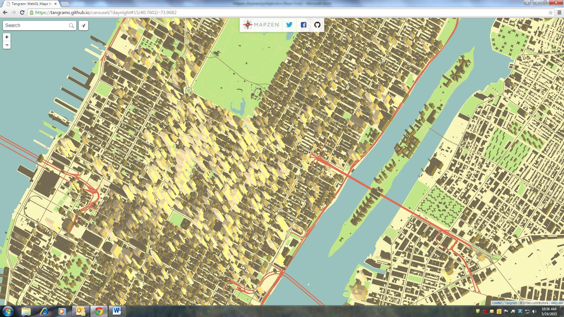
In this view just south of Central Park in Manhattan, an isometric camera’s perspective is varied along with the color and direction of a light (morning), resulting in a time-lapse drone’s-eye view.
Using Tangram’s plain-text markup language, developers can write graphics card programs (called “shaders”) and even JavaScript to add interactivity, mix data sources, and control the design of maps.
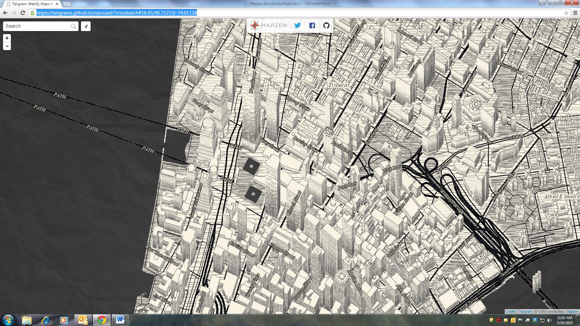
This example of lower Manhattan uses a shader to color geometry with hand-drawn textures, blending between them based on the color, angle, and amount of light on each face.
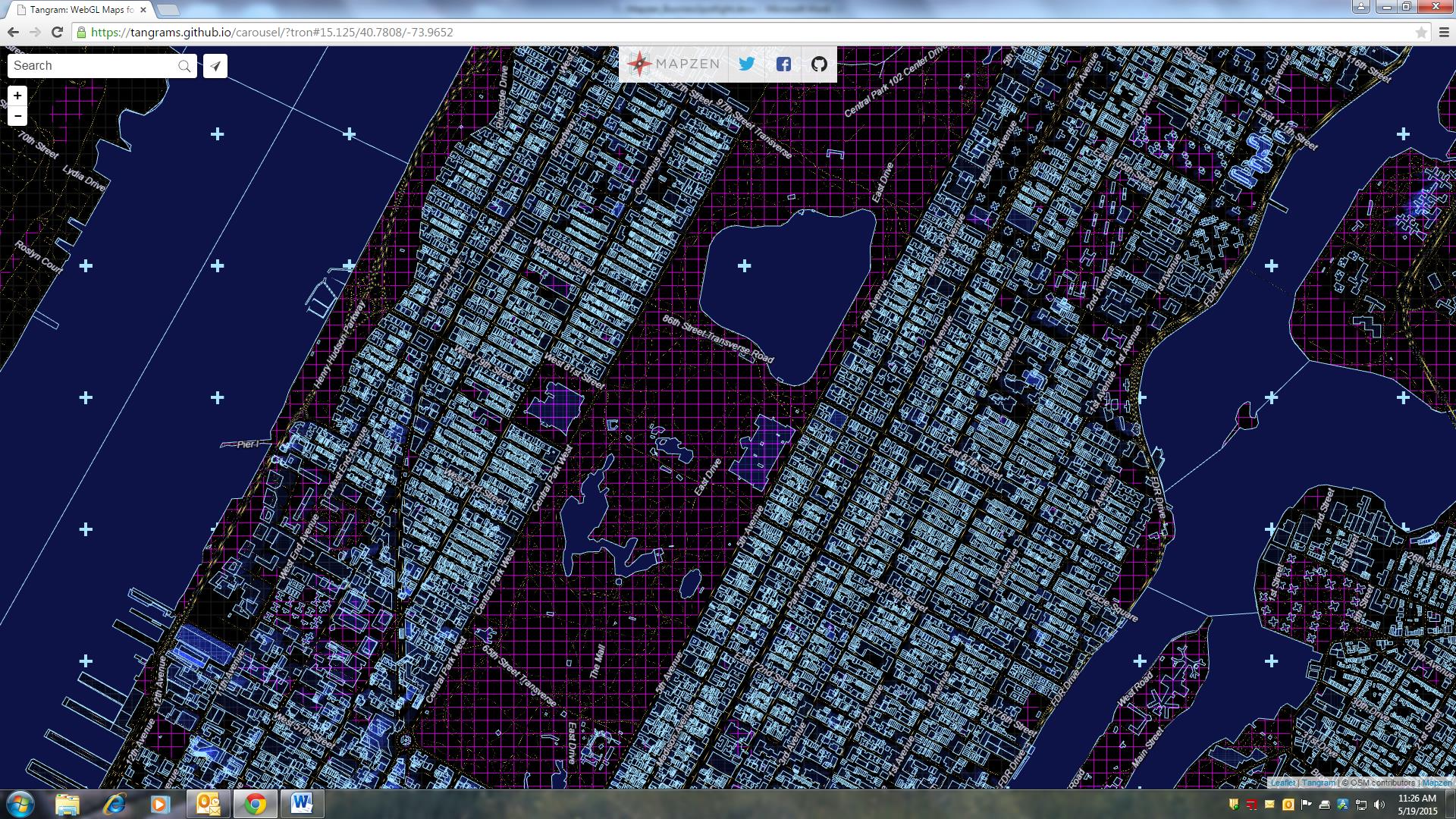
Tron uses procedural shaders to create a view of the future. The shaders, defined by mathematical functions, are applied to various data layers with UV maps, just like texturing an object in a 3D application like Blender.
Other current Mapzen projects include:
- Vector Tile Service: a free vector and super fast OSM base layer
- Pelias: a modular open-source geocoder
- Open by Mapzen: a proof of totally open source and open data app
- Valhalla: a unique routing engine based entirely on open data
- transitland: a community edited aggregation of transit feeds
Find out more about Mapzen’s data products, employee blog postings, and additional information for developers on their website.
Contact
Alyssa Wright, VP, Partnerships and Business Development, President of OpenSteetMap US, and co-organizer of the GeoNYC Meetup group.