
As GIS and mapping technologies evolved through the later part of the 20th century focusing mainly on the physical(outdoor) landscape, the digital mapping of the built/interior environment continued to focus on the use of AutoCAD/Revit and related CAD technologies. With exceptions, there were two definitive geographic mapping camps: Geographic Information Systems (GIS) software vs. Computer Aided Design (CAD) software. One or the other. And with little integration of both.
As both technologies matured, integration between the two computing environments became more common and the lines of division blurred. New technologies including, but not limited to Global Positioning Systems (GPS), Laser Scanning, Building Information Modeling (BIM), and drones, as well as advancements in 3D modeling and increased desktop and internet capacity aided to the continued integration of the software platforms. GIS and BIM Integration Will Transform Infrastructure Design and Construction is a very recent and quick read from Autodesk charting the path of this flourishing market.
Fast forward to 2018 and the evolution of indoor wayfinding which leverages many of the components of these same outdoor and indoor mapping concepts. Based on a similar spatial data model, Wayfinding applications are now found in a wide range of public spaces, educational and industrial campuses, entertainment and athletic venues, buildings, and healthcare facilities. Offering indoor maps for handheld mobile devices is becoming more and more common, as are digital information kiosk systems in office complex lobbies, and as part of web mapping applications. (It is often recognized that The Americans with Disabilities Act of 1990 (ADA) represented a milestone and was instrumental in helping to make spaces universally accessible and improving wayfinding for all individuals.)
Connexient
New York City-based Connexient was formed in June 2012 with the vision that indoor GPS and navigation will become as widespread inside as it is outside.
With over 60 licensed hospital client sites and a total square footage over 70 million square feet mapped, Connexient is a market leader in healthcare in providing smart phone based turn-by-turn indoor navigation and all screens digital wayfinding solutions. Leveraging significant breakthroughs in the ability to implement low cost, navigation quality indoor positioning, users can now expect the same kind of functionality – intuitive, reliable and accurate maps, directions and turn-by-turn navigation which is commonly available from outdoor world mapping and navigational companies such as Google, Apple and Waze. The same user experience can be available via a mobile app for any large, complex indoor facility or campus that they enter. Today, these capabilities are highlighted in Connexient’s flagship product MediNavTM.
Selected MediNav functions include:
- Multiple levels of zoom and detail
- 5D visualization and 360 degrees of freedom of camera control
- Detailed routing network and intelligent routing
- Turn-by-turn instructions
- Visual landmarks (signage) to provide locational reference
- Visual and audio turn prompts
- Off-route notification & route recalculation
- “Balcony view” route visualization – what is coming next
- 1 to 2 meter accuracy
- Dynamic refresh of user position
- Parking Planner, Find my Car and Meet Me
The co-founders of Connexient, Mark Green and Joe Motta have over two decades of experience in designing and deploying hospital wayfinding solutions, which at that time was primarily static signage. The success of these signage systems depended in large part on their skills in indoor mapping, and developing a methodology for conveying complex routing information in simple ways. But no matter how good the system, these could not come close to the power of navigation.
They also worked on deploying kiosks over the years, but these had similar limitations:
- Can’t take them with you through the large facility you are trying to navigate; and
- indoor maps and directions often don’t work in facilities and campuses of the size and complexity that are common in the healthcare industry because they simply lack the kind of references like street and route names, exit numbers, etc., that make outdoor maps useful.
“So we started with a simple question”, notes Connexient Chief Product Officer, Geoff Halstead, “why can’t we have Indoor GPS and Smartphone navigation apps? And we had a deep conviction that if we figured that out, we could finally truly solve the problem of getting around hospitals and other very large facilities.” He adds “But even that is just the tip of the iceberg. When you look below the surface, you find that there are all kinds of inefficiencies across operations, facility management, safety & security response and more which will benefit from the revolution of Indoor Navigation and Location-based services that is unfolding in large Enterprises across the world.”
Connexient is dedicated to providing the platform, tools and services required to provide a framework to maintain navigation-quality maps and navigation services as an Enterprise solution. This framework includes mapping and data services support, Cloud-based map and Content Management System (CMS) editing tools, indoor positioning technology such as Bluetooth Low Energy (BLE) Beacons and other industry leading solutions, a toolbox of software development kits (SDK) and APIs which can be used by developers to integrate Connexient’s wayfinding solution into existing facility/agency enterprise applications, and location based analytics tools to report and generate important metrics. Partnering with Armor.com, Connexient ensures all of its applications, personal data collection, and related patient information meets PCI DSS (Payment Card Industry Data Security Standard) and HIPAA (Healthcare Information Portability and Accountability Act) compliance requirements.
The following images are captured from the University of Alabama-Birmingham Medicine Wayfinder web app:
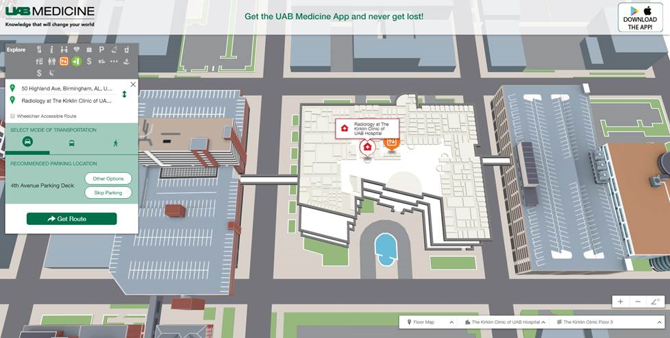
After identifying the end destination (Radiology at the Kirklin Clinic) in the upper left-hand dialog box, the application shows the interior floorplan where the clinic is located. The user can then include a street address as the starting point (50 Highland Ave., Birmingham, AL).
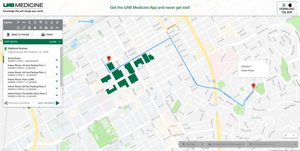
The familiar Google Maps “directions” screen then appears after clicking on the “Get Route” button taking the user from the starting address to the building to where the clinic is located at the UAB medical facility.
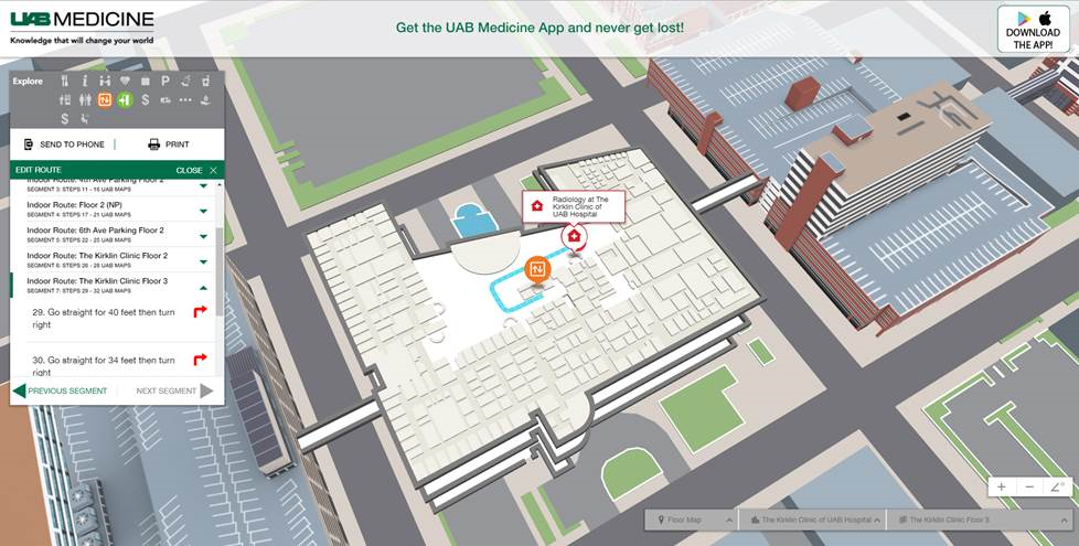
After a series of screens (or Segments) the user is provided with the specific directions on the 3rd floor of the building where the Radiology office is located.
The UAB Medicine Wayfinder is available in a mobile version for both iOS and Android devices, as well as a web version for desktop use (which is used for the screen grabs above.) The app is powered by Bluetooth LE Beacon technology, which emits radio transmissions between the phone and installed fixed locations. There are 1,534 beacons arrayed across the UAB Medicine campus. The app covers 10.7 miles of routable pathways and over 5 million square feet of space with 135 points of interest or destinations covering seven buildings and three parking garages. The desktop version provides the capability to print paper directions. The app is available at the App Store by searching for UAB Medicine Wayfinder. A video demonstrating the app is available here.
Other MediNav examples include: Froedtert Hospital and Medical College (Milwaukee, WI), the National Institutes of Health Clinical Center (Bethesda, MD), Cape Fear Hospital (Fayetteville, NC), and Baycare Health (Western Florida), which features Connexient’s new Navigator v. 3.0 and an Enterprise-wide deployment to 12 sites.
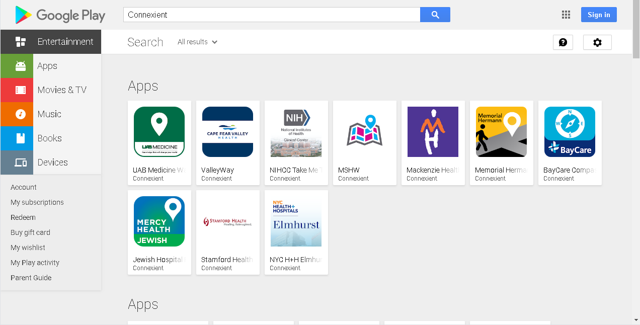
Check the Google Playstore for other Connexient apps.
Extending the Wayfinding Experience
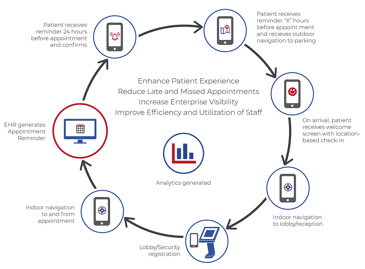
Connexient is working to extend its technology towards creating a more holistic and improved “Patient Experience”. One specific example of how this can work is the integration of digital wayfinding with appointment scheduling in a new model for Patient Experience called the “Airline Check-in Model.” The idea is simple: connect the dots to reduce stress, improve patient experience and reduce missed and late appointments, all while lessening the impact on staff who must provide wayfinding assistance. Moving forward, this can provide both predictive and real-time visibility to healthcare networks on inbound appointment flows and related patient engagements to optimize the use of personnel and other onsite resources.
New Patient Experience “Airline Check-in Model”
Connexient also recently joined the Epic App Orchard, established by health IT behemoth Epic Systems. The App Orchard provides APIs, documentation and support that enable synergistic application and platform companies to integrate and leverage Epic’s Electronic Health Record (EHR) platform and related applications, as well as a marketplace which allows customers to browse through available pre-approved applications. It is envisioned that healthcare organizations can leverage these applications to solve many of the emerging challenges of data-driven care, including clinical decision support, predictive analytics, population health management, and managing patient-generated health data. The “app store” being a growing model and option for many software development environments and certainly very visible in the outdoor geospatial industry.
Summary
The new breakthrough and development of Indoor Navigation and Digital Wayfinding applications provides new opportunities for the traditional GIS/geospatial community. Government organizations which are the owners and stewards of large public facility datasets now have the growing opportunity to work with Digital Wayfinding solution providers such as Connexient to improve the ease and efficiency of navigation both indoors and outdoors in large public facilities and community centers. Transportation hubs – such as Airports, Train Stations, Subways – are also rich with opportunity to benefit from this technology – as well as the emerging “Smart Cities” paradigm.
In the private (and public) sector, medical complexes, corporate campuses, shopping malls, stadiums and concert arenas are all also marching forward to take advantage of this revolution. Industrial complexes and facilities are also pursuing similar paths to enable efficient, reliable geospatial indoor + outdoor mapping and navigation.
With business and industry leveraging new indoor mapping and spatial data collection technologies to deliver Enterprise that spans customer and visitor experience, operational efficiency, safety and security response and more, these are exciting new geospatial developments for the Empire State.
Contact:
Geoff Halstead
Chief Product Officer
Connexient, Inc.
geoff@connexient.com