
University at Albany Program Hosts Third Annual Symposium September 13-14
Background
In April 2014, the State of New York in collaboration with the Division of Homeland Security and Emergency Services funded the University at Albany to design, install, and operate the NYS Early Warning Weather Detection System. The centerpiece of the system is the New York State Mesonet (NYSM) network of 126 weather stations across the state, with at least one site in every county and borough. Each of the Mesonet’s 126 weather stations collects observations of surface temperature, relative humidity, wind speed and direction, precipitation, solar radiation, atmospheric pressure, snow depth, and soil moisture and temperature at three depths (5, 25, and 50 cm). Each site is also outfitted with a camera that collects still images.
In addition, several sub-networks of specialty sites have been deployed. A Profiler Network of 17 sites, which leverages LiDAR technology, provides additional atmospheric data in the vertical (up to 6 miles above ground); a Flux Network of 17 stations monitors the surface energy and a Snow Network of 20 sites which measures snow water content. Operated by the University at Albany, the New York State Mesonet collects, archives, and processes data in real-time every five minutes, feeding weather prediction models and decision-support tools for users across the greater New York region. The NYS Mesonet implementation is part of the larger National Mesonet Program. NYSM is a cross-disciplinary team supporting a standard of excellence in delivering high-quality weather data across the Empire State.
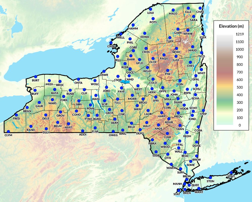
The Mesonet network includes stations in all 62 New York State counties including the five boroughs of New York City
Metadata is provided for each site including lat/long, local landscape characteristics, pictures, elevation, soil classification, among other items. Adjacent variables, such as obstructions, are reflected in a World Meteorological Organization (WMO) rating which indicates that the site’s surrounding environment may cause uncertainty in the data.
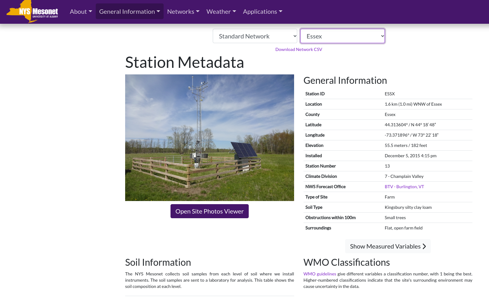
Detailed metadata is available for each station across the Mesonet network which can be used in supporting local weather-related mapping and analysis applications
Data and Geospatial Products
NYSM utilizes these high quality weather data to create end products designed for use by government, academic, and with commercial partners. NYSM supports solving real-world problems in agriculture, emergency management, energy, transportation and protecting public health. Much of the mapping and data visualization products on the Mesonet site is the responsibility of Nathan Bain, Sr. Software Engineer, NYS Mesonet, University at Albany, SUNY. “The core set of software products I use in publishing content on the website include OpenLayers, python scripting, REACT for website development, and Highcharts for interactive time-series plots and line graphs.”
According to Bain, frequent users of the data are the National Weather Service, New York State Department of Health, New York State Department of Environment of Environmental Conservation, a variety of forensic meteorological companies, and private citizens. Forty-four maps are updated every five minutes as presented on this page.
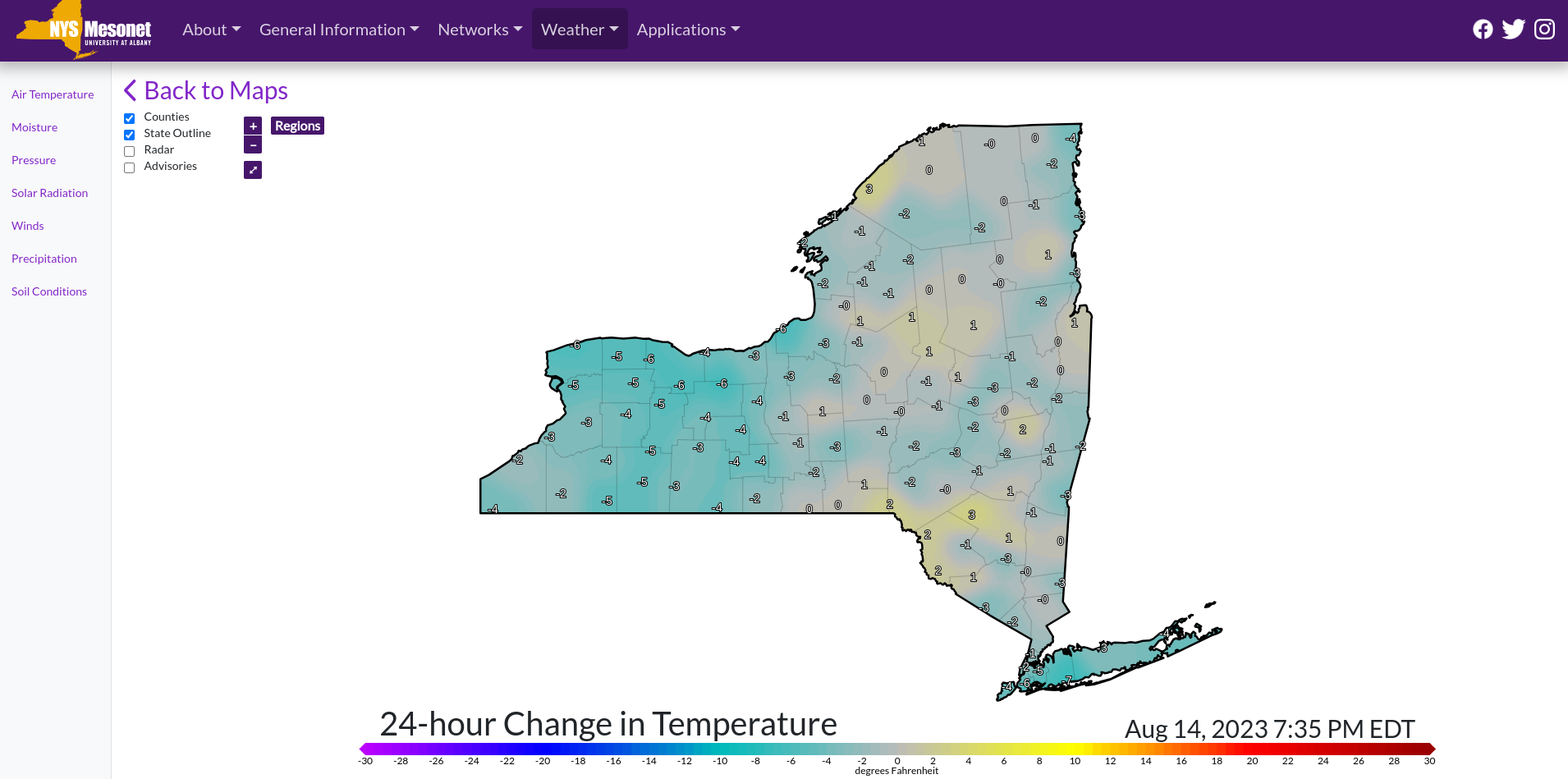
24-hour temp change is one of the many maps which is refreshed every five minutes on the Mesonet website
Mesonet field station data can be requested by completing and agreeing to the terms found in the Data Request Form. Data can be delivered in either NetCDF (network Common Data Form) which is a format for storing multidimensional scientific data (variables) such as temperature, humidity, pressure, wind speed, and direction. Each of the variables can be displayed through a dimension (such as time) in ArcGIS by making a layer or table view from the netCDF file. Data can also be delivered in normal CVS format. Today’s weather statistics are available here. One interactive mapping application which Mesonet publishes “live” is its Transportation app showing the weather variables from sites along the NYS Thruway.
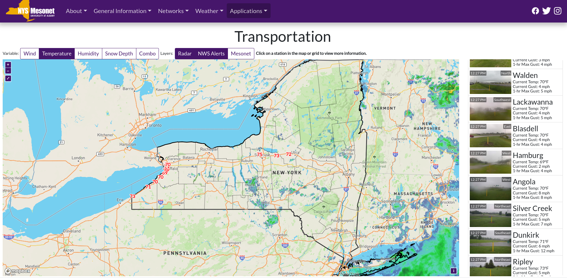
While many of the Mesonet Thruway weather stations are located in western New York near Buffalo, real-time data is collected as far east as Oneida.
September 2023 Conference
The Third Annual New York State (NYS) Mesonet Symposium will be held on 13-14 September 2023 at UAlbany’s ETEC building. Similar to previous symposiums, this will be a chance for people from academia, government, and the private sector to present on research and operational applications of the NYS Mesonet data. While in-person participation registration has been closed, those interested in participating via Zoom can use this link and a copy of the September agenda including presenters and participating organizations is available here.
Contact:
Nathan Bain
Software Engineer
NYS Mesonet
University at Albany
nbain@albany.edu