
While traditional trail maps (hardcopy and digital) are still paramount and important, Mohonk Preserve uses GIS for environmental and facility management purposes as well.
Mohonk Preserve is a nature preserve in the Shawangunk Mountains in Ulster County consisting of over 8,200 acres of cliffs, forests, fields, ponds and streams, and a wide range of unique environmental habitats. It also has over 70 miles of carriage roads and trails for hiking, cycling, trail running, cross-country skiing, snowshoeing, and horseback riding. It is also a major destination for rock climbers in the eastern United States. The Preserve is New York State’s largest nonprofit nature preserve with an estimated 300,000 visitors annually.
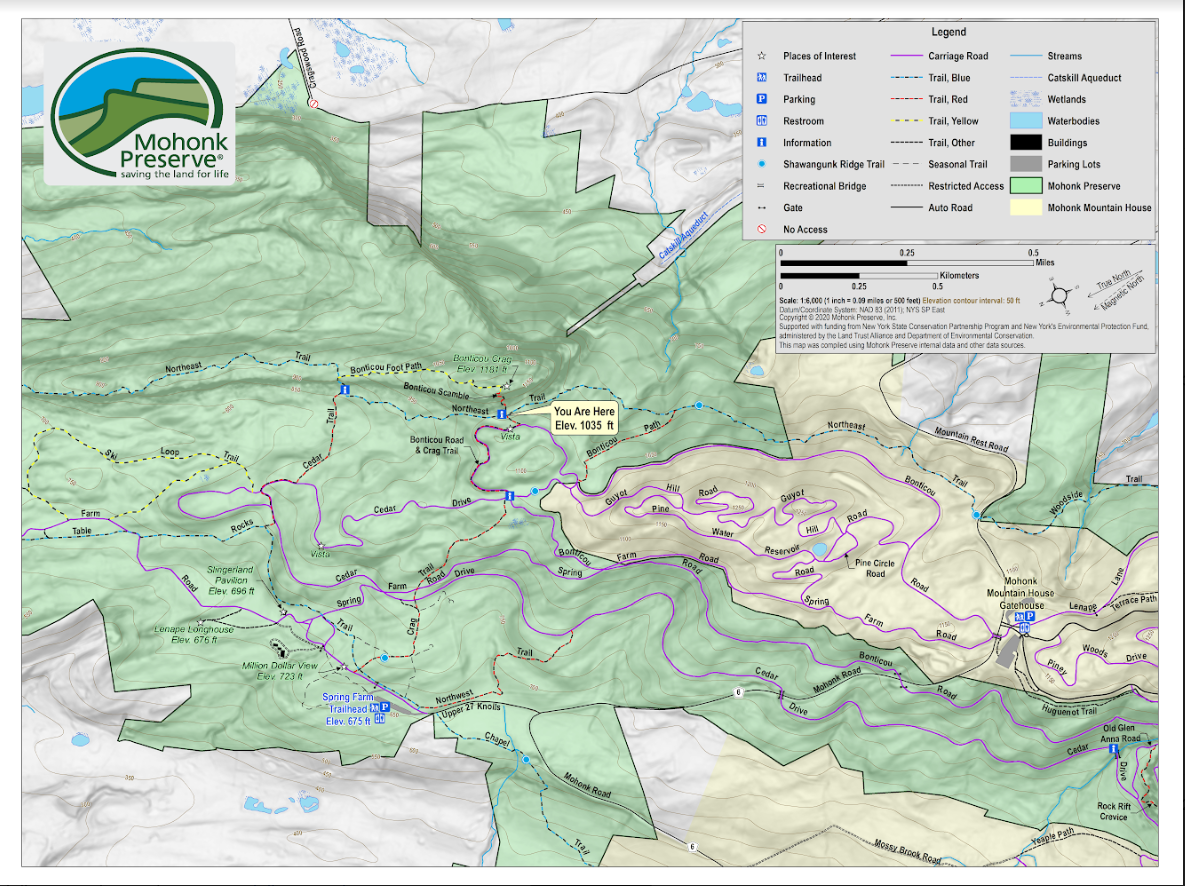
Map making and cartography are still particularly important skillsets at Mohonk
Preserve given the focus on trail use and rock-climbing activities. This is the
wayfinding or locator map that is on the ground (board attached to post) at the intersection of
Crag Trail and Northeast Trail, near the base of the Bonticou Crag Scramble.
Due to its rich biological diversity, New York State’s Shawangunk Mountains (a.k.a the “Gunks”) is one of the most important sites for conservation in the northeastern United States. Because of the many rare natural communities and species found here, the New York Natural Heritage Program ranked the Shawangunks highest in biological diversity. The northern Shawangunk Mountains support 42 state rare species, eight state rare ecological communities, and three globally rare ecological communities in a forested landscape surrounded by residential housing and agricultural uses. Geospatial technologies have supported many government and non-profit-led scientific efforts and studies in the region for years.
Current GIS Applications
Since the early 2000s Preserve staff have been using GIS to inventory and map rare species and habitats in ArcGIS, as well as a wide range of recreational trail maps and related products. Leading the current and most recent use of GIS at Mohonk Preserve is Ed Pestone who serves as Land Protection and GIS Manager. Pestone’s geospatial toolbox includes: ArcGIS client (Map/Pro), ArcGIS Online, Field Maps, Survey 123, and Quick Capture. Helping support higher accuracy field data collection, support staff also use Bad Elf GNSS Surveyor with real time kinematic (RTK) positioning. For the final rendering of maps and cartographic products, staff use several of the apps found in the Adobe Creative Cloud platform.
In recent years, Pestone and the entire Preserve staff have embarked on a major redesign of the preserve-wide map which was a nearly 20-year-old, hand drawn map by artist Jack Fagan. While still functional, the Fagan map was missing several elements both staff and visitors felt needed to be included in an updated map. Approaching the update with a focus on “wayfinding” – in both the hardcopy and digital format – the new map would include new trailheads, new lands acquired by the Preserve, emphasize and better symbolize elevation, and be a product which could be used at trailheads and widely distributed (color and greyscale versions). It was also hoped and intended that the new map would reduce the number of lost hikers. It was an incredibly comprehensive and inclusive redesign effort which is documented in this Hudson Valley online news journal article. A more comprehensive overview of the project is included in the YouTube video from a 2021 inhouse webinar. A geo-referenced version of the new map is available for the Avenza app which can be accessed using this link.
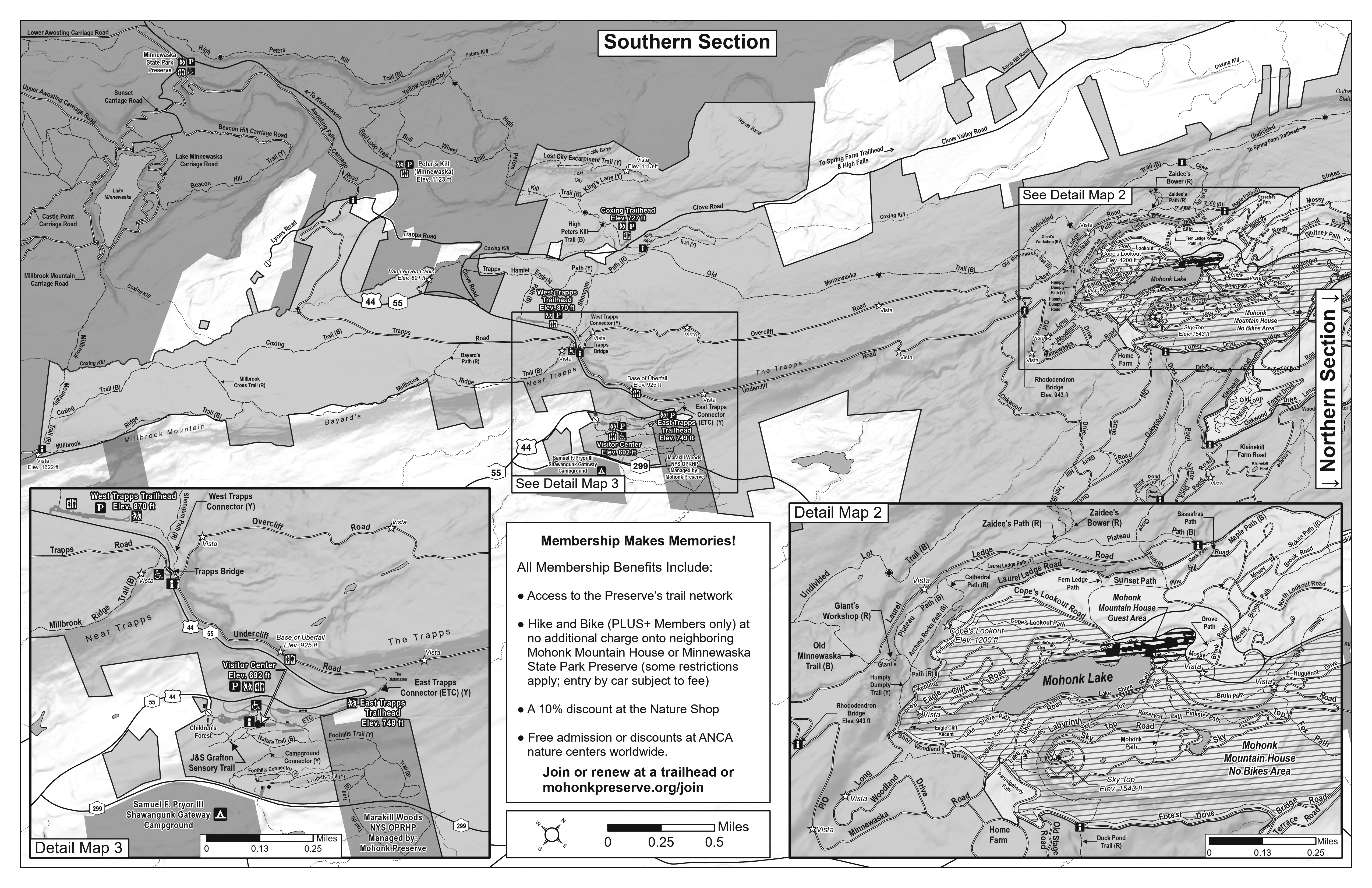
At the request of Preserve Rangers, redesign of the new map included the production of a
greyscale fold-up version which is broken into a “Southern Section” on one side and a Northern Section” on the other (not shown). Rangers wanted an easy to reproduce map that could be given out for free on the trails to hikers and other recreationists.
Geospatial Data
The Preserve data catalog includes an extensive range of both
natural/environmental, cultural, and human-made geographic features. Mobile data collection efforts have collected built environment datasets such as culverts, bridges, signage, waterbars, trailheads, buildings, and parking lots. A majority of this current data was collected in Field Maps by our 2021 Scheuer Intern. The Preserve's carriage roads/trails (as well as the Preserve boundary) are publicly available on ArcGIS Online, they are also both on ESRI vector basemaps through the Community Maps Program. Environmental datasets include forest types (including forest health plots) protected lands, deer and land management units, and significant habitats/species (contributed by both NY Heritage Program and Preserve staff). GIS mapping has also been used to document the locations of rock shelters, historic building foundations, and burial grounds, as well as in support of mapping (courses, mile markers, and aid stations) for special events
such as the Shawangunk Grit. Just a sample of the man-made features mapped at the Preserve include, but not limited to, 356 interpretive signs, 288 trail/directional signs, 290 culverts, 43 gates, 156 waterbars, and 148 traffic/parking signs among others.
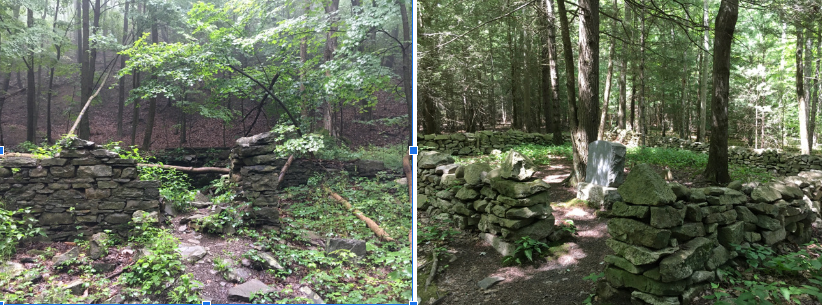
Two of the many man-made and cultural features inventoried in the Preserve using ArcGIS Field
Maps by seasonal staff: historic building foundations (left) and cemeteries (right).
Local data such as parcel, surface water, and zoning datasets are
obtained from Ulster County GIS. GIS work at the Preserve also
leverages data from many sources including the NYS GIS Clearinghouse, NYS Dept. of Environmental Conversation, NYS Office of Parks, Recreation and Historic Preservation, as well as CUGIR at Cornell University, U.S.G.S (national wetlands inventory, National Hydrology Dataset [NHD], and digital elevation data), the Nature Conservancy, and Scenic Hudson. Quite a list.
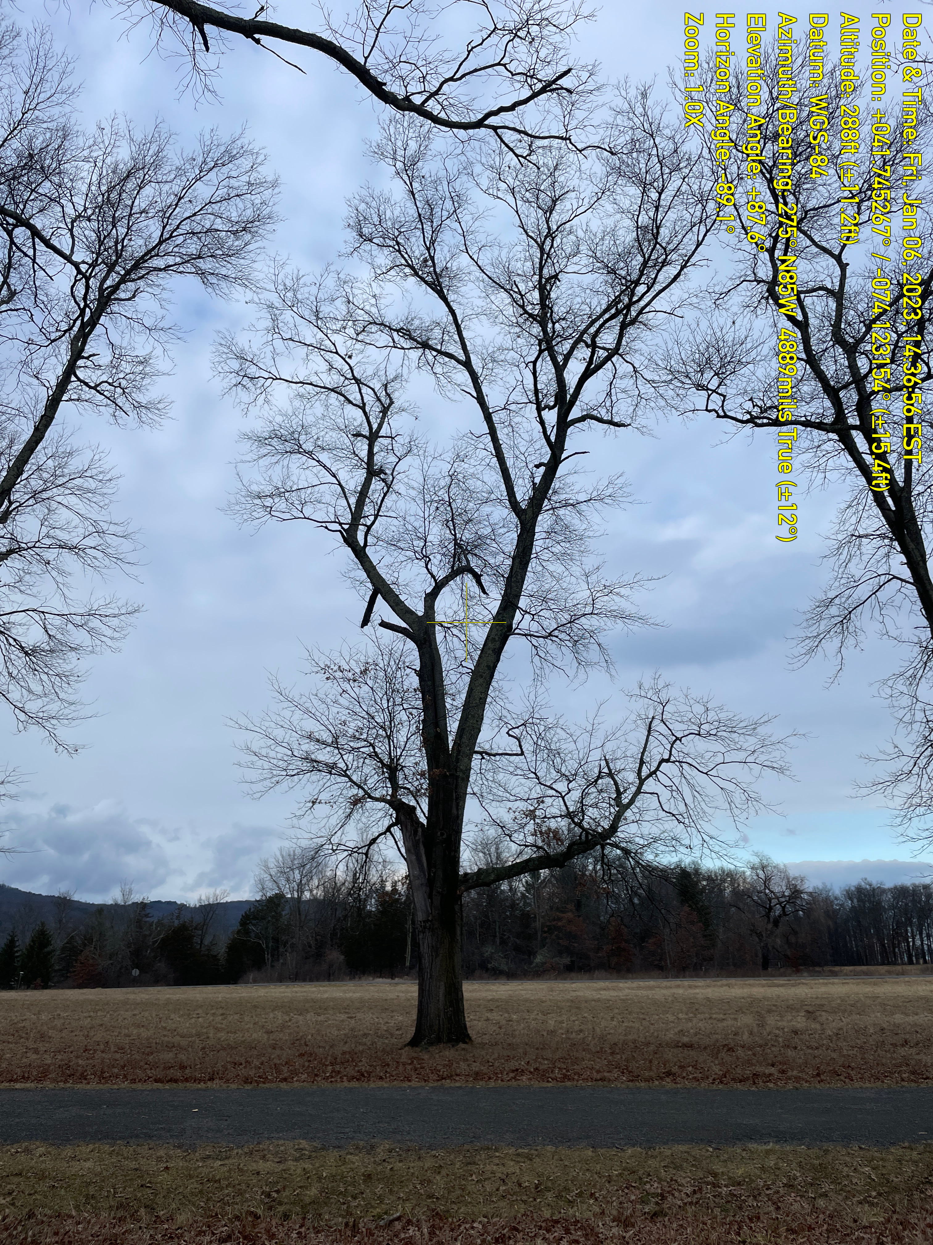
Pin Oaks (Quercus palustris) are an important tree species on the Preserve often bordering some
of the most historic carriage roads. Many of the oaks along carriage roads are at or nearing
their general life span. The Preserve has mapped the location of the Pin Oaks monitoring and
documenting the condition of trees at least once annually (leaf off for photos) using Field Maps.
Work such as cabling, pruning and removing some of the trees is involved in the management
program.
Summary
“Mapping and GIS are integral parts in all aspects of managing the built and natural environment at Mohonk Preserve” notes Pestone. He adds “In the future we see expanding use geospatial technologies by both seasonal and full-time staff and with our collaborating agencies. I anticipate no shortage of uses and applications.”
Contact:
Ed Pestone
GIS and Land Projects Manager
Mohonk Preserve
epestone@mohonkpreserve.org