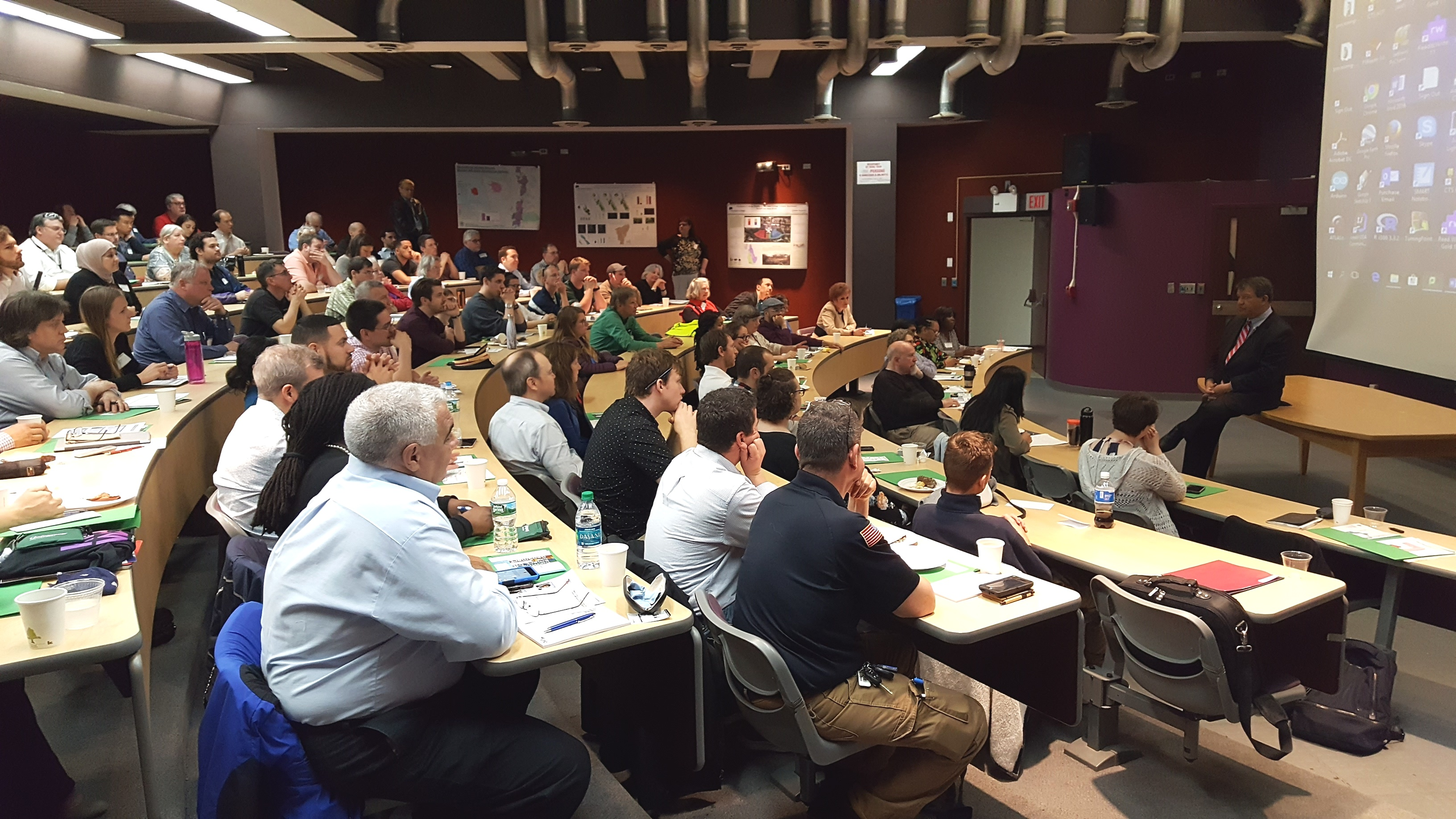
Westchester County GIS has been fortunate to build a broad and diverse community of GIS users and followers over the past two plus decades which is embodied at the our annual GIS User Group Meeting each May. Similar to many first generation GIS government programs which were created in the late 1980s/early 1990s, most of the first decade worth of geospatial programs and applications Westchester County GIS developed were government focused. But as geospatial technology grew at warp speed in industry and business and combining the development and availability of a high accuracy countywide Westchester County digital base map, the visibility of the program quickly expanded. Interest from public safety, nonprofit, academic and civic groups soon followed. And not to minimize the importance of the continued political support the program has maintained over the past two decades at both the county and municipal level. Illustrative of this year’s May 17th meeting held at Purchase College, nearly 170 representatives from government, industry and business, utilities, academia, nonprofits, community groups, and the military convened for the sharing of presentations, geospatial solutions, and best practices to move the countywide and regional geospatial agenda forward.
2018 Agenda
In years past there had always been an effort to keep the presentations and agenda diverse – a little bit of everything. While this has generally served us well over the years, this was the first year we had a specific theme: GIS for Resiliency and Sustainability. This was in response to recent work our GIS program had completed in context of investigating potential impacts of projected sea level rise on county-owned assets as well as administrative changes in the Westchester County Executive office as a result of the November 2017 elections. In the process of bringing these two issues together and including the Office of Sustainability at Purchase College, we were able to add Westchester County Executive George Latimer and Purchase College President Thomas Schwarz to our agenda. Both mentioned and acknowledged the importance and relevance of technology and geospatial in supporting the regional sustainability agenda.

Westchester County Executive George Latimer talking with 2018 User Group meeting attendees. He made reference to the use of geospatial technologies in confronting Climate Change issues.
2018 Speakers
Working with the theme of GIS for Resiliency and Sustainability, we were able to include two well recognized state government speakers in Mark Lowery, Climate Change Analyst with New York State Department of Environmental Conservation, and Amanda Stevens, Project Manager with New York State Energy Research and Development Authority (NYSERDA) Environmental Research Program. With the County’s work in this space increasingly including nonprofit groups, representatives from both Abundant Efficiency and the Westchester Community Foundation were also on the agenda. In the mix were talks by SUEZ North American (water utility) and BetaNYC – an open data advocacy organization based in New York Ctiy. Additionally, we continued to feature our ongoing relationship with the U.S. Military Academy at West Point with a noon presentation by Lieutenant Colonel Jared Ware. Our afternoon session of Lightning Talks and panel discussion featured Sustainable Westchester and representatives from five local governments.

In the morning session, Amanda Stevens provides an overview on NYSERDA’s work and research efforts in the area of climate change – which includes programs in the Lower Hudson River region
Bringing it Together
Admittedly there is always a little luck in hosting conferences such as this and it only takes a day of bad weather for attendance to bottom out (been there). Of course, nothing beats an agenda based on current and cutting-edge geospatial topics backed with recognized speakers, but there are a couple other factors worth noting that seem to help make all of this work for us, including the following:
All Things Local: For all the benefits and advantages of the larger shows, localizing the day’s content and message for local/regional like-minded individuals goes a long way. Geospatial business needs and problems – and often the solutions – are conceptually very similar. Familiar faces with familiar issues. The organic approach.
Affordability: Offering such events at a discount, like free as in our model, makes the event more attractive to more people. However, if its free, it is easy to not show. Nothing paid nothing lost. And we have the historical numbers to show as such. Over the past six-seven years we’ve seen a 25%-30% no show rate from the actual number of pre-conference registration numbers. That said, we’ve learned to factor this variable in the printing of conference materials and sizing break refreshments and lunch. We’ve also learned over the years that other groups and professional societies we’ve tried to partner with in hosting the show may be hesitant to collaborate because they (other organizations) do not want to send a message to their memberships that meetings, and certainly ones that offer Professional Development Units (PDU), are available for free. The bottom line for us is that we continue to make the show free based on vendor fees and affordable food services from the venue location. And besides, there is no capacity to collect money online and/or to deal with bank accounts. What little money management needs we have are handled graciously through the college. Getting pass the bouncer at the door for free works for us.
Vendor Interaction: I can’t say enough about how important this is. We put a lot effort into making sure our sponsors have ample time for interaction with the attendees. Information gathered by attendees in the exhibitor area only adds to the overall value of their day. Food and refreshments are close by so everything (and everybody) is in reaching distance of the vendors. We also have vendor “Vendor Bingo Card” game that encourages attendees to visit each vendor table to qualify for a prize drawing. Pretty nice incentive as this year the prize was a vendor donated iPad. All sponsoring vendors are entitled to 5-minute “Vendor Spotlight” presentation over the course of the day. Without vendor support the day doesn’t happen so we make it worth their while.

Everything is nearby at the Westchester GIS User Group Meeting. Vendors, refreshments, and the main auditorium are all intertwined and close. Making the experience interactive and personal on many levels. It’s a win-win for everyone in attendance. Who are those folks in pink?
The Venue: For the past seven years, Purchase College has graciously made their facilities available to us to host the show. Prior to that we bounced around the County at other locations, but given our relationship with the faculty in the Environmental Studies Program this became a logical spot. Centrally located in mid-Westchester. Easy access.
A naturally lighted vendor area, albeit small, adds to the personal “feel” of the show. One of the main reasons we originally went to Purchase during the third week in May was that the Student Union cafeteria was still open we could make lunch “on your own”. Avoiding all the overhead and cost of providing lunch. We’ve since been able to work with campus caterers to provide us with an affordable lunch menu which is vendor sponsored. This “grab lunch and go” format enables users to eat where and how they want – attending special lunch time presentations, continued discussions with vendors, or simply going outside to eat on the campus plaza. The entire agenda is plenary format held in a cathedral style 150-seat auditorium. We once tried a concurrent sessions format but it just didn’t work and feel right so we went back to the basics. Post-meeting training sessions have proven to be hit or miss. Just seems that just come 3PM after a long day of presentations, networking, and interacting with vendors, most folks are running to the exits. Or the no-host reception down the street.
One of the ironies – and downsides – of having the show on a college campus in mid-to-late May is that spring semester is already over and students have fled campus, though there is normally a handful attending looking for summer or full-time work and passing out resumes. But we clearly do not have the college student attendance that is seen at comparable conferences such as GIS-SIG.
Engage the Professions: We make a significant outreach to the “aligned” professions including engineering, public works, surveying, police and fire departments, government administrators, the planning community and increasingly nonprofits. I wish there was an easier entry point into the 41 school districts here in Westchester County – and particularly their uber large budget bus transportation systems – but we’ve never been able to find it. We focus our efforts to reach the professions with individuals and technical staff that use geospatial technology. Day-to-day work flows that has geospatial intertwined – but is not the only focus of their business day. Truth be told, there simply aren’t a lot of individuals locally who only do GIS work during the course of their business day. The carrot that we offer across the board – and the common denominator – is the geospatial content we publish from our program via our data warehouse or map services.
Summary
Declining government budgets and travel restrictions positions the Annual Westchester GIS User Group meeting as the primarily, if not only, major GIS event many of our government attendees get to each year. It enables us to craft a geospatial message in context of local needs and applications as illustrated in this year’s theme “GIS for Resiliency and Sustainability”. And keeping in mind the importance of their support, the event provides a great framework for industry and business to showcase their product and services. And none of it possible without the support of the great folks at Purchase College.
Cognizant of the many differences and capabilities within the regional GIS communities, it is often difficult to host such events on a reoccurring basis. Perhaps some of the elements of our event can be used in helping build capacity for creating similar events for other regional GIS user communities across the Empire State.
