
Company Name: CARTO
Location: New York, New York
Website: www.carto.com
Employees: 143
Established: 2009
 Founded by Javier de la Torre, CARTO is a diverse and expanding company which includes data scientists, geospatial analysts, cartographers, software developers and engineers, visualization experts, and web designers focusing on Location Intelligence. Most recently in May 2019, CARTO expanded its worldwide professional service portfolio offerings by acquiring Geographica.
Providing ready to use software tools for data scientists and application developers, CARTO’s client focus is on turning location data into business outcomes, and is built around the following workflow:
- Data Ingestion & Management
- Data Enrichment
- Analysis
- Solutions & Visualization
- Integration
Software & Capabilities
Complex analysis, filtering, and visualization are integrated in real time reducing time-to-insight. Users can integrate CARTO’s API’s and geocoding services to complement other apps and business applications and can be integrated with custom proprietary analytical models. CARTO can be used as an engine to visualize a wide range of data services.
CARTO is scalable and offers a Software as a Service (SaaS) deployment model to push new features instantly allowing users to “grow as you go.” Being enterprise-ready also means making on-premise and private clouds architecture solutions available to clients. CARTO also offers a mobile platform.
Sample Products and Applications
On October 16, 2019, CARTO hosted the 2019 Spatial Data Science Conference (SDSC) at Columbia University which I covered and reported on in a previous blog post. Typically GeoSpatial Business Spotlight focuses on three or four applications from the firm being highlighted. However, since SDSC was a day-long series of entirely CARTO-based applications, the conference website provides a better and more thorough overview on how CARTO is applied in business, academia, government, and nonprofit organizations. Choose from presentations by Uber, Facebook, University of Chicago, American Securities, Salesforce Maps, and MIT among others. In Empire State, CARTO supports numerous programs in the metropolitan New York City area in both business and government.
Contributions to the Profession
As part of CARTO’s long-standing commitment to FOSS, Open Source, Open Data, and Open Science, the company has collaborated with many organizations providing access to next generation geospatial technology, data, and models. Most recently (October 2019), CARTO’s Javier de la Torre joined the Urban Computing Foundation (UCF) Technical Advisory Committee which is a neutral forum for accelerating geospatial open source and community development. The UCF operates under the umbrella of The Linux Foundation. In July 2019, Geospatial Media and Communications included Javier de la Torre as part of the Location Analytics & Business Intelligence (LA & BI) Advisory Board. Additional
CARTO is an open source software built on PostGIS and PostgreSQL which was first released in Beta at FOSS4G in September 2011 and officially released at Where2.0 in April 2012. The CARTO software solution uses JavaScript extensively in front end web applications, back end Node.js based APIs, and for client libraries.
Overall, CARTO’s platform consists of the following primary components:
- CARTO Builder
- CARTO Engine
- APIs (Maps, SQL, and Data Services)
- JavaScript Libraries
- CARTOframes
The CARTO platform enables users to access and manage vast amounts of data while at the same time providing numerous processes to discover, filter, and integrate local and Big Data libraries. Geo-enabling large datasets provides a means to visualize and better understand large and complex datasets. CARTO enriches user location data with versatile, relevant datasets, such as demographics and census, and advanced algorithms, drawn from CARTO’s own Data Observatory and offered as Data as a Service (DaaS).
CARTO uses widget-driven dashboards, an array of maps, and unified workflows so that non-GIS and non-mapping users/staff can bring the power of location into the organization’s decision making.
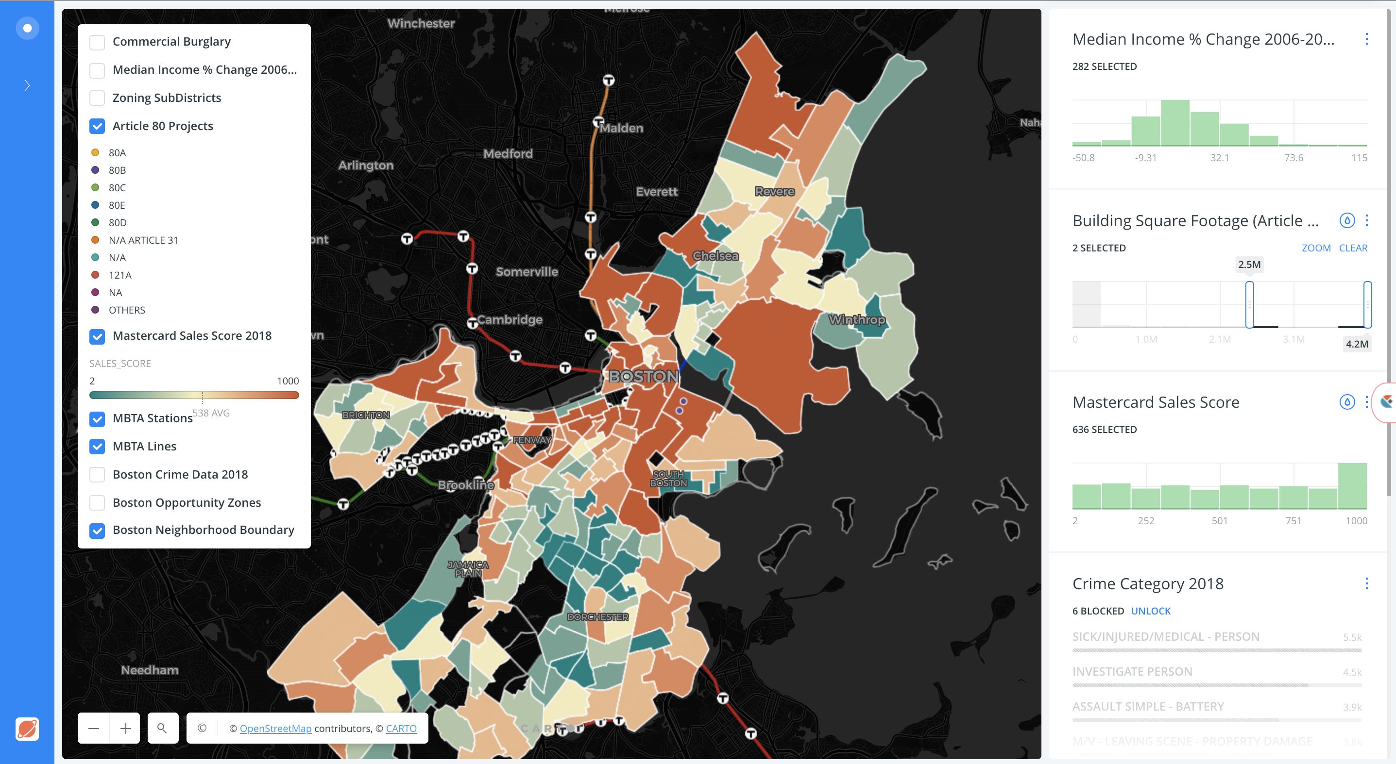
The CARTO software user interface provides both user-friendly mapping and dashboard visuals which can be customized to user needs and experience.
Complex analysis, filtering, and visualization are integrated in real time reducing time-to-insight. Users can integrate CARTO’s API’s and geocoding services to complement other apps and business applications and can be integrated with custom proprietary analytical models. CARTO can be used as an engine to visualize a wide range of data services.
CARTO is scalable and offers a Software as a Service (SaaS) deployment model to push new features instantly allowing users to “grow as you go.” Being enterprise-ready also means making on-premise and private clouds architecture solutions available to clients. CARTO also offers a mobile platform.
Contact:
Florence Broderick
VP Marketing
flo@carto.com
4475-686-89402