For nearly 30 years, Green Map has been an anchor in the Metro NYC nonprofit mapping community. Led by its original founder, Wendy Brawer, Green Map’s portfolio of work and advocacy in locally-led mapping and sustainability efforts is quite impressive. Since the launch of the Green Map System by Wendy Brawer in 1995 and publication of the original Green Map of NYC through her eco-design company, the program’s engagement tools and mapping resources have been adapted by locally-led projects in 65 countries. Many joined the Green Map network when Greenhouse – their first content-managed website – was activated in 2007. The site grew to become a rich resource highlighting community developed mapping work in all parts of the world.
While “green” mapping was one of its early defining products and focus, the organization has expanded its services to include interactive web mapping, education, multimedia, event coordination, workshops, tours, planning and consulting, and creating software development tools.
Community Engagement Maps and Tools
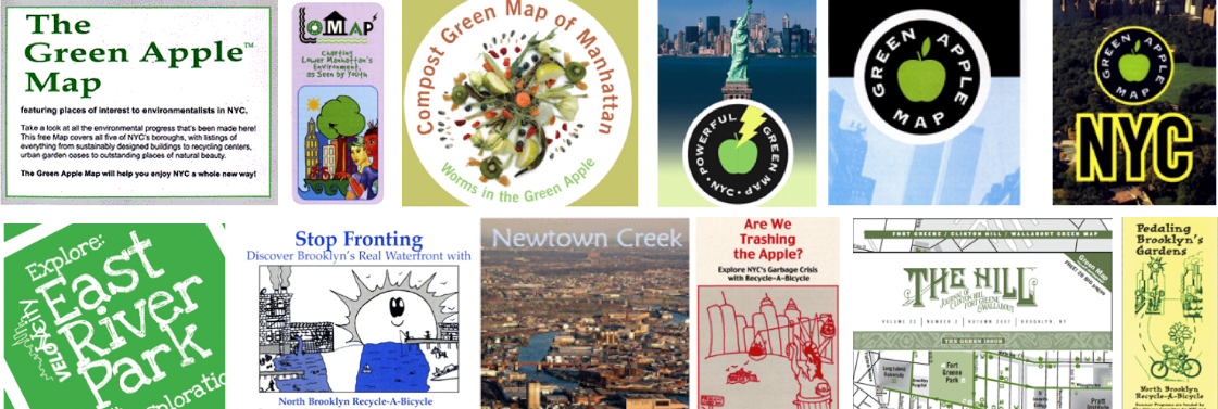
Green Map’s award-winning icons, tools, platform(s) and tutorials help create engaging and visually powerful mapping content used as guides for local nature, culture, community living, social justice and resources for sustainable living. In addition to providing tools and tutorials on making maps, Green Map promotes their mapping efforts as part of Project Stories. Project Stories are locally written and use tags to categorize the story type, theme, and purpose. Users can discover how Green Map projects were created, people and organizations involved and about the project’s impact on their community. Green Map projects are tagged and can be searched as part of the following 11 categories:

Besides its own mapping platform (with version 2 of the Open Green Map now in beta), the program also offers suggestions and tutorials on how to promote the use of the Green Map icons in other interactive mapping platforms such as ArcGIS Online (Story Maps), CARTO, Google Maps, Google Earth, and the Map of Tomorrow.
Projects in New York City
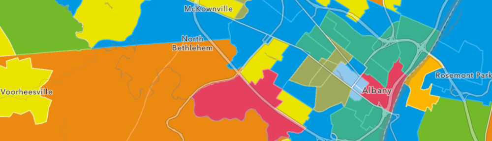
With Manhattan being the geographic genesis of Green Map in 1992, its location provides an incredible range of projects and initiatives. Green Map’s presence expanded significantly in the wake of 2012 Superstorm Sandy which led to a growth of projects focusing on climate change, community preparedness, bicycling systems, inventorying of community assets, energy, and waste reduction.
Whether mapping all of New York City, boroughs, or specific neighborhoods, the Big Apple continues to be the testing ground for new types of Green Maps content including workshops, tours and media projects for the past 25 years.
Its Manhattan efforts include outreach and involvement in New York City classrooms, community theater and stage presentations, creative settings, hack sessions and exhibitions. Green Map also works with a wide diversity of local universities, museums, nonprofits, schools and conferences across the five boroughs. Recent and current work includes the Parsons School of Design, NEW Museum’s NEW INC, Loisaida Open Streets Community Coalition, as well as the following selected efforts:
Refresh L.E.S
A Summer 2019 Lower East Side Green Map project (Refresh LES!) focused on helping residents save energy and reduce both the heat island effect and poor air quality while keeping cool and connecting with the community. This project produced an awesome flyer – page two is below but the entire flyer can be downloaded here. And a Spanish version, too!
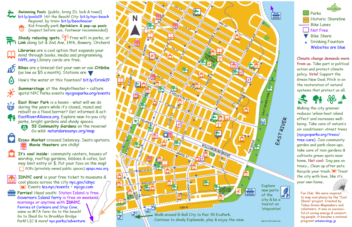
Manhattan’s Lower East Side is getting hotter and more crowded all the time ! The solution?
GreenMapNYC created a new map focusing on saving energy while increasing comfort and expanding community connections.
Newtown Creek Alliance
When the COVID19 pandemic hit the metropolitan New York City area, Newtown Creek Alliance Director of Advocacy and Education, Lisa Bloodgood, found the work of her organization radically impacted. The Alliance had to quickly move their environmental education program focused on Urban Ecology, STEM, and place-based learning, all online to facilitate an existing collaborative program that had been established with selected public schools in Queens. “While we found a platform that suited our needs and began to build interactive materials” says Ms. Bloodgood, “I reached out to Wendy Brawer at Green Map because I knew of the map icons they had created, and I wanted to utilize them for our new tools. The Green Map icons made our final product beautiful, truly unique, far more intuitive, and that much easier to use!”
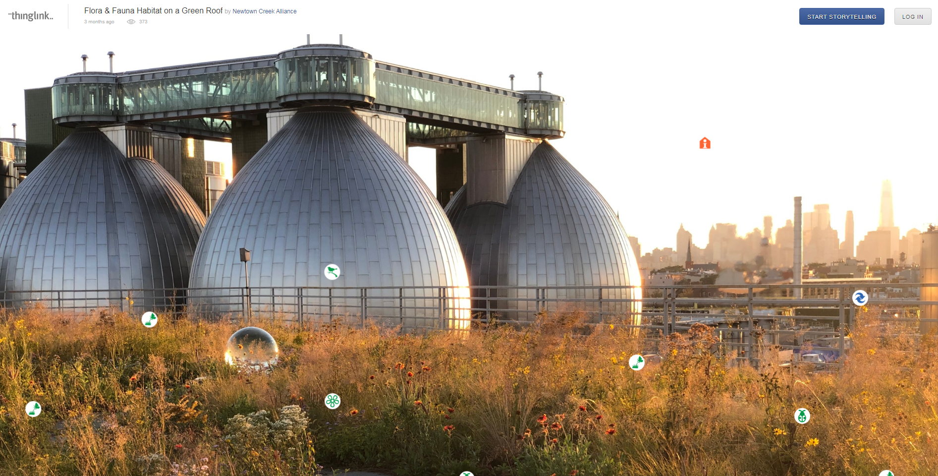
Newtown Creek Alliance currently publishes six online interactive curriculum units one of which is “Flora & Fauna Habitat on a Green Roof”. Click on the image above and see how the Green Map icons are integrated into the application.
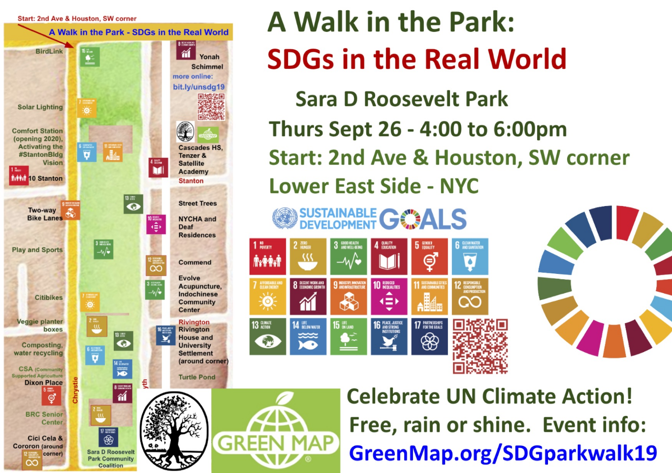
A Walk in the Park: Bringing the UN Climate Summit Downtown
Last September, the Sara D. Roosevelt Park Coalition partnered with Green Map during the UN Climate Summit to connect local and long standing grassroots community sustainable efforts with the work of the United Nation’s (UN) Sustainable Development Goals (SDG). The effort was to educate the local community on what was happening 42 blocks away from the park in the UN building while also offering to educate UN delegates on what was happening in a diverse, low-income NYC neighborhood park. Entitled “A Walk in the Park: Bringing the UN Climate Summit Downtown”, the program had 17 “stations” highlighting exemplary local community assets and programs – each station linked to and focusing on one of the 17 UN SDG goals. A detailed walking map of the event rich with Green Map icons can be downloaded here.
“Wendy thinks big and collaboratively and then rolls up her sleeves to sweat with the rest of us to make those ideas come to life” says K Webster, President, Sara Roosevelt Park Coalition, “she doesn’t shrink from saying her thinking, she is generous with contacts and her own expertise, she listens, is open to rethinking everything after the communities she works with weigh in. That just doesn’t happen very often!”
gardeners, artists, turtle caretakers, small businesses, food
purveyors, social justice organizations, children’s story readers, substance use
disorder providers, senior nutrition centers, help for the unhoused, a Settlement
House, Urban Park Rangers, Bird habitat builders, anti-poverty groups, bee
farmers, housed and unhoused park workers and volunteers.
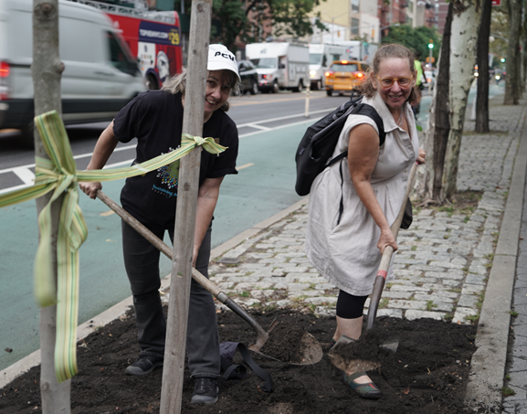
As part of the Sara D. Roosevelt Park event, K Webster (left) and Wendy Brawer (right) plant the first of the new street trees.
“Open” for Collaboration and Innovation
A very recent and major change for the organization was to “go open” with the beta release of the new OpenGreenMap (OGM2) website. The open technology for the OGM2 portal is being developed voluntarily by the GISCollective. A presentation by those contributing to the application’s development was made at the August 2019 FOSS4G open mapping conference in Bucharest, Romania, now this team offers demos on the OGM2 platform.
Built on top of OpenStreeMap, OGM2 enables registered users to create their own projects, collaborate with others, and visit Green Map mapping efforts all over the world.
With the urgency of climate change, barriers to participation are being lifted. Green Map System, Inc. has also re-licensed the once-copyrighted Green Map Icons, V3, for use under the Creative Commons BY-NC-SA license (+CC). This licensing vehicle enables users to freely use the Green Map Icons on non-commercial projects of any kind, adapting and sharing them providing users provide credit to the Green Map System and sharing the project. Reciprocity from any income-generating project – which requires Green Map notification ahead of time – is expected.
What’s Next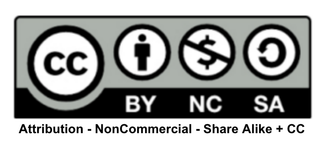
Currently, Green Map is involved in a range of place making and engagement projects that support wellbeing and community action, even during the COVID period. For example, check out the new set of Recovery Icons which highlight public health, recuperation and regeneration resources and needs. The icons can be used on any app, map, art, sign etc, including OGM2 which Green Map will help promote. More pandemic projects by Green Map and Wendy Brawer can be explored at bit.ly/GMpivot.
Soon, watch for event announcements (virtual and IRL) regarding the Green Map exhibit opening at the Museum of Reclaimed Urban Spaces (MoRUS) in Manhattan’s East Village. Individuals will be able to see how people, near and far, have used mapping to showcase How Green Is My City! It includes a special section of ‘beyond the map’ projects that Green Map NYC collaborates on locally, including the return of a long-shuttered Sara D Roosevelt Park Rec Center, the Stanton Building, to the community (with new public restrooms opened in Jan 2020), the Dutch Kills Loop (an infrastructure reuse project in Long Island City) and more.
Wendy concludes, “We face new challenges on an almost daily basis, and Green Map is hearing from new mapmakers ready to help people find new directions to a greener and healthier future. I’m always available to help strategize an inclusive, engaging community sustainability mapping project or to discuss how our open assets can help your program thrive. Let’s all work toward a better common future”
Indeed, Green Map’s body of work speaks for itself.
Contact:
Wendy Brawer, Director
Green Map System
GreenMap.org + NYC
WendyBrawer.com
web@greenmap.org
+1 212.674.1631