 eSpatiallyNewYork had the opportunity to participate in the recent New York State Association of Professional Land Surveyors (NYSAPLS) annual conference in Saratoga Springs in late January. In doing so, I was able to meet with numerous NYSAPLS members, including briefly with current NYSAPLS President Greg de Bruin, as well as several vendors in the exhibit hall. Having run almost exclusively in the statewide GIS circle for the past 25+ years, and having really no reference point what to expect at the show – I was not disappointed.
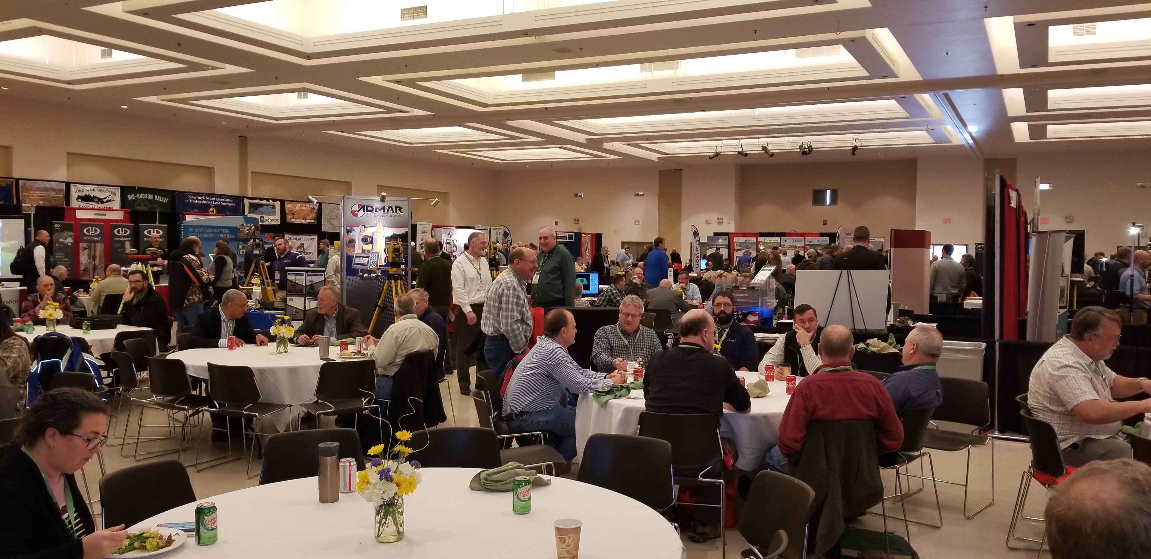
The three-day conference brought together 704 registered attendees with the overall total reaching 775 when including 31 exhibitor representatives. While I was almost certain to see components of the traditional surveying profession (i.e., leveling rods, measuring tapes, tripods, safety equipment/clothing, nails and spikes, monuments, flagging and marking paints – the customary surveying equipment fare), I was pleasantly surprised to see in both the exhibit hall and throughout individual presentations evidence of the statewide surveying community investing in a variety of developing technologies such as laser scanning, drones, 3D, advanced GPS and photogrammetry, and an abundant number of emerging mobile and field programs. Quite noticeably, surveying firms offering a broader range of geospatial products and services. It was clear on the exhibit hall alone how the Empire State surveying community is embracing state-of-the-art geospatial technologies in 2019.

The exhibit hall at this year’s NYSAPLS conference offered an impressive line-up of vendors. The daily Strolling Lunch with Exhibitors engages attendees with the exhibitors.
The conference offered a very diverse range of presentations, classes and workshops. Of particular interest was to see presentations focusing on Building Information Modeling (BIM), 3D Building Rights and Air Rights, and several focusing on the drone/UAV. Given the surveying profession’s important role in the development and maintenance of statewide tax maps, there were a number of sessions dedicated to the issues associated with land ownership including easements and right-of-ways, tying into and using historical documentation, tides and tidal datums, highway law, and even canal boundary retracement. Though I was unable to attend, a class on stone walls focusing on their importance in land records and property boundary definition was held. Even a class on “Dendrology for Surveyors” class was included on the agenda. Of course there was a very visible presence of the field of photogrammetry which remains a staple throughout the profession, while new capabilities in the field of underground and subsurface mapping were also on display. Making reference to the range of content at the conference, Ben Houston, Professional Engineer, Associate Member of NYSAPLS and NYS GIS Association Board Member commented “This year’s NYSAPLS Conference offered a nice mix of training and social/networking opportunities. I was particularly impressed at the number and variety of professional services and geospatial data vendors in the exhibit hall.”

Of course there was ample time for mixers and social events at this year’s NYSAPLS conference. One of the Special Events at the show was the Field Olympics. Participants were able to compete against others in three events one of which was Tree Identification. Is that Ginkgo Biloba in #4? And here are the winners of this year’s map contest!
An important takeaway for me from the NYSAPLS conference was the focus on the business of surveying. A geospatial profession largely dominated by private practice, business and industry, and enabling itself to create a presence in Albany. As part of this presence, NYAPLS has recently created a Political Action Committee (PAC). PACs are a type of political committee, once properly registered, which can engage in promoting candidates for election to public office that share the views, interests, and concerns of the land surveying community. This new committee is one of several active NYSAPLS groups working on issues such as standards and strategic planning. Outreach and communication to the professional engineering communities and the State Board for engineering, land surveying, and geology remain priorities as well. (New York State professional surveyor accreditation and licensing is administered through the NYS Education Department Office of the Professions.) “This year’s conference was outstanding”, notes current NYSAPLS President Greg de Bruin, “the facility, content, conference coordination were all first rate.”
For those involved in mapping technologies within the Empire State, it’s worth the time to visit the NYSAPLS website to see the many areas and programs this professional organization touches across the geospatial community. There are a multitude of opportunities for collaboration.
Contact:
Amber Carpenter
amber@nysapls.org
518-432-4046
Greg de Bruin
gdebruin@gayrondebruin.com
516-805-4118
