Eileen Allen is a familiar and respected face across the New York State GIS landscape. First a foremost an instructor at SUNY Plattsburgh, she has instructed and mentored hundreds of students who are now part of the statewide geospatial fabric. And in her spare time she has participated and contributed to numerous statewide GIS advisory committees over the past 20 years. Always upbeat and a pleasure to work with, she is most certainly a first ballot lock for the GIS wing at the Hall of Fame in Cooperstown.
eSpatiallyNewYork: How long have you been at SUNY Plattsburgh?
Allen: I was an undergraduate student at Plattsburgh State from 1973-1977. In August 1984, I was hired to help finish a remote sensing research grant mapping historical beaver locations in the Adirondacks. I’ve been here ever since.
eSpatiallyNewYork: Where are you originally from and tell us about your journey that led to Plattsburgh.
Allen: Both my husband and I grew up in Plattsburgh. Fortunately there were state and federal programs to help me get a college education. After college at SUNY Plattsburgh, I went to McGill and worked on a Master’s in physical geography. Everything seemed to go wrong with my advisor and the research. It was hard but necessary to leave there. Fortunately, I could use my McGill credits and finish a Master’s program in Natural Resources at SUNY Plattsburgh while I worked on research projects. I thought about getting my PhD but I just didn’t end up going in that direction. Besides, I liked the research projects I was working on too much!
eSpatiallyNewYork: You’ve been associated with the GIS program at Plattsburgh since its origin. How did it get started? Who was involved?
Allen: My involvement with teaching GIS developed out of research projects and the need to train student workers. Dr. Richard Lamb was instrumental in developing the GIS courses and a minor in addition to his planning courses and practice. He started the GIS course in the late-1990s and by the early-2000s we would take turns teaching the Introduction to GIS class. I took over all the GIS classes when he retired and the Remote Sensing courses when Dr. Donald Bogucki retired.
But there is more, because so many chance occurrences determine our path. Also, it has been noted that many more women are in GIS than in other natural sciences. When taking college classes, I was often one of a very few or the only female. Many people think that because GIS is so collaborative, women often gravitate towards it. This is certainly true for me.
As an undergraduate, I was interested in many things but was unsure what I would major in and tried out several paths. I needed a Social Science course and Physical Geography was on the list, so I took it. Drs. Donald Bogucki (Geography) and Gerhard Gruendling (Biology) were working on a pilot project mapping wetlands and demonstrated this in their classes. The grant was to investigate the use of remote sensing to estimate the impact of regulating the Richelieu River (the outflow of Lake Champlain, NY-VT) because of flooding concerns in Quebec. Dr. Bogucki showed some color infrared imagery of wetlands in Physical Geography class and I was totally flabbergasted! I absolutely had to be involved with the project! It took several days for me to get the courage up to ask if I could be part of the research. It so happened that they needed someone to use a transit to establish ground control. I had been working with my father, a land surveyor, for many years and was enlisted by Dr. Bogucki to help set out targets and map them.
In the early 1970’s, it was very unusual for an ecologist and a geomorphologist to work together. That was part of the attraction, though, where many of my interests could be combined. By chance, at about the same time, the Environmental Science Program was started at SUNY Plattsburgh and I had found my academic home. I continued to be part of the project mapping Lake Champlain wetlands using custom flown 70-mm imagery until my graduation.
By 1984, other environmental problems were surfacing. Acidic deposition was recognized as impacting Adirondack lake fish populations and one theory (to distract from mid-western power plant pollution) was that beaver dams in the Adirondacks prevented fish from reaching ponds and stream reaches for breeding. My friend working with Dr. Donald Bogucki, Dr. Gerhard Gruendling, and Dr. Ken Adams on this project was leaving for graduate school to earn her PhD and I came in to finish her work. Drs. Bogucki and Gruendling kept getting more grants and I kept working for them.
In the early 1990’s, the Adirondack Park Agency received funding from US EPA to map wetlands in one of the major Adirondack Park watersheds. The Agency subcontracted to Drs. Bogucki and Gruendling to map wetlands from USGS NHAP and NAPP color infrared imagery. Remote sensing work and transfer to base map was all analog; we had to hand digitize many of the data layers. We worked closely with John Barge at the NYS Adirondack Park Agency (a gifted practitioner) and we felt that just as we critically needed GIS functionality, it was becoming available. We had PC Arc/Info and John had Arc/Info for Prime – all command line but wonderful for the time. Over a period of 20 years we received numerous grants to map Adirondack wetlands. By the end of the wetlands mapping projects, GIS and Remote Sensing hardware and software had matured enough that we could do all of the work digitally. We trained many students in GIS and Remote Sensing. It was truly a team effort!
eSpatiallyNewYork: What classes are you teaching these days?
Allen: My classes are Introduction to GIS and one of the two labs every semester: GIS Applications in the Spring, and Principles of Remote Sensing in the Fall. I also host independent studies or oversee internships. I’ve been fortunate to help teach the Geomorphology lab with Dr. David Franzi for several semesters. He has written excellent labs that use GIS and Excel together to help students analyze geological processes.
Part of my job, in addition to maintaining labs and research space, is to help other faculty with their GIS needs. This is fantastic since I am basically nosey and like to see what their research is. However I tell them that I like doing this because problem solving is so fulfilling.
eSpatiallyNewYork: Over the years, has the type of student pursuing geography/GIS as a profession changed in any way?
Allen: Since many of our programs expose students to GIS, there is a broader range of students taking the classes. Early students were primarily from planning or geography majors. I believe that there is a greater familiarity with spatial data now because of the easy access to it from our cell phones. Consequently students have a better understanding of the power of maps – and an expectation of readily available data – even before they attend college. Also, there has been a shift in expectations of a college degree and many students will take the course because they recognize that GIS may be a skill that will get them a job.
eSpatiallyNewYork: How has teaching geospatial/GIS concepts in the classroom changed over the years?
Allen: This is an interesting question because not only has GIS changed but I’ve changed how I approach it. One turning point in GIS was the true incorporation of Windows to ESRI products. This resulted in students already knowing some of the basic functions. Online content makes it easier for students to explore data and do more customized projects. However, we still take time to explore data quality and creation. If they have to do heads-up digitizing, it makes them appreciate some of the data sets a wee bit more and how to anticipate errors.
My teaching has changed to also emphasize problem solving, quality control, and how to deal with frustration. While I try to be sneaky about it by teasing and overly good moods, I am pretty sure that when students ask a question, they’d just as soon not hear the process of how to resolve the inquiry. It is an important part of their education though. I make a big fuss with the students that my job is to teach them principles, not software. Software will keep changing and they will need to know principles, possibilities, and how to do problem solving. Once they understand what GIS does, they should be able to figure out anything they want to do if they have the underlying concepts.
eSpatiallyNewYork: Any piece/part of GIS/geospatial technology that seems to resonate more among your students?
Allen: In the Introduction to GIS course, we have to cover many basic principles such as projections, cartography, and data management because these are not introduced in other courses. The students do problems, usually through tutorials, meant to explore principles and become familiar with the ArcGIS interface. Even late in the semester when they do their own maps, most students need help remembering what they did at the beginning of the semester. However in our second course, GIS Applications, the focus is on project problems and using GIS for their resolution. While they have to struggle to remember what they learned in Introduction to GIS and to explore new tools, the focus makes their learning more relevant and even fun.
eSpatiallyNewYork: Have you had any experience with or been involved with any MOOCs?
Allen: I’ve taken a couple of the ESRI MOOCs both as a way to be introduced to ArcGIS Pro and to see how MOOCs are structured. They were well done, informative, and entertaining as well as a great multimedia way to reach a broad audience. MOOCs also made me appreciate that students need learning through guided tutorials as well as through problem solving. I still really like learning by poring over hard-copy manuals, though.
eSpatiallyNewYork: Over the years, what statewide GIS committees and programs have you served on and contributed to?
- Academic representative on the NYS GIS Coordinating body, 2004-December 2012
- Member of the New York State GIS Working Groups: GIS/LIS, and Land Use/Land Cover. 2003- 2010.
- Member NYS GIS Association Education Committee January 2013 to present
- Member of NYS GIS Coordinating Body Nominating Committee, December 2012
- Member of NYS GIS Coordinating Body Data Sharing Policy Workgroup, Sept.-Dec. 2012
- Member NYS GIS Association Regional Groups Committee,
- NYS GIS Association member, 2005-present.o Member of the NYS GIS Association Regional Groups Committee. January 2013 to present
- Certified GIS Professional: Certification Number 00046560. I was the second person in New York State to earn GISP certification (2009).
- Participated in initial discussions on the creation of the NYS GIS Association
These state groups have been an important part of my education. Academics really do have a different mindset than other GIS users. Membership on state committees is really important for communication across the profession; just as conferences are. I wish the land surveying professionals would also contribute with their different set of skills and concerns.
eSpatiallyNewYork: Lake Champlain is a big piece of the Plattsburgh landscape. Have you ever been involved in any GIS applications, projects, research in this area?
Allen: Almost all of my projects have been in either the Adirondacks or the Lake Champlain watershed. It is interesting working between states (NY and VT) and countries (US and Canada). GIS data are becoming part of government infrastructure and web access is nearly ubiquitous but there are still major differences in availability, ease of access, and resolution.
eSpatiallyNewYork: You’ve been doing this a long time. What are some of your all-time favorite projects?
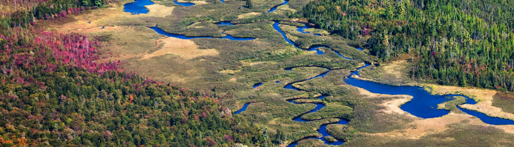
Allen: Every time I see new imagery it is a thrill. I still love problem solving so I’ll always love GIS (ha!). Whenever I travel, I’m drawn to wetlands (which has been most of my work) and marvel at their beauty, diversity, and adaptations. It seems that mapping wetlands from aerial imagery and developing GIS data layers from that and then teaching these skills to students was what I was meant to do.
eSpatiallyNewYork: What are your go-to hardcopy and online GIS publications?
Allen: I really like the e-newsletters such as Stack Overflow, Directions Magazine, webinars such as those offered through NYS GIS Association, and eSpatiallyNewYork. While the GIS text we use (Mastering ArcGIS by Maribeth Price) is an excellent resource, I really learn the most from trying to problem solve; the web has truly changed our abilities to share solutions. Conferences are particularly valuable but I can attend so very few.
eSpatiallyNewYork: Had you not ended up in teaching geography and GIS as a profession, what else might had you done? What might life outside of academia been like?
Allen: My ambition in high school was to be a high school teacher in earth science or math or music. Perhaps becoming a Land Surveyor. In reality, I would probably just join other characters at the U.S Post Office.
eSpatiallyNewYork: So what’s on the bucket list after SUNY Plattsburgh?
Allen: My husband and I would like to travel a bit. It would be wonderful to have time to get back into hiking and canoeing, to have a well-weeded garden, and to learn the mandolin.
eSpatiallyNewYork: It’s all about geography. Where’s the most favorite place you’ve traveled to?
Allen: That’s a tough one – especially since we live in an incredible area and have traveled to some amazing places. I think meeting family in Scotland and being able to explore ruins, castles, and Hadrian ’s Wall in England (designed to keep my ancestors out!) was pretty awesome.
eSpatiallyNewYork: You live in Plattsburgh. It’s either one or the other: Hockey or some kind of snow sport. Come clean – what winter sports equipment is in your garage?
Allen: In our garage are cross-country skis and snowshoes. For the summer, we have muddy hiking boots and road bikes. I have to admit that I went to my student’s rugby game a couple of weekends ago. That’s a first but it was important to him. While I had no clue what was happening in the game, I loved visiting with his parents and sisters! Same when I went to my one and only soccer game when your son played in Plattsburgh. I had no clue what was going on then, either. However, the effort, enthusiasm, and teamwork from the students was thoroughly enjoyable!