Program built and designed by Rochester area New York Army National Guard member
While serving in a Joint Multinational Training Group in Ukraine (JMTG-U) in 2018 along with other NATO nation soldiers, New York Army National Guard CPT James Pistell, a Rochester resident, was using a website to make operations graphics as they planned training operations while training Ukrainian soldiers and battle staffs. A self-taught software web developer in civilian life, Pistell felt the website was outdated, had limited functionality, and believed he could build a much better version based on his military in-field service and programming skills.

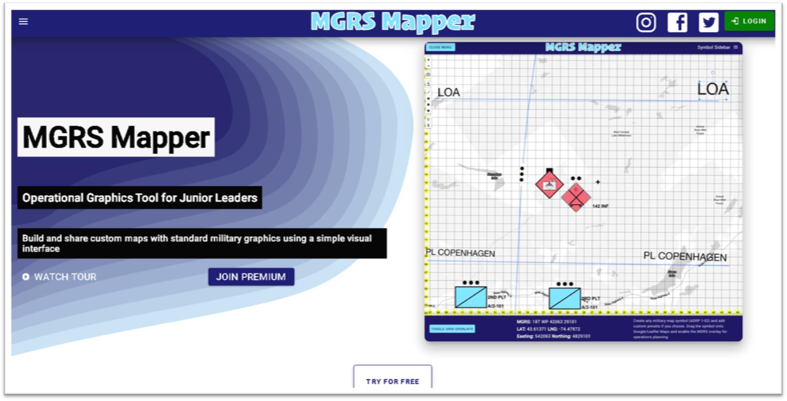
Pistell makes available both free and subscription-based versions of MGRS-Mapper. The web site landing page provides access to the free version enabling site visitors to see samples of the military symbology and easy-to-use drag and drop functionality
Upon his return to the states, leaving his full-time job in marketing and dedicating over a year of full-time development work, Pistell released MGRS-Mapper (MGRS for Military Grid Reference System) in late 2018. (The MGRS overlay is based on standard Grid Zone Designator intervals commonly found on military installation maps using the NAD 83/WGS 84 industry standard).
Developed entirely with JavaScript the application enables users to easily overlay the MGRS grid atop of a Google base map (other base maps are available as well) and provides Premium users access to the latest standard in military symbols as part of ADP 1-02 (Army Doctrine Publication) which contains over 737 unique symbols used by many branches of the military. This set includes all Land Forces, Equipment, Activities, Graphic Control Measures, Tactical Mission Tasks, Installations, Supplies, Command Posts, Civilian Authorities, Sea Units, Air Units and Sustainment. Definitely not the same symbol sets the GIS community is accustomed to using in making land use and environmental maps albeit interesting nonetheless!
Premium Version
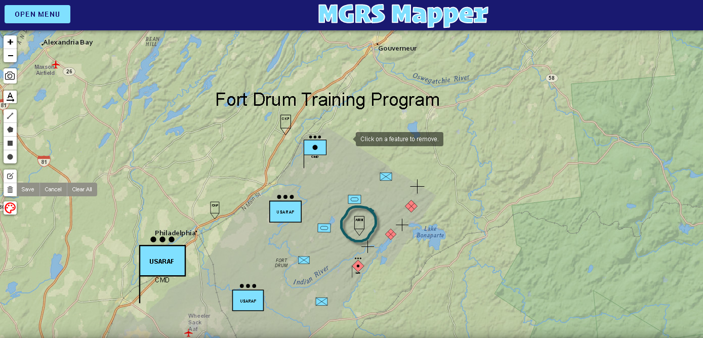
With access to the premium version I was able to build, if only an introductory amateur version at best, a CONOP (Concept of Operation) map. Using symbols compliant with ADP 1-02, I’ve mapped out a National Guard training program in the area of Ft. Drum showing the locations of friendly (blue symbology) platoons and infantry, armored tank units, and field artillery. Red colored symbols, or hostile resources, identifying the locations of infantry and artillery units. Also included in the map show the locations target reference points (black crosses), check points on the western edge of Ft. Drum along Route 11 and a larger blue symbol in the southwestern part of the map to highlight a National Guard Command Post. The symbol circled in green in the middle of the map is an Amnesty Point. Hundreds of other military symbols are available for the user.
The horizontal toolbar on the left side of the application provides the user with the capabilities of taking a screen snapshot (camera icon) and saving as a .png to be downloaded and emailed to another user, printed out as a handout, or embedded in slides.

Users can click on any symbol on the map and drag it to your preferred location. From there you can rotate, resize, invert, scale up or scale the symbol down.
Pistell is currently working on several enhancements to the application including allowing Premium mobile users to cache maps on their device for use in places with limited internet connection, porting the application for use on both Apple iOS and Android devices, and the ability to share live links of user maps for live map scenario collaboration. MGRS Mapper also offers certain organizations a large discount on team accounts including Volunteer Search and Rescue Teams, Volunteer Fire Departments, ROTC Battalions, U.S. Military elements at section level or above, as well as any organization that relies primarily on volunteers.

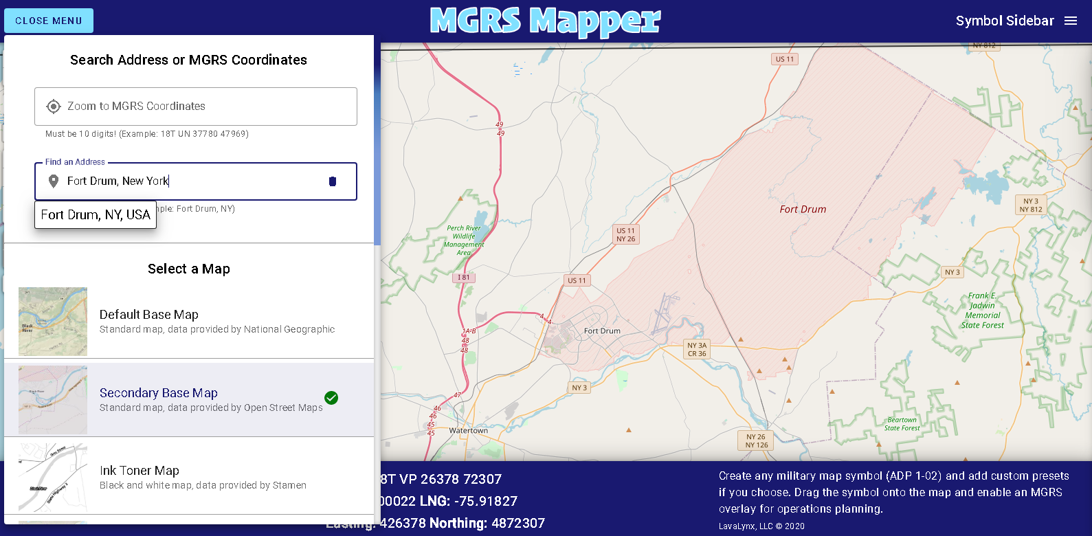
MGRS Mapper allows users to find locations by either typing in an address or inputting a valid MGRS grid coordinate as well offering several easily accessible and open source base maps including OpenStreetMaps (shown below), National Geographic, ArcGIS, Stamen (black & white) and OpenStreetMap.
Pistell notes he has about 225 active subscriptions with many in military (Army). He also includes on the list the Panamanian National Guard, Californai Search and Rescue Team, and numerous civilians who are military trainers. “It’s incredibly rewarding to see individuals and organizations using a software program that you’ve written all the code for and built from scratch”, he says. Continuing he notes “ this all started with my experience overseas and wanting military leaders and colleagues to make training maps and apply the same principals to organizations stateside.”
It would appear with the release of MGRS Mapper that Pistell is fulfilling that vision.
He currently serves as Cyber Network Defense Manager for the 173rd Cyber Protection Team in the New York Army National Guard.
Contact:
CPT James Pistell
MGRS-Mapper
admin@mgrs-mapper.com
