Publishing spatial data content has proven to be great outreach in terms of providing transparency and exposure for many government GIS programs – including here at Westchester County. Increasingly much easier for geospatial organizations to do courtesy of powerful server technology allowing these same agencies to easily spin together data services based on common thematic features such as environmental, planimetric, business, demographics, cultural, parcels, and aerial photography to name only a few. Though the data service environment is better understood and leveraged by a specific user community knowing what type of spatial content to look for, there remains even a larger community of geospatial users which navigate data portals to download just individual data sets. Looking for that individual shapefile, KML, or .dwg file for their own individual project.
And even with all of this good geospatial content available, many publishing organizations – particularly government – struggle with building educational outreach programs for the larger GIS user community. Tailored programs for users in community and advocacy groups, nonprofits, and even the business sector instructing how to effectively use and leverage our data. Government GIS programs often do not have the resources or the business model to deliver these types of services outside of their organization.
Enter the emerging roll of “service” Hubs which specialize in leveraging government open data in ways government programs normally cannot offer. Some are nonprofit in nature or affiliated with academic institutions. Others, like OpenHub based in the lower Hudson Valley, is a for-profit venture. The common theme among them is a window offering a wide range of engaging programs increasingly based on government data sets featuring hackathons, workshops and training programs, application tools, and offering business tech “round table-type” discussions. While open source software such as OpenStreetMap, QGIS, Python, and R are commonly used to support their missions (and thus, the easy and affordable entry point for new users), one can see the use of ArcGIS Online and CARTO being offered as well. Effectively expanding the use and understanding of geospatial concepts and bringing technology to the people.
Third Party “Hubs”
I’ve referenced and written before on the great work of BetaNYC serving in this space. Particularly with regard to extending content of NYC OpenData through their numerous programs including the flagship NYC School of Data conference. While New York City does an incredible job in promoting and maintaining city government’s open data catalog itself, BetaNYC extends the effort by building an entire framework of putting the data into the hands of residents on the streets.

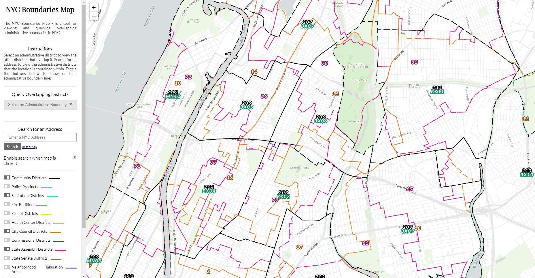
This BetaNYC viewing applications enables user to navigate the numerous political, administrative, and operational districts across New York City
Early in this space in the metro NYC area was the work of Steve Romalewski who started providing mapping services to the nonprofit sector as part of the Community Mapping Assistance Project (CMAP) which at the time was affiliated with New York Public Interest Research Group (NYPIRG). Since 2006 he has been affiliated with the CUNY Mapping Service as part of the Center for Urban Research, Graduate Center at City University of New York (CUNY).
The Long Island Index was an early and very visible project that the CUNY Mapping helped create. Another effort affiliated with the Center is the NYC Labor Market Information Service uses federal business and labor data sets. Be sure to check out their Career Maps infographics and reports. Similar academic efforts in the city exist at the Spatial Analysis and Visualization Initiative (SAVI) at Pratt Institute and the Center for Spatial Research at Columbia University.

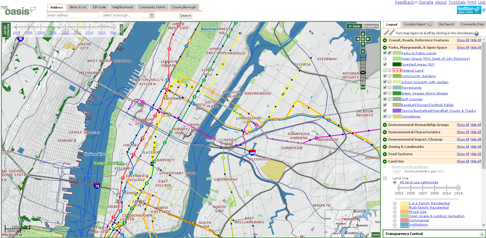
Though originally developed at CMAP, the CUNY Mapping Service now hosts OASIS which is one of the most comprehensive mapping and viewing application covering the New York City footprint. Dozens of government generated datasets are made available in the viewer.
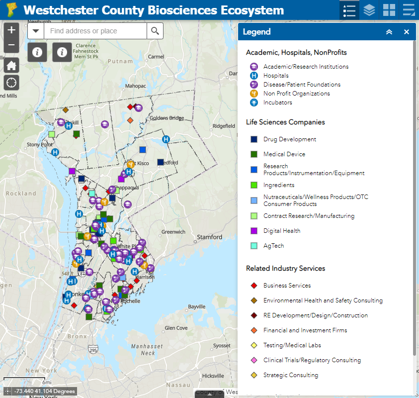
While the OpenHub is only beginning to jump into the geospatial space, its Founder Yulia Ovchinnikova will be highlighting the Westchester County GeoHub as part of the 2021 HV TechFest Conference as an example of open government and open-source data sharing to promote building communities. OpenHub will also be using content from the county’s GeoHub as part of a course project during a current online Data Analytics Bootcamp. As regional technology and economic development is an important focus to OpenHub’s mission and purpose, our discussion started by focusing on a new web map being published which highlights the emerging BioSciences Ecosystem community in Westchester County. The County is home to the largest biosciences cluster in New York State, boasting 8,000 jobs and 20 percent of the State’s total biosciences employment. The cluster comprises academic institutes doing basic research, R&D and clinical stage startups, large manufacturers and supply chain participants. OpenHub offers a mixture of both free and fee-based online programs including coding clubs, meetups, programming, and specific events for small businesses and startups. OpenHub is an open ecosystem resource center committed to building a tech-sector in the Hudson Valley and beyond

Government open data and economic development. BioScience business location X,Ys are available for download via ArcGIS Online.
MANY organizations leverage government generated geospatial data to support their own business needs and/or to champion a host of civic needs and issues. In just one area, such as environmental justice (EJ), a Google search located a document published by the SeaGrant program at SUNY Stony Brook which identifies the numerous individual agencies (largely government and nonprofit) engaged in providing “Environmental Justice Mapping Tools for New York State Communities”. Child care, social services, public safety, public transportation, sustainability, climate change, and civic issues only scratch the surface of the spaces where advocacy groups are involved in using government geospatial content for the larger public good.
Summary
What differentiates the groups itemized above are that they are more full service, a la carte organizations offering a wider range of products and services. Staffing and resources to turn government data content into meaningful deliverables such as workshops (online and in-person), hackathon-type events, community events, training courses, and even bringing the data to civic leaders and administrators in ways which is simply not possible by government publishing agencies. Such outreach is often very targeted making the data more meaningful and ending up in the hands of those who understand its content the most. Viewing and using the data at the “micro” as opposed to the “macro” or a larger geographic footprint. Local is better.
While technically not all “hubs” in name, these groups continue to illustrate the growing benefit of how organizations are adding value and exposure to the government data assets. In many scenarios, building partnerships with these types of service organizations can be of great value to government publishing agencies.

