Northeast UAS Airspace Integration Research Alliance
 Ken Stewart is currently Chief Executive Officer of NUAIR (Northeast UAS Airspace Integration Research Alliance, Inc.) located in Syracuse, New York. NUAIR is a New York based nonprofit organization that provides expertise in unmanned aircraft systems (UAS) operations, aeronautical research, safety management and consulting services. He joined the organization in late 2020 where he is responsible for setting the overall vision and product strategy for the organization. Mr. Stewart is an experienced industry veteran in wireless telecommunications and cloud-based software market with a specialization in building Enterprise SaaS, Federated digital marketplaces and platforms.
Prior to joining NUAIR, Mr. Stewart served as the CEO of AiRXOS, a General Electric aviation company, where he led innovation, development, and commercialization of Unmanned Traffic Management services. After beginning his career in engineering and management positions at IBM and GTE, Stewart served as an executive with several venture capital and private equity-backed companies commercializing and scaling pre-revenue start-ups and transforming organizations for growth.
He was recently appointed president of the Commercial Drone Alliance (CDA) which is an independent nonprofit that works with all levels of government to collaborate on policies for industry growth and the overall responsible use of commercial drone technology.
I was recently able to catch up with Ken and NUAIR staff to discuss his work in the drone space in New York State.
eSpatiallyNewYork: What is the primary function and purpose of NUAIR?
Stewart: NUAIR is responsible for the continued development and advancement of New York’s AAM Proving Grounds and 50-mile UAS corridor between Syracuse and Rome, facilitating beyond visual line of sight testing, commercial operations, and the safe integration of UAS and eVTOLS into the national airspace. Here’s a link to some of the history of how everything got started: https://esd.ny.gov/central-ny-rising-uri
NUAIR also manages operations of the New York UAS Test Site at Griffiss International Airport in Rome, NY, one of just seven FAA-designated UAS test sites in the United States and is responsible to the Federal Aviation Administration (FAA) and National Aeronautics and Space Administration (NASA) to conduct operations for UAS and advanced air mobility (AAM) eVTOL (electric vertical takeoff and landing testing).
eSpatiallyNewYork: NUAIR seems to be mostly New York State-based. How does its function and purpose differ from CDA?
Stewart: We continue to conduct meaningful projects and tests in New York for the FAA, NASA, and industry to advance both the UAS and advanced air mobility (AAM) industries. These projects provide the needed data to prove the safety and reliability cases to help shape policy and regulation to unlock the true potential of commercial drone operations. I am taking my professional expertise, coupled with the knowledge of the 3,600+ UAS test flights NUAIR has conducted at the New York UAS Test Site to help generate the needed policies and regulations to make national commercial drone operations both scalable and economically viable. I also represent NUAIR on the FAA beyond visual line of sight (BVLOS) advisory and rulemaking committee (ARC), actively working with the FAA and fellow industry leaders to solve the issues around safely flying BVLOS. Being a part of both of these initiatives gives NUAIR the ability to directly influence and shape the future of aviation.
eSpatiallyNewYork: Can you share some examples of NUAIR providing outreach and consulting to governments in New York State on drone use and/or technology?
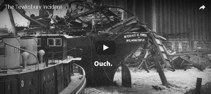
Stewart: NUAIR has helped over 20 state agencies implement their drone programs including law enforcement, fire departments, environmental conservation and more. Selected examples are highlighted in this YouTube video.
We’ve also just started working with the New York State Thruway Authority, helping them integrate drones into their daily operations for routine bridge and infrastructure inspections. Flying a drone to scan a bridge is a lot safer than the traditional means of using a snooper truck, both for the crew inspecting the bridge and for motorists. Couple that with faster, more cost-effective inspections, it’s a win-win for the crew, the local economy and New York State as a whole.
eSpatiallyNewYork: Would appear a lot of this work is in the public safety community. Are there other areas of government?
Stewart: The healthcare industry is beginning to realize the benefits of utilizing drones as well, especially the ability of contactless delivery of materials. You can read here about one of our recent collaborations with SUNY Upstate Medical where we helped deliver unused COVID-19 Test Kits.
eSpatiallyNewYork: Explain NUAIR’s relationship with the start-up incubators Genius NY and The Tech Garden.
Stewart: GENIUS NY and The Tech Garden are key partners and organizations for the Central New York UAS and high-tech ecosystem. We work directly with many of the companies in the Tech Garden and actively promote the resources both organizations provide to tech startups, actively contributing to the economic development of the region. Our COO Tony Basile is also on the board of directors for GENIUS NY, actively reviewing applicants and voting on the winners.
eSpatiallyNewYork: The NUAIR Alliance is impressive. How do these categories stack up in New York State?
The NUAIR Alliance continues to grow on a global scale and includes organizations from all aspects involved with UAS and technology including policy & standards, spectrum, test sites, components, government and more. Visit https://nuair.org/alliance/ to see all of our active Alliance members.
NUAIR and the New York UAS Test Site has brought over 330 different companies from across the world and thousands of people to Central New York throughout the years and continue to bring in companies to test and setup shop.
eSpatiallyNewYork: FAA, NASA Aviation, and state/local drone regulations – how does NUAIR stay on top of all the changes? It all seems so fluid, dynamic, constantly changing.
Stewart: This is what we do all-day, every-day. NUAIR employees are talking with, working with and/or conducting meaningful projects the FAA, NASA and industry every day of the week.
eSpatiallyNewYork: How’s the industry dealing with all of the security concerns over Chinese made drone products such as the DJIs? How are US-based companies responding in this regard?
Stewart: The concern with Chinese/foreign made drone and components continues to grow, including the recent regulations from the United States government stating that federal funds cannot be used to purchase Chinese (or other specific foreign countries) drone components. A lot of the public safety officials we work with are now looking into one of our partners, Skydio, an American drone manufacturer, who was a major hit at the New York Public Safety UAS Summit we just held. We’ve also validated a drone parachute on the WorkHorse, an American-made UAV built for deliveries.
eSpatiallyNewYork: Any involvement / business development with the any GIS companies?
Stewart: We have quite an active program with Cardinal Geospatial, trying to define an analysis tool that could be used to determine whether an operator was using a DEM with enough granularity for their mission and the terrain over which they are flying.
eSpatiallyNewYork: Looking into the crystal ball, what’s the next big thing for the upstate drone/NUAIR community?
Stewart: 5G. MITRE Engenuity Open Generation Consortium has determined New York’s 50-mile corridor is a prime location to launch the nation’s first 5G UAS testing range, a designation that will greatly enhance New York’s position as a global leader in this emerging technology sector.
The work we continue with the FAA, NASA, and industry both on the standards/regulations side and the physical data collection/testing side are helping shape the future of aviation. This work will unlock the true potential of drones for commercial operations that are both scalable and economically viable. The drone and overall high-tech Central New York ecosystem has everything a company needs to land and expand their UAS operations.
Contact:
Tim Lawton
Director of Marketing & Public Relations
tlawton@nuair.org
www.nuair.org


