Qntfii & Harkin Work Together to Provide Reality Capture Services and Education to the New York State Geospatial Community

The two New York State-based firms focus on drone and Lidar technology including SLAM (Simultaneous Localization and Mapping) applications.

The growth of UAV technology in New York State – particularly the Central New York (CNY) corridor is well documented and has the subject of eSpatiallyNewYork blog articles over the past couple years.  The region is home to a recognized UAV start-up incubator and there have been several news and market analysis articles covering the staggering growth of the industry, including a recent one (sample article available upon request) from Newswires

Two New York State firms in this space doing business together, albeit on the outskirts of the CYN region – one in Albany and the other Long Island:  Qntfill and Harkin.

History

The two initially crossed paths a couple years ago when tasked together on a Metropolitan Transportation Authority (MTA) project to map telecom infrastructure within the subway tunnels. However, the project was unfortunately scrapped before the two firms got to doing any actual (drone/laser/what kind) scanning – but it did serve as an introduction to each other’s services and laid the groundwork for many future collaborative efforts. 

Bill Gutelius is the principal at Qntfii who began his journey in the field of reality capture more than 25 years ago.  He transitioned from working with environmental engineering companies to working directly with the manufacturers of LIDAR equipment which at the time was a very emergent remote sensing technology.  He has founded a couple of startup business focused on LiDAR tools for reality capture, most recently starting Qntfi in 2014.  Qntfi is currently partnered with Emesent out of Brisbane Australia, the makers of the Hovermap SLAM LiDAR scanning tool.  Qntfii is an authorized Hovermap LiDAR sensing technology distributor.

Educated as an engineer, Scott Harrigan has served as President of Harkin Aerial since 2016 specializing in data visualization services to engineering, construction, and architectural clients, as well as custom engineered aerial solutions for a variety of industries.   His career path also included serving as a Product Specialist at Virtual Surveyor supporting clients on workflows to create quality CAD data from drone mapping.  He also served as Assistant Director of Long Island Group’s (LIG) Unmanned Aircraft Systems program, overseeing training, recruitment, logistics, and continuing education in UAS technologies for Civil Air Patrol members on Long Island.

Hovermap offers revolutionary advantages to challenging above ground, underground and GPS-denied environments. Underground mines, tunnels, bridges, telecom and transmission towers and many more can now be mapped and inspected safely, without putting staff at risk.

The different, but similar, individual focus and expertise uniquely augments their mutual business development.    Qntfii primarily focuses on handheld/ground level laser scanning, including indoors while Harkin brings drone and aerial data capture to the business equation.  Harrigan also coordinates training and education services as part of their joint work. Even though areas seem uniquely distinct, their services overlap on many projects.  One of their shared goals is to introduce drone, photogrammetry + LIDAR technology in a way that is both easy and cost effective for small-to-medium AEC (Architecture, Engineering, Construction) firms, as well as municipalities at the local town/village level to adopt. 

Selected Projects

Downtown Troy
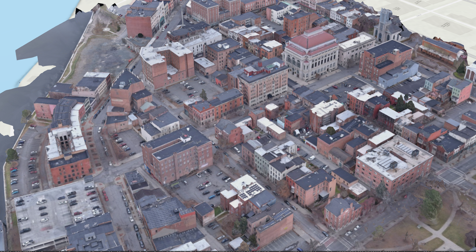
This was a proof-of-concept project employing a truck-mounted Hovermap to collect street level 3D data of a portion of downtown Troy, NY at 4 AM.  This work was then followed by a couple of short drone flights during the day to collect well-lit imagery that was then processed in a standard photogrammetric software package.  The two datasets were then merged to colorize the LiDAR data from Hovermap. 

Cohoes Power Plant
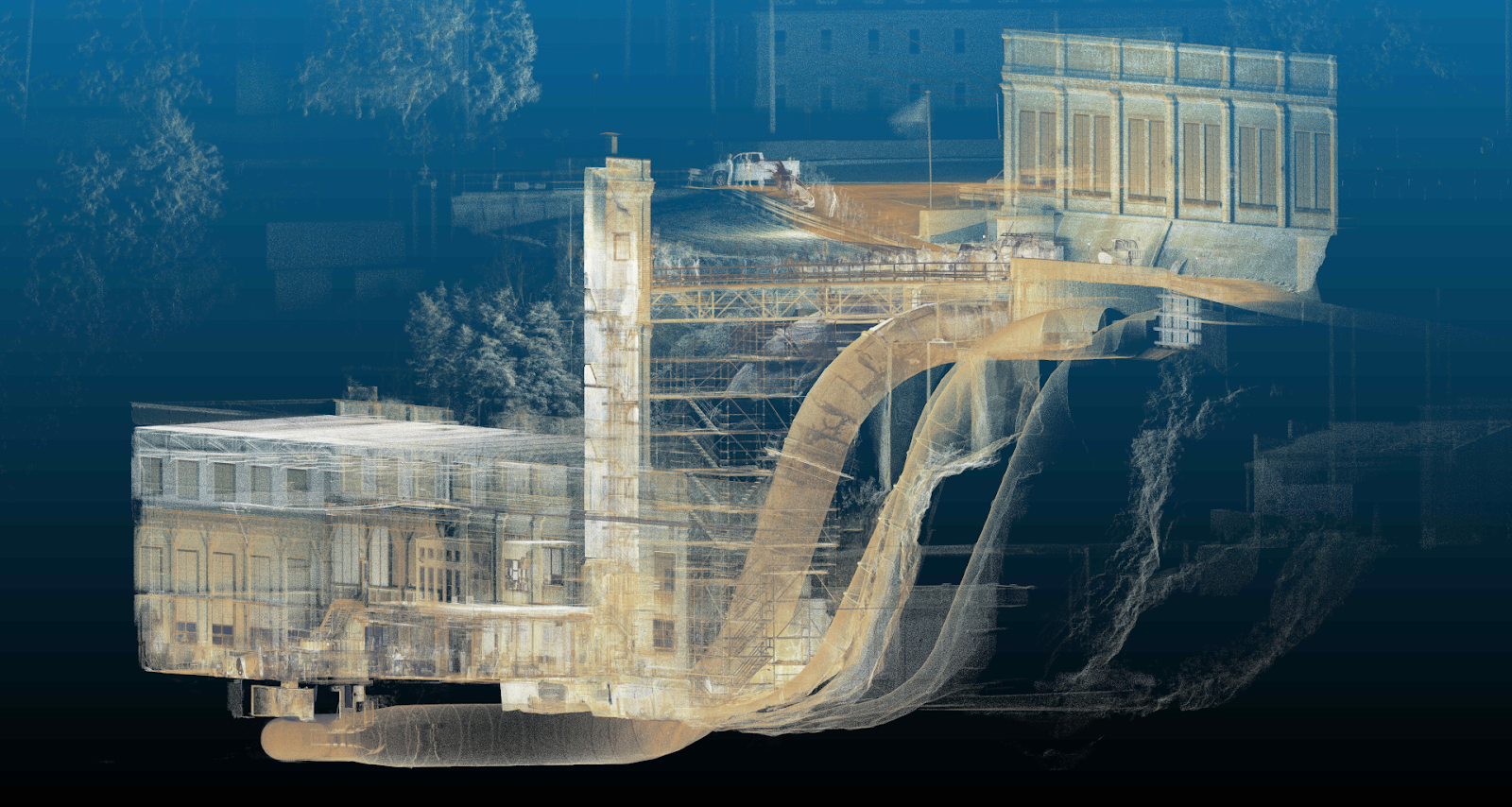
Power plant operators were  interested in documenting the entire site (including a penstock tube) using LIDAR.   Hovermap played a critical role obtaining 3D data of parts of the plant which would have been impossible or very costly to collect.  In one application, Qntfill and Harking were able to place the Hovermap (secured in a protective aluminum cage) through an insertion point in the penstock tube and then lower it 50-60 feet inside the tube, mapping the geometry and condition of the penstock interior. 

Site Development
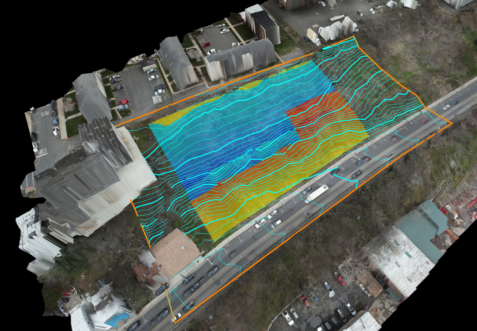
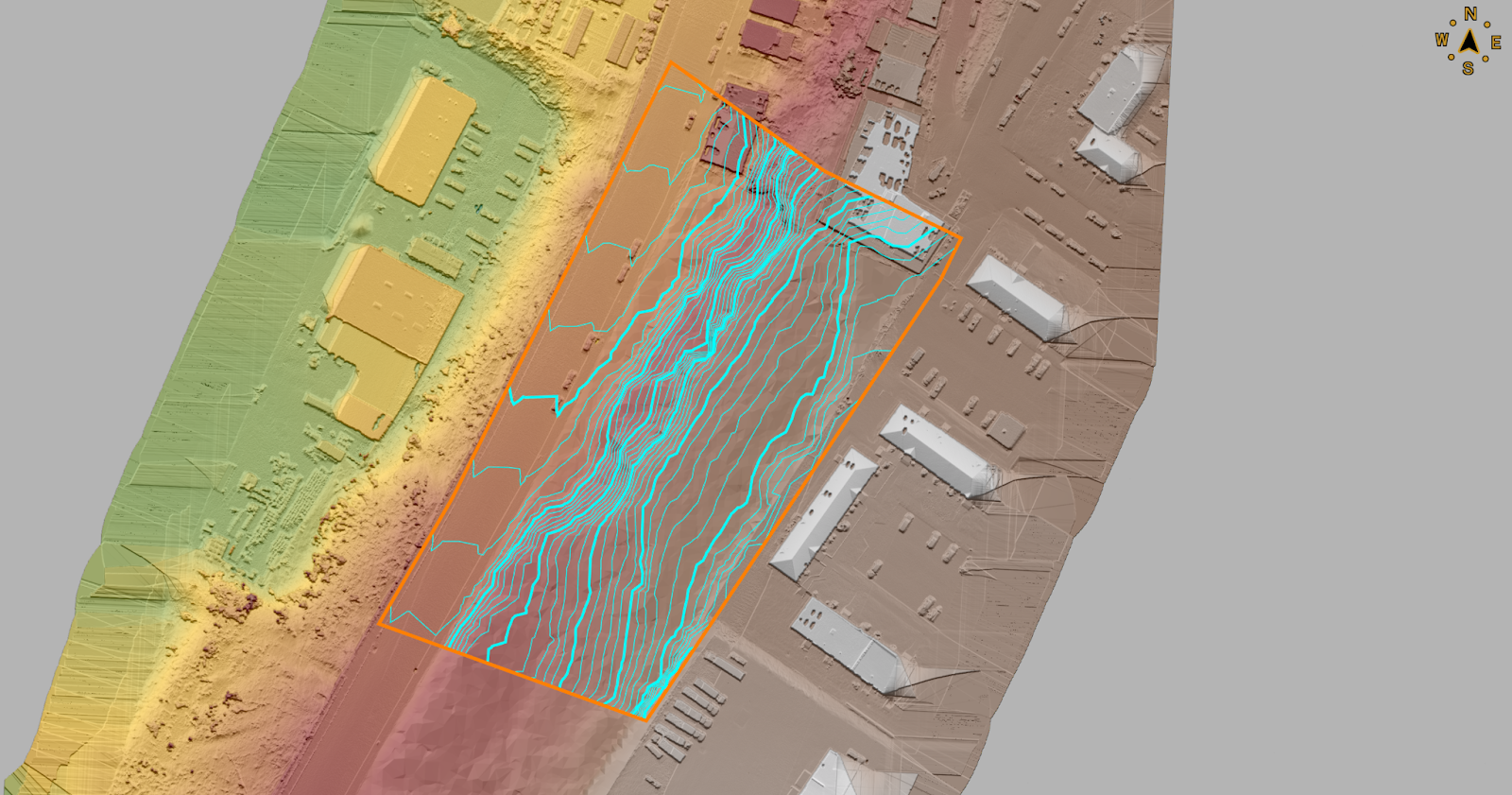
A DJI M300 drone with L1 LiDR was utilized by Harkin to produce bare-earth surface and contours for a new development in the Tri-State area.  Data was processed using DJI Terra (LiDAR) and Agisoft Metashape Photogrammetry software to provide up-to-date orthomosaics of the site.

By using the LIDAR-acquired surface, a 3D model was produced from excavation plans to determine the amount of cut and fill of earthwork required onsite.   The 3D model and volume calculations provided by Harkin allowed the site engineer to quickly adjust excavation plans to balance the earthwork onsite, greatly reducing the amount of trucks needed to bring in fill material, or take away excavated material. Cut/Fill calculations, contours, and surface were produced using Virtual Surveyor.  (Both images generated from Virtual Surveyor).

Harbors and Ports
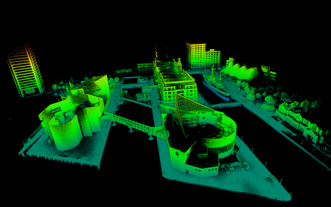
In the Baltimore Harbor, U.S. Navy and commercial port operators were interested in knowing the condition of port/pier infrastructure as very little existing documentation (as-built plans) were available for facility planning purposes.  Qntfii flew a Hovermap drone to identify available space for vessels and equipment, as well as to establish the general configuration of the port(s) and arrangement of vessels currently berthed in the harbor.

Additionally, the two firms have combined on a wide-range of projects in government and industry including, but not limited to, the following: NYC Department of Environmental Protection (NYCDEP), New York City Economic Development Corporation (NYCEDC), Village of New Paltz, NY, Town of Oyster Bay, NY,  U.S. Marine Corps, U.S. Naval Information Warfare Systems Command (NAVWAR), and The New York Times.

The drone market will most definitely continue to grow across the New York State, particularly as professional groups continue to come together and work together on common goals”, notes Harrigan who serves as Secretary for the NY chapter of AUVSI (Association for Unmanned Vehicle Systems International).  The chapter represents unmanned (drones, ROVs, robots) operators and businesses across the state and is probably the largest “drone” specific organization across the U.S.

Summary

“So much of this industry is geared towards “enterprise”,  big cities, and large – systems which requires a lot of manpower, IT, and intensive training to use. Our partnership focuses on bridging the gap to the small and mid-size organizations”, adds Harrigan.  

The two believe users don’t need to be large engineering/surveying firms or a state level department to have a successful drone and reality capture programs.  Both Gutelius and Harkin believe the best impact the UAV technology has is when it is working for smaller organizations.   

Contact

Bill Gutelius
Qntfill, Inc
1-518-406-0055
www.qntfii.co
info@qntfii.com

Scott Harrigan
Harkin Aerial
1-516-584-3035
www.harkin.io
info@harkin.io

Editor’s Note:  The 2024 IEEE Systems and Technologies for Remote Sensing Applications Through Unmanned Aerial Systems (STRATUS) is May 20-22, 2024 in Syracuse, New York

10 Questions: Ken Stewart, NUAIR

Northeast UAS Airspace Integration Research Alliance

Ken Stewart is currently Chief Executive Officer of NUAIR (Northeast UAS Airspace Integration Research Alliance, Inc.) located in Syracuse, New York.  NUAIR is a New York based nonprofit organization that provides expertise in unmanned aircraft systems (UAS) operations, aeronautical research, safety management and consulting services.   He joined the organization in late 2020 where he is responsible for setting the overall vision and product strategy for the organization.  Mr. Stewart is an experienced industry veteran in wireless telecommunications and cloud-based software market with a specialization in building Enterprise SaaS, Federated digital marketplaces and platforms.

Prior to joining NUAIR,  Mr. Stewart served as the CEO of AiRXOS, a General Electric aviation company, where he led innovation, development, and commercialization of Unmanned Traffic Management services.  After beginning his career in engineering and management positions at IBM and GTE, Stewart served as an executive with several venture capital and private equity-backed companies commercializing and scaling pre-revenue start-ups and transforming organizations for growth.

He was recently appointed president of the Commercial Drone Alliance (CDA) which is an independent nonprofit that works with all levels of government to collaborate on policies for industry growth and the overall responsible use of commercial drone technology.

I was recently able to catch up with Ken and NUAIR staff to discuss his work in the drone space in New York State.

eSpatiallyNewYork: What is the primary function and purpose of NUAIR?

Stewart:  NUAIR is responsible for the continued development and advancement of New York’s AAM Proving Grounds and 50-mile UAS corridor between Syracuse and Rome, facilitating beyond visual line of sight testing, commercial operations, and the safe integration of UAS and eVTOLS into the national airspace.  Here’s a link to some of the history of how everything got started: https://esd.ny.gov/central-ny-rising-uri

NUAIR also manages operations of the New York UAS Test Site at Griffiss International Airport in Rome, NY, one of just seven FAA-designated UAS test sites in the United States and is responsible to the Federal Aviation Administration (FAA) and National Aeronautics and Space Administration (NASA) to conduct operations for UAS and advanced air mobility (AAM) eVTOL (electric vertical takeoff and landing testing).

eSpatiallyNewYork:  NUAIR seems to be mostly New York State-based.  How does its function and purpose differ from CDA? 

Stewart:  We continue to conduct meaningful projects and tests in New York for the FAA, NASA, and industry to advance both the UAS and advanced air mobility (AAM) industries. These projects provide the needed data to prove the safety and reliability cases to help shape policy and regulation to unlock the true potential of commercial drone operations. I am taking my professional expertise, coupled with the knowledge of the 3,600+ UAS test flights NUAIR has conducted at the New York UAS Test Site to help generate the needed policies and regulations to make national commercial drone operations both scalable and economically viable. I also represent NUAIR on the FAA beyond visual line of sight (BVLOS) advisory and rulemaking committee (ARC), actively working with the FAA and fellow industry leaders to solve the issues around safely flying BVLOS. Being a part of both of these initiatives gives NUAIR the ability to directly influence and shape the future of aviation.

eSpatiallyNewYork:  Can you share some examples of NUAIR  providing outreach and consulting to governments in New York State on drone use and/or technology?

Stewart:  NUAIR has helped over 20 state agencies implement their drone programs including law enforcement, fire departments, environmental conservation and more. Selected examples are highlighted in this YouTube video.

We’ve also just started working with the New York State Thruway Authority, helping them integrate drones into their daily operations for routine bridge and infrastructure inspections. Flying a drone to scan a bridge is a lot safer than the traditional means of using a snooper truck, both for the crew inspecting the bridge and for motorists. Couple that with faster, more cost-effective inspections, it’s a win-win for the crew, the local economy and New York State as a whole.

eSpatiallyNewYork:  Would appear a lot of this work is in the public safety community.  Are there other areas of government?   

Stewart:  The healthcare industry is beginning to realize the benefits of utilizing drones as well, especially the ability of contactless delivery of materials. You can read here about one of our recent collaborations with SUNY Upstate Medical where we helped deliver unused COVID-19 Test Kits.

eSpatiallyNewYork:  Explain NUAIR’s relationship with the start-up incubators Genius NY and The Tech Garden. 

Stewart:  GENIUS NY and The Tech Garden are key partners and organizations for the Central New York UAS and high-tech ecosystem. We work directly with many of the companies in the Tech Garden and actively promote the resources both organizations provide to tech startups, actively contributing to the economic development of the region. Our COO Tony Basile is also on the board of directors for GENIUS NY, actively reviewing applicants and voting on the winners.

eSpatiallyNewYork:  The NUAIR Alliance is impressive.   How do these categories stack up in New York State? 

The NUAIR Alliance continues to grow on a global scale and includes organizations from all aspects involved with UAS and technology including policy & standards, spectrum, test sites, components, government and more. Visit https://nuair.org/alliance/ to see all of our active Alliance members.

NUAIR and the New York UAS Test Site has brought over 330 different companies from across the world and thousands of people to Central New York throughout the years and continue to bring in companies to test and setup shop.

eSpatiallyNewYork:  FAA, NASA Aviation, and state/local drone regulations – how does NUAIR stay on top of all the changes?  It all seems so fluid, dynamic, constantly changing.

Stewart:  This is what we do all-day, every-day. NUAIR employees are talking with, working with and/or conducting meaningful projects the FAA, NASA and industry every day of the week.

eSpatiallyNewYork:  How’s the industry dealing with all of the security concerns over Chinese made drone products such as the DJIs?  How are US-based companies responding in this regard?  

Stewart:  The concern with Chinese/foreign made drone and components continues to grow, including the recent regulations from the United States government stating that federal funds cannot be used to purchase Chinese (or other specific foreign countries) drone components. A lot of the public safety officials we work with are now looking into one of our partners, Skydio, an American drone manufacturer, who was a major hit at the New York Public Safety UAS Summit we just held. We’ve also validated a drone parachute on the WorkHorse, an American-made UAV built for deliveries.

eSpatiallyNewYork:  Any involvement / business development with the any GIS companies?

Stewart:  We have quite an active program with Cardinal Geospatial, trying to define an analysis tool that could be used to determine whether an operator was using a DEM with enough granularity for their mission and the terrain over which they are flying.

eSpatiallyNewYork:  Looking into the crystal ball, what’s the next big thing for the upstate drone/NUAIR community? 

Stewart:  5G. MITRE Engenuity Open Generation Consortium has determined New York’s 50-mile corridor is a prime location to launch the nation’s first 5G UAS testing range, a designation that will greatly enhance New York’s position as a global leader in this emerging technology sector.

The work we continue with the FAA, NASA, and industry both on the standards/regulations side and the physical data collection/testing side are helping shape the future of aviation. This work will unlock the true potential of drones for commercial operations that are both scalable and economically viable. The drone and overall high-tech Central New York ecosystem has everything a company needs to land and expand their UAS operations.

Contact:

Tim Lawton
Director of Marketing & Public Relations
tlawton@nuair.org
www.nuair.org

Geospatial Business Spotlight: Spatial Analytix

Company Name:        Spatial Analytix

Website:                      http://www.spatialanalytixllc.com/

Established:                2015

The Company                                                       

Spatial Analytix is currently under the leadership of Ben Houston (CEO) and Matt Mercurio (GTO).  Together, both bring a wealth of experience in GIS and mapping to the growing Unmanned Aerial Vehicle (UAV) mapping market in New York State and beyond.

Most recently, Matt was GIS Manager in Allegheny County, PA and before that Project Manager at the Institute for the Application of Geospatial Technology (IAGT) in Auburn, NY. He also continues to be a principle and founder at Civic Mapper (www.civicmapper.com). Ben has spent the past six years as founder and officer at GroundPoint Technologies (www.groundpointllc.com) and prior to this worked with Matt and other colleagues at IAGT in both NASA and New York State Department of Environmental Conservation (NYSDEC) funded geospatial programs.

Spatial Analytix was formed in early 2015 to support a growing need in the UAV data processing market.   The current emphasis in the UAV market is on platforms, hardware, software and cloud based solutions, not the data. Spatial Analytix believes that the next few years will be characterized by market confusion over data quality and deliverables as even experienced geospatial professionals sort through the fog. By bringing a focus on data quality and useful deliverables, Spatial Analytix moves UAV data collections beyond being just imagery projects to producing high quality, plug and play geospatial data.

Geospatial Services   

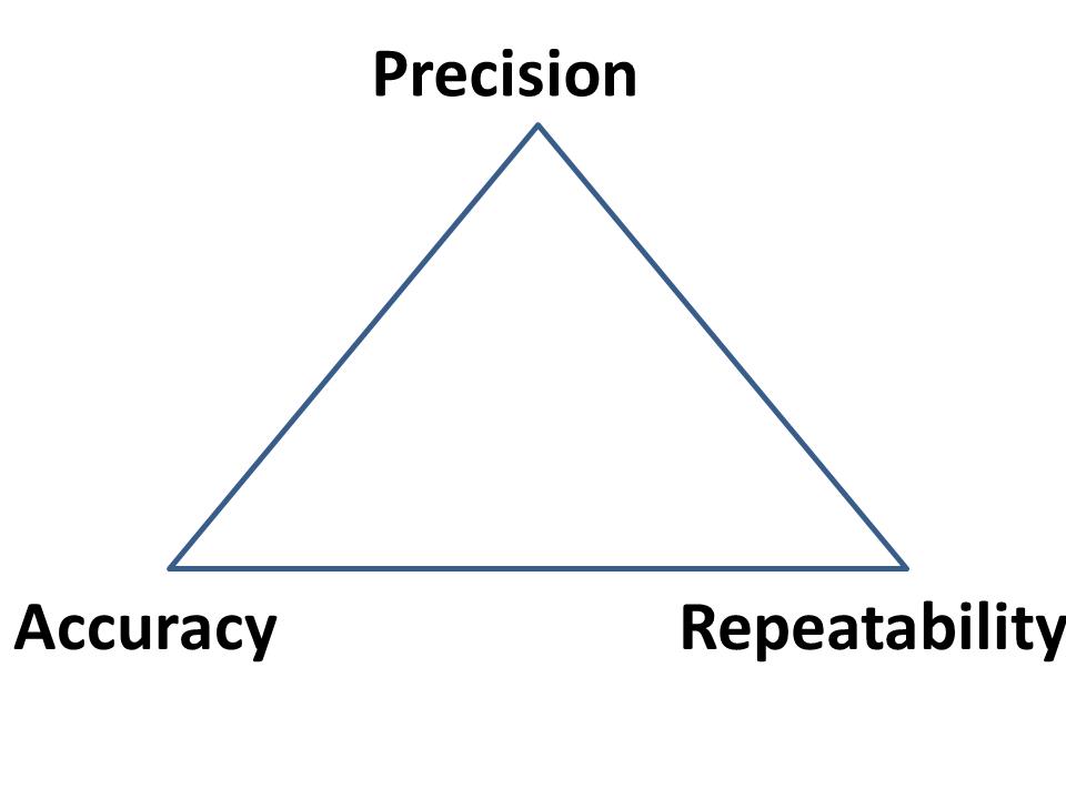
Spatial Analytix focuses on geospatial data in terms of the data quality triangle:

SA1While much of the current discussion in the UAV market focuses on the wow factor of precision, Spatial Analytix also considers temporal components along with verifiable accuracy in the data deliverables to ensure customers get what they want, when they want it. It’s the three elements together that bring real value to the data.

Typical outputs from automated processing (i.e., web based solutions) normally include point clouds, terrain models, and image mosaics (often labeled with the misnomer of “orthomosaics”). Such deliverables are usually acceptable for surveillance and monitoring uses, but for true GIS and engineering mapping applications, automated processing solutions leave a big data quality gap. Artifacts, noise and flight line overlap issues can clutter the point cloud and skew surface models, making for inaccurate contours and messy mosaics. Automated orthophotography can show up with smearing and ghosts, and usually do not include optimal image and cut line selection. Although available off-the-shelf geoprocessing tools in this space are becoming more powerful and functional each day, Spatial Analytix combines the right mix of quality tools, technical knowledge, and artisanal experience to get projects to come out right. The first time.

Clients can access raw data and processed deliverables through standard file systems, or as a URL which can be delivered across an enterprise for data visualization and exploration. No longer do the deliverables need to be sent to a GIS or CAD operator to put on screen for a supervisor or program manager. Live, web based delivery of hosted data is now standard. Platforms range from Google Maps to ArcGIS Online to Pictometry Connect. When compared to traditional photogrammetric and aerial survey products, Spatial Analytix deliverables are designed to be not only equivalent…but better.

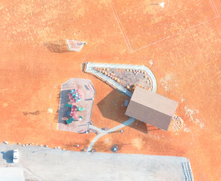
Ortho-Image

Ortho-Image

Spatial Analytix is developing a network of regional UAV data collectors offering standard services including:

  • Point Clouds (LAS format)
  • DTMs (full surface)
  • DEMs (bare earth surface)
  • Contours
  • Breaklines
  • Planimetrics
  • Image mosaics/orthomosaics
  • Volumetrics
  • Drainage
  • Vegetation/Landcover/Impervious surface mapping
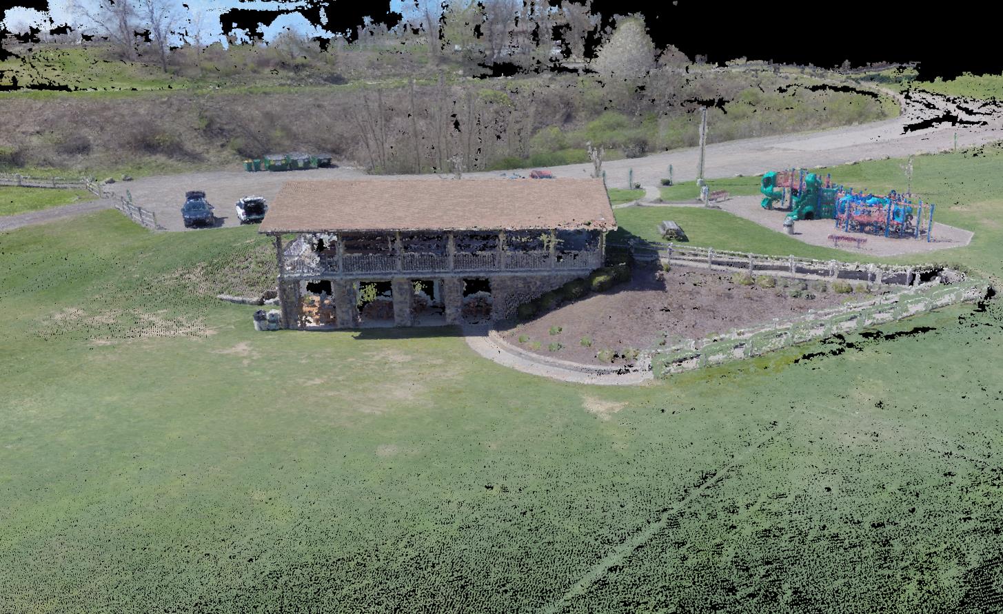
Colorized point cloud

Colorized point cloud

In the near future, Spatial Analytix product enhancements will include:

  • Oblique imagery integration (Pictometry Connect integration)
  • GeoVideo
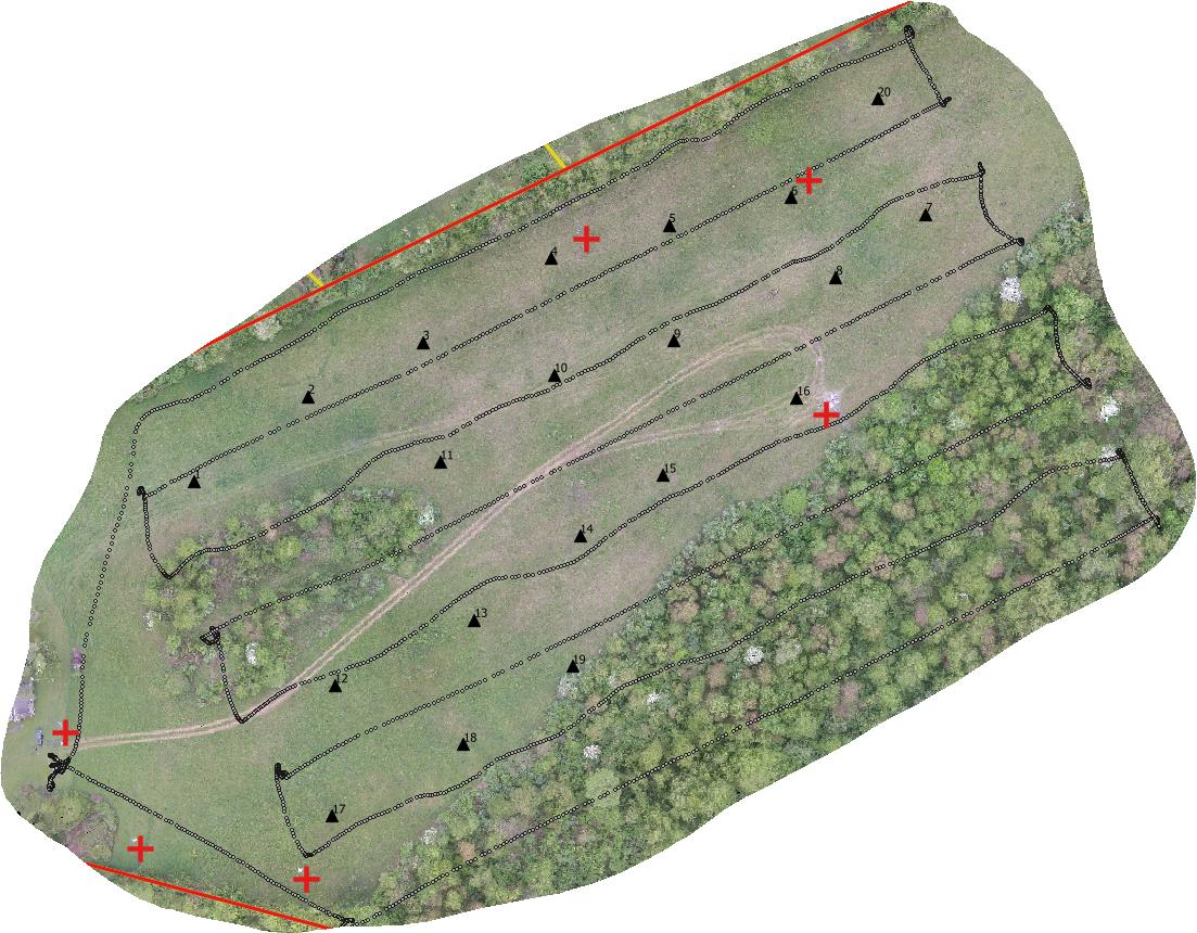
Typical UAV Flight Line Configuration Developing 3D Model

Typical UAV Flight Line Configuration Developing 3D Model


Spatial Analytix offers Virtual Geospatial Technology Office (vGTO) services to partner companies looking to leverage UAV and geospatial technologies by providing authoritative consulting support on such things as optimal flight planning and data processing, enterprise data management, and web based solutions. Whatever the UAV geospatial data deliverable is –  imagery, elevation, vector, or raster –  Spatial Analytix is confident that users have never seen data like this before.

Contact:   

Ben Houston, ben.houston@spatialanalytixllc.com

Matt Mercurio, matt.mercurio@spatialanalytixllc.com

Website: spatialanalytixllc.com

Facebook: /spatialanalytix

Twitter: @spatialanalytix

(412) 368-6015

GTO © Professional Services

SA7