Recent national designation highlights impressive Scenic Byways inventory across the Empire State
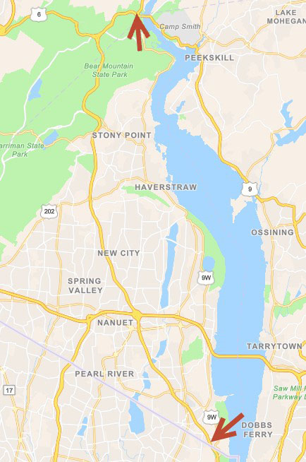
With little fanfare in January, the Federal Highway Administration, through the National Scenic Byways Program (NSBP), added the Palisades Parkway Scenic Byway to its list of New York State “national” designated Scenic Byways. The Palisades designation – northern and southern most boundaries highlighted in the image below – brings the Empire State’s National Scenic Byways total to four joining the Great Lakes Seaway Trail, Lakes to Locks Passage, and the Mohawk Towpath Byway. These four combine for nearly 700 miles of nationally – designated scenic byways across the state.

The new nationally designated Palisades Parkway Scenic Byway, part of the State’s Scenic Byways program, originates in the south at the New York/New Jersey boundary heading north approximately 26.5 miles to just west of the Bear Mountain Bridge.
The designation augments the established New York State Scenic Byways program which includes both the federal and state designated scenic byways. Administered through NYS Department of Transportation, the State’s Scenic Byway program was created in Highway Law (HAY 349-aa-dd) in 1995 authorizing the Commissioner of the NYSDOT to establish the scenic byways program and to coordinate the activities of state agencies, local governments and not-for-profit organizations. Prior to the establishment of the state Scenic Byway program, the NYS Department of Environmental Conservation had a scenic roads program under Article 49 of the Environmental Conservation Law. Those roads, along with all state parkways (listed in the regulations of the Commissioner of the Office of Parks, Recreation and Historic Preservation pursuant to Section 13.03 of Parks, Recreation and Historic Preservation Law) were incorporated into the Scenic Byway program under HAY 349-dd (k) and (l).
HAY 349-bb defines a “Scenic Byway” as a transportation route and adjacent area of particular scenic, historic, recreational, cultural or archeological characteristics which is managed to protect such characteristics and to encourage economic development through tourism and recreation. Today, the State’s program includes the four national and 26 state designations. A list of all designations the program is available here which includes a link to a thumbnail graphic of each byway.
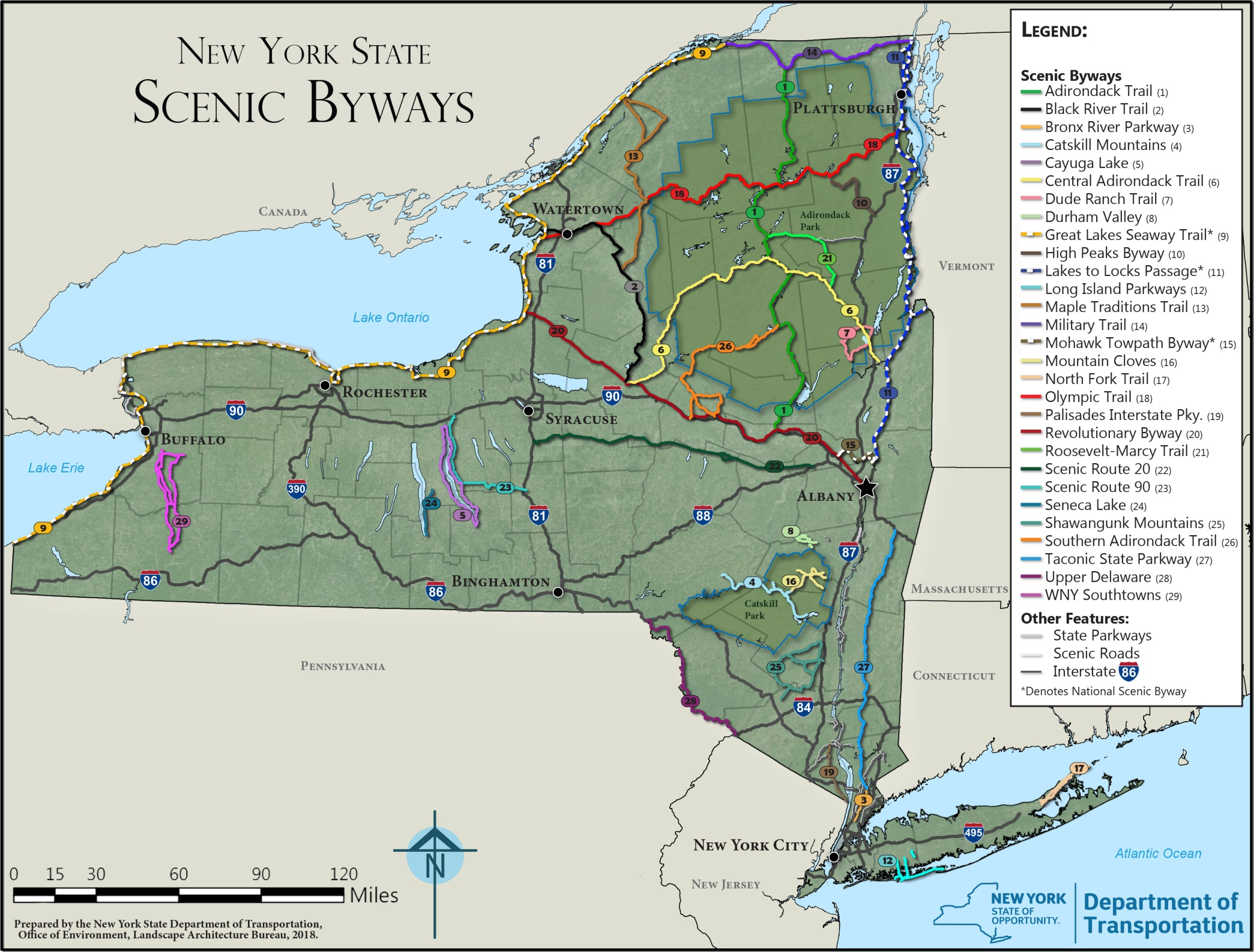
State Scenic Byways Map
The January designation gave me reason to revisit a favorite piece of cartography I’ve been eyeing and wanting to write about for quite some time. It’s a map on the Scenic Byways web page which speaks to the art of a well and purposely designed hardcopy map. Increasingly lost as part of our insatiable appetite for interactive online mapping as the primary “cartographic” end product. Substituting the web viewer for what once was the primary GIS desktop objective: The map.
The map was created by staff in the Landscape Architecture Bureau (LAB) in the Department of Transportation. According to Christine Colley, Senior Landscape Architect and Scenic Byway Coordinator, its original creator was Marcy Sammons – who now works for another state agency. Map revisions – to update routes and add new routes not previously included in the original map – is now the responsibility of Alexandra von Bieberstein. Both staff are landscape architects whose background clearly contributed to the “feel” and overall simplistic cartographic design of the map. Symbology – colors, fonts, labels and shields – are all appropriately selected. The state boundary clearly defined with green/gray green underlying base map colors which accentuates the colors representing the statewide byways. Even the limited use of selected hydrologic features – providing more context to the map than anything – as well as the limited amount of place names adds to the visual appeal of the map. All map components combined to perfectly convey the statewide scenic byways story.
Colley notes “The map is created using ArcMap (LAB currently using version 10.7.1 although the original map may have been created using an earlier different version) and then then exported into Adobe Illustrator for editing and providing more detailed graphic enhancements.”
In absence of online mapping applications, Colley also adds that Scenic Byways staff respond to “map a specific Scenic Byway or to key locations on the Scenic Byway. Staff also assists the public – using Google Maps to create a route – in navigating through the state to enable travelers to” requests by sending the public Google Maps “routes” from their location to:
- Avoid parkways (which are limited access – no trucks, trailers or RVs on the parkways)
- Encounter the most scenic route
- Encounter the most scenic byways
For a myriad of reasons, hardcopy maps will continue to be an important product of the geospatial profession and a very special skillset to maintain. The utility and importance of the traditional map has even been noted in online geospatial blogs and media publications in recent months. Just last month there was an article in USA Today entitled ““Move aside, Google Maps, Apple Maps and GPS: Why people still love their paper maps”
If you haven’t had a chance, download the map and take a look. Pan around, zoom in to larger scales and take a spin around the state.
Enjoy the views.
Contact:
Christine Colley, RLA
Scenic Byway Coordinator
Senior Landscape Architect
New York State Department of Transportation
Office of the Environment
50 Wolf Rd, POD 4-1, Albany, NY 12232
518-485-9313 | christine.colley@dot.ny.gov
www.DOT.NY.gov

