SAVI Builds a Metro NYC Presence

The last couple years I’ve been watching the growth of GeoNYC Meetup group and continue to be amazed at the far-reaching representation of individuals and companies now involved in the broad field we call “geospatial”.  One person shops, start-ups, open source/open data techies, apartment and loft based companies, strong business and private sector representation, community based mappers, and everything in-between.  A much different composition and representation than that of the other existing statewide geospatial/GIS communities and organizations that I and other colleagues of my GIS generation came through.   To date I have published three previous blog posts focusing on other contacts made through GeoNYC:  Mapzen, Mapillary and NiJel.

Spatial Analysis and Visualization Initiative (SAVI)

Also establishing a niche in the expanding geospatial space are community facing programs associated with and supported in academia environments.  One such program, which I was also introduced to through GeoNYC, is the  Spatial Analysis and Visualization Initiative (SAVI).  It was launched in 2013 and is at Pratt Institute.  SAVI is a GIS-based research lab and service center that focuses on mapping, data analysis, and visual storytelling, providing students, faculty, and community groups with the resources they need to communicate information in compelling ways. The first and only New York City college-based GIS lab open to community organizations and civic groups, SAVI offers computer access, technical assistance, professional training, workshops, and research that empower local organizations to create their own visions to improve the quality of life for their clients and constituents. At Pratt, SAVI supports students and faculty whose work reaches beyond the Institute’s campus to engage and benefit New York City.

Leading the SAVI program is Jessie Braden, who was appointed Director in the Fall of 2013.  Prior to SAVI, Braden spent three years at the Pratt Center for Community Development, a non-profit affiliated with Pratt Institute that provides technical services to community organizations.  She has also been an adjunct professor of GIS in Columbia University’s Graduate School of Architecture, Planning and Preservation Program since 2010.  Braden initially started SAVI with Pratt Programs for Sustainable Planning and Development (PSPD) Professor Juan Camilo Osorio as a volunteer side project in 2011 with the guidance of then Department Chair John Shapiro.  In addition to PSPD, Pratt Center and the Graduate Communications Design Department offered their official support, allowing the lab to come to fruition and solidifying SAVI’s focus on communities AND design.  Pratt Center also secured a $670,000 grant from NYC City Council to renovate a physical space on Pratt’s campus so SAVI can serve community organizations and students.  During the time the program was being institutionalized at Pratt, Osorio took a full-time position as Director of Research at the New York City Environmental Justice Alliance. Though not involved in day to day operations, Osorio remains a trusted advisor to SAVI.

SAVI consolidates the Institute’s GIS resources with an eye to social benefit. This means putting data analysis in the hands of community activists, students, and faculty. It also means making the products of GIS expertise visually legible and compelling so that the stories they tell will have as much impact as possible.

“At the end of the day, visual representation is as important as the quality of data analysis,” Braden observes. “Our vision for SAVI is to produce outstanding multidisciplinary projects  with the highest-caliber visual display— making the invisible visible, both inside and outside Pratt’s gates.”  Its Jessie’s belief, which I share,  that a well designed map should be able to stand on its own.  Such a product enables the reader to conduct the “spatial analysis” based on the distribution and rendering of the map data itself – with only minimal accompanying narrative to explain or describe the map.

Braden points to specific mapping projects which exemplify the SAVI cause:
Continue reading

Rochester GIS Scholars

GIS Scholars is a Rochester community-based youth program, serving ages 14-21, which started in 2012 at a small neighborhood agency.  Its origin can be traced back to as early as 1988,  when under the support of Joseph Becker,  who at the time was  employed with  the City of Rochester Bureau of Planning,  started a program which provided local youth the opportunity to learn and work with GIS technology by establishing training and employment opportunities.

Since 2014, the GIS Scholars program has collaborated with the Rochester City School District’s Schools Without Walls (SWW) to begin to integrate geospatial learning into overall educational offerings.   In addition to providing office and administrative support, SWW continues to occupy an important role in the Scholars initiative towards helping identify students as potential candidates for the GIS program.  While the relationship with SWW continues, Monroe Community College (MCC) has more recently become a major sponsor of the Scholars program by donating office, administrative, and computing space at their downtown Rochester Damon City Center facility. Additional volunteers, financial donations, as well equipment and software donations from companies such as ESRI, continue to support the underlying purpose of the program.  One Scholar has already completed the Digital World course and two have started the Business GIS course thanks to a donation to the MCC Foundation. Continue reading

The Blue Highways of GIS: Brooklyn, New York

Among the brownstones and sycamore trees on Carroll Street in Brooklyn, New York is the office of HabitatMap.  Founded in 2007, HabitatMap is an established metro-New York City non-profit environmental health justice organization whose goal is to raise awareness about the impact the environment has on human health.

HabitatMap was created as a nonprofit by activists focusing on the impact of hazardous facilities and sites on the well-being of residents in areas adjacent Newtown Creek in Brooklyn.    Today, HabitatMap’s products and services, including online mapping and social networking platforms, provide a framework for hundreds of community groups across the country to maximize the impact of community voices on government and industry, as well as strengthening ties between organizations and activists. The Founder and Executive Director of HabitatMap is Michael Heimbinder.

Utilizing Habitat’s shared advocacy and mapping platform individual and organizations can:

  • Alert the public to environmental health hazards
  • Hold polluters accountable for their environmental impacts
  • Highlight urban infrastructures that promote healthy living
  • Identify future opportunities for sustainable urban development
  • Promote policies that enhance equitable access to urban resources

Just a small sample of community-based organizations in the metropolitan area which use HabitatMap includes the Upper West Side Streets Renaissance Organization of Waterfront Neighborhoods,  Sustainable South BronxNeighbors Allied for Good Growth,   Brooklyn Compost Collective, the Bronx River Alliance, and the United Puerto Rican Organization of Sunset Park.   The HabitatMap website is accessed and used worldwide.

Similar to other smaller organizations with limited infrastructure and technical staff, HabitatMap integrates Google Maps to support it’s map viewer as well as a customized toolkit to edit and add “markers”.  Google products are also used as a means to publish content from their AirCasting platform.
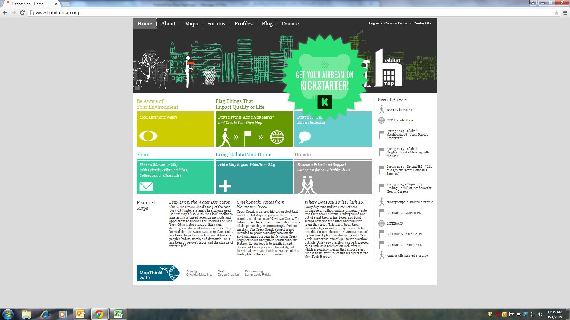
The HabitatMap homepage at http://www.habitatmap.org

The HabitatMap homepage at http://www.habitatmap.org

HabitatMap Interactive Website

Once a personal profile is created, participants can start making maps on HabitatMap.org, mapping (aka “Add a Marker“) items of interest either by geocoding or clicking on a specific location on the map viewer  – which is based on Google Maps.  For example, I quickly created an account and mapped the location of a community facility in my hometown which is in need of minor repairs and perhaps retrofitted to provide space for community groups in a section of our town with limited such facilities.  As tags are associated with each marker location,  users can search the HabitatMap database for specific projects or areas of interest by using keywords such as water quality, recycling, fracking, community gardens, or greenways.  Keyword matches are then rendered on the viewing screen.
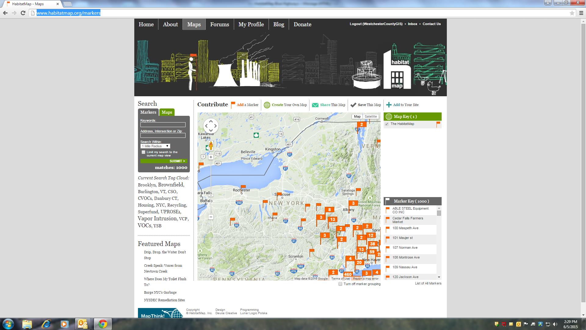
Community groups and individuals across New York State, particularl in the NYC metropolitan region, contribute to the HabitatMap by adding “markers” to identify a wide range of community-based issues and projects.

Community groups and individuals across New York State, particularly in the NYC metropolitan region, contribute to the HabitatMap by adding “markers” to identify a wide range of community-based issues and projects.

The Forums tab enables registered participants to start a discussion among other like-minded HabitatMap participants in categories such as Community Health, Water & Air Quality, Energy, Transportation, and Mapping.  Participants click on the forum category that best matches their intended topic of conversation and click “Post New Topic”.  The Blog tab is largely dedicated to the HabitatMap funded and developed Airbeam monitor which measures fine particulate matter (PM2.5), temperature, and relative humidity   Being used by community groups and activists across the country, the AirBeam connects to the AirCasting smartphone app via Bluetooth to map, graph, and crowdsource exposure to fine particulate matter in real time.
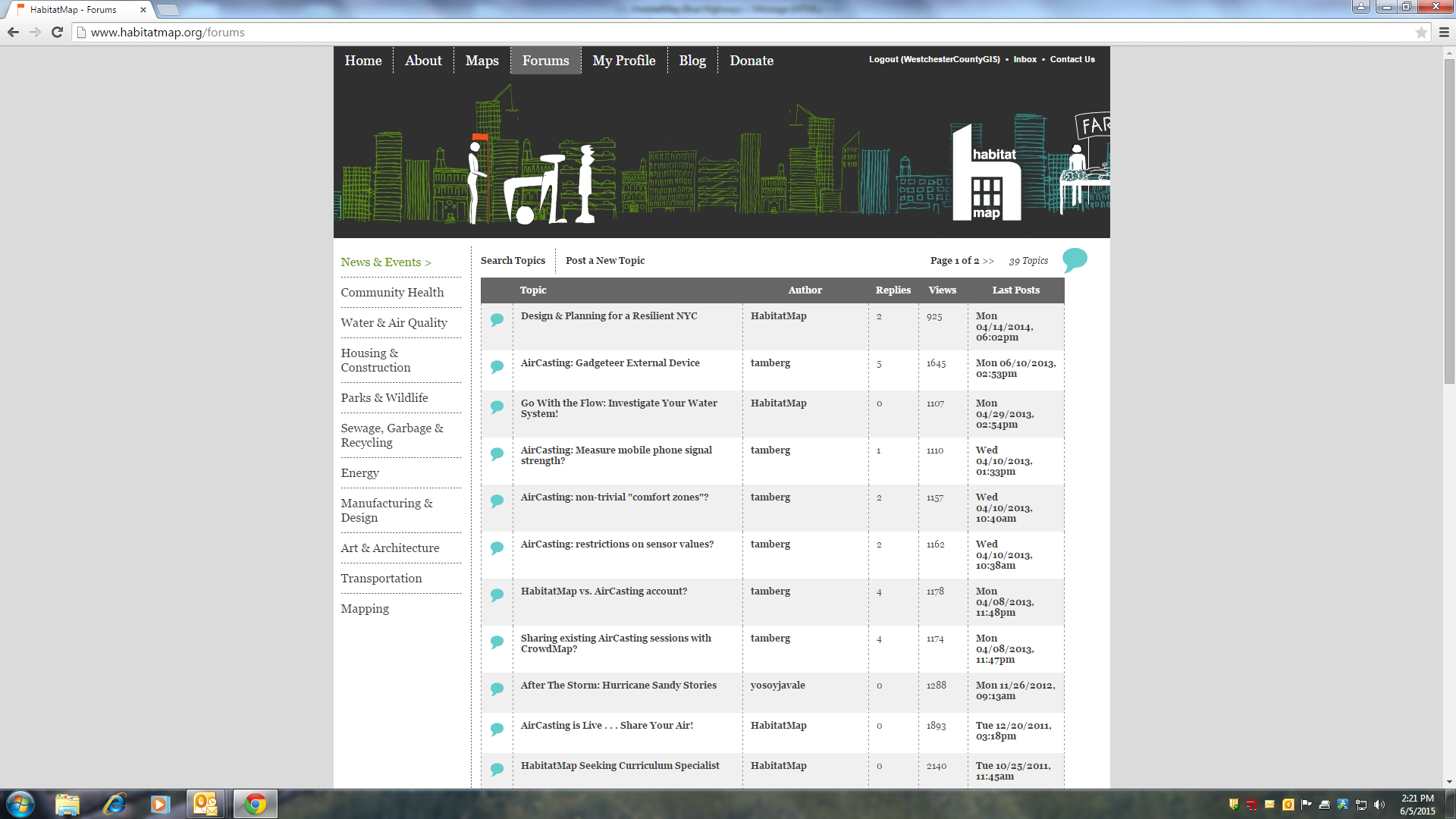
The Forums page enables participants to contribute and engage in dialog with others in topical areas such as Community Health, Mapping, Water and Air Quality, and much more.

The Forums page enables participants to contribute and engage in dialog with others in topical areas such as Community Health, Mapping, Water and Air Quality, and much more.

An excellent example of HabitatMap’s primary online mapping product can be seen as part of the Creek Speak map which provides access to stories of people and places near Newtown Creek. In addition to mapping the locations of local issues and events, the HabitatMap interactive map enables users to also include and associate URLs, graphics, and similar files with each mapped location.  Similar to other community organizations which partner with HabitatMap, the   Creek Speak Project map’s purpose is to highlight and document the knowledge of individuals who are “inside narrators” of day-to-day life in the Newtown Creek community.
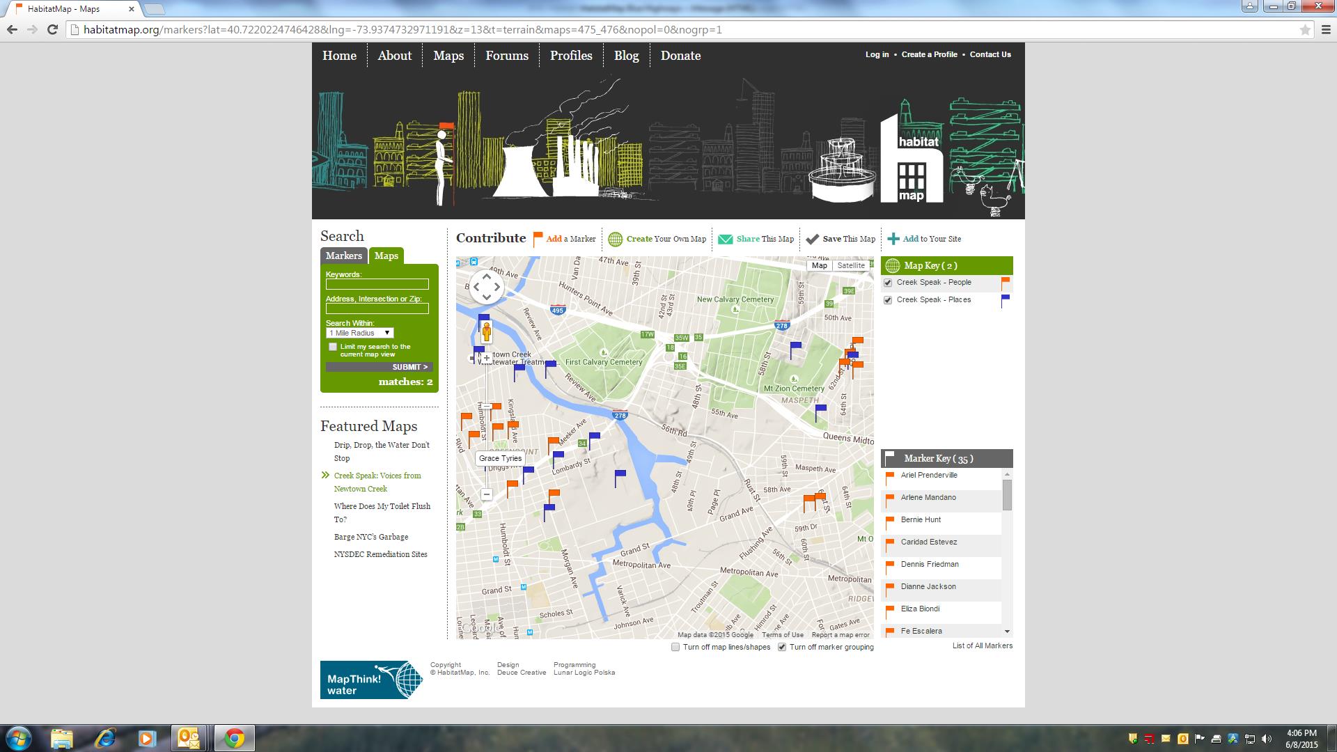
Founded in the Newtown Creek areas of Brooklyn, New York, there have been many contributions to the online HabitatMap from individuals and organizations located nearby.

Founded in the Newtown Creek areas of Brooklyn, New York, there have been many contributions to the online HabitatMap from individuals and organizations located nearby.

.Other groups use the HabitatMap interactive map to identify locations in their community that either enhances the quality of life such as parks, scenic vistas, farmers markets, civic programs, or public parks, or those might  cause for concern, such as a graffiti, unsafe properties, traffic/pedestrian issues, or illegal dumping or discharges.  Users can also create individual maps highlighting a specific area of interest, embed maps on a personal or agency website or blog, invite fellow activists to contribute to maps, and discuss issues and recruit collaborators in the online forums.

Mapping & Educational Programs

One area which best exemplifies HabitatMap’s use of mapping is through its educational outreach programs.  Central to this effort is  MapThink, an educational toolkit series developed by HabitatMap which introduces maps-based research methods to high school students and community based organizations so that they can become active participants in their community and advocate.  The MapThink Toolkit series focuses on creating planning and advocacy maps using their online tools: HabitatMap.org and AirCasting.org.

Illustrative projects in this regard include youth program workshops in Brooklyn and San Francisco during 2014.  In San Francisco, HabitatMap worked with 60 seniors from the Galileo Academy of Science & Technology, a public high school that provides students with career pathways in biotechnology, environmental science, health, hospitality and tourism, computer science, and creative media technology.  In Brooklyn, HabitatMap worked with UPROSE which is a grass roots, multi-ethnic, intergenerational community-based organization dedicated to environmental and social justice. UPROSE Youth Justice members were introduced to the AirCasting product which was used to map the air quality problems in their neighborhoods, which is host to multiple power plants and waste transfer stations, dozens of auto shops, and bisected by the Gowanus Expressway.

Another HabitatMap mapping effort was conducted by the students at the Green School in East Williamsburg Brooklyn.   Their project, entitled “Drip, Drop, the Water Don’t Stop”, focused on the New York City water distribution system.  Using Habitat’s online mapping and the “Go With the Flow” toolkit, students developed maps based on research of the NYC water storage, filtration, delivery, and disposal infrastructures.  You can learn more by clicking through the project map, looking at photos, and reading student learning reflections.
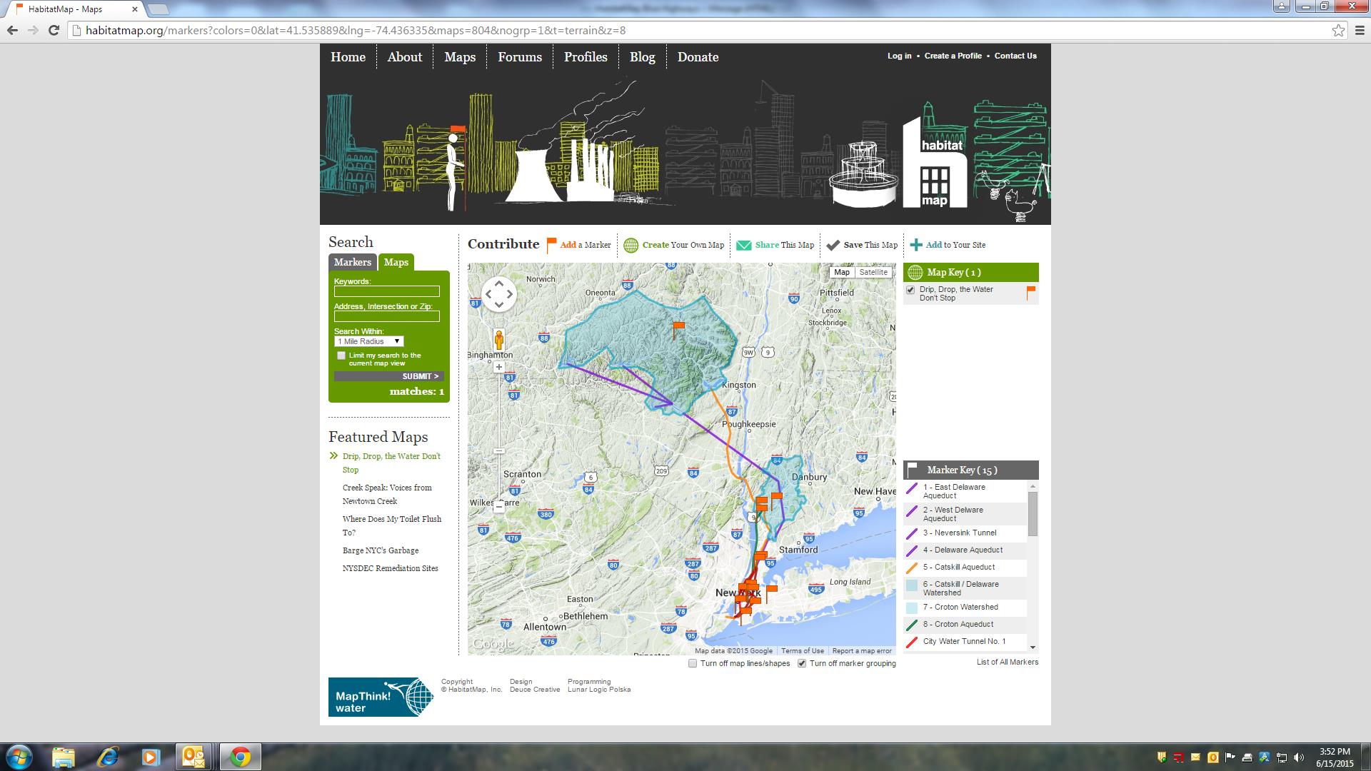
The Green School’s research project of the New York City drinking water system as rendered on the HabitatMap interactive map.

The Green School’s research project of the New York City drinking water system as rendered on the HabitatMap interactive map.

This summer, HabitatMap is working with the North Brooklyn Boat Club and the New England Interstate Water Pollution Control Commission mapping and collecting water samples in Newtown Creek with the new HabitatMap WaterSense monitor, which measures dissolved oxygen, conductivity, and temperature.  The instrument connects to the AirCasting app via Bluetooth to record, map, and graph the data in real time.  Made possible through funding from the Lily Auchincloss Foundation, the project was initiated to address water quality concerns in Newtown Creek, a Federal Superfund site that is inundated by over a billion gallons of raw sewage annually, the result of combined sewer overflows.

HabitatMap:  Looking Forward

While boasting a diverse collection of partners and collaborators including Google Earth Outreach, New York Community Trust, Mozilla Hive NYC, Environmental Protection Agency (EPA), Carnegie Mellon CREATE lab, and the New York State Pollution Prevention Institute, among others, the likes of NYS Dept. of Environmental Conservation, Michael Heimbinde remains the only full-time staff at HabitatMap and envision’s a bright future for the nonprofit.  He notes:

“We’re excited to continue growing the AirCasting community. Our ambitions for AirCasting, and it’s true potential, lie in 1) creating ultra-dense networks of AirCasters that network together multiple schools and community based organizations in a single neighborhood and 2) scaling nationally and internationally. HabitatMap, in partnership with Sonoma Technology, NYU School of Medicine, NYU Wagner, and the Newtown Creek Alliance have crafted a proposal for a community based participatory research project that would enable us to create an ultra-dense network of AirCasters in Greenpoint, Brooklyn, bring together the technical experts needed to address improving air quality in a neighborhood overburdened with pollution sources, and establish a model for expanding nationally and internationally.”

Tim Dye, Senior VP at Sonoma Technology, adds, “Our collaboration with Michael Heimbinder and HabitatMap on the development of the AirBeam sensor has been very rewarding. Together, we launched the Kids Making Sense program, which combines education and technology to empower students to drive positive change in their communities, in the U.S. and abroad.”

One community group and one map at a time.  Communicating community geospatial data that matters from Brooklyn, New York.  HabitatMap.

Along the Blue Highways of GIS.

Thanks for reading and see you down the road.


The Blue Highways of GIS: Watertown, New York

On the second floor of the main visitors building within the New York Zoo at Thompson Park in Watertown, New York are the offices of the Tug Hill Tomorrow Land Trust (THTLT).  The Trust is a regional, private, nonprofit organization founded in 1990 by a group of Tug Hill residents, and incorporated as an independent, nonprofit organization.   Since 1991, the Trust has permanently conserved more than 15,000 acres, and worked with over 86 landowners in Jefferson, Lewis, Oneida, Herkimer, St. Lawrence  and Oswego Counties.   The conserved land includes working farms, productive forestland, recreation and wild lands – all conserved through voluntary, private land protection.   The Trust works collaboratively with many local and statewide conservation organizations – including Ducks Unlimited, Nature Conservancy, Wildlife Conservation Society, among others – to make conservation projects happen.  THTLT is one of dozens of other statewide Land Trusts associated with the Land Trust Alliance and is an accredited land trust through the National Land Trust Accreditation Commission. Continue reading

The Blue Highways of GIS: Annandale-on-Hudson, New York

The Bard College Field Station is located on the Hudson River near Tivoli South Bay and on the mouth of the Saw Kill. Its location affords research and teaching access to freshwater tidal marshes, swamps and shallows, perennial and intermittent streams, young and old deciduous and coniferous forests, old and mowed fields, and other habitats. A library, herbarium, laboratories, classroom, and offices are open to undergraduate and graduate students, faculty, and environmental researchers by prior arrangement. Also based at the field station are laboratories and offices of Hudsonia Ltd., an environmental research institute. The Field Station is owned by the College and operated with support from  Hudsonia and other public and private funding sources.

Founded in 1981, Hudsonia is a not-for-profit institute for research, education, and technical assistance in the environmental sciences. Staff scientists, applying long experience in regional ecology and natural history, collect and analyze data and recommend measures to reduce or mitigate impacts of land development on the local environment. While biological sciences and research is at the foundation of the Hudsonia mission, geospatial technology provides tools which are used extensively throughout its programs.

Leading the GIS mapping efforts with Hudsonia is Gretchen Stevens who has been with the organization for 24 years. Receiving her B.S. in Environmental Conservation from the University of New Hampshire, Gretchen is a botanist and is self-taught in using GIS software with Hudsonia which has standardized on the ESRI platform. She is Director of Hudsonia’s Biodiversity Resources Center and has over 34 years’ experience in remote sensing, habitat assessments, habitat mapping, rare plant surveys, and other field biology in the Northeast. She manages the GIS laboratory at Hudsonia, curates the Bard College Field Station Herbarium, and supervises the Habitat Mapping and Biodiversity Education programs.

Over the past 13 years Gretchen has led and produced a significant amount of GIS work in the lower Hudson River Valley for the benefit  of local governments and organizations which would otherwise have been unable to take advantage of geospatial technology. Of particular focus in her work has been the use of GIS to support detailed mapping of ecologically significant habitats throughout towns in Dutchess and Ulster counties, as well as selected watersheds and stream corridors in Orange County (Trout Brook and Woodbury Creek), Schoharie, Albany, and Greene Counties (Catskill Creek) and Fishkill Creek in Dutchess County.

Hudsonia’s approach to most of their habitat mapping efforts has been similar by combining desktop ArcGIS tools, including the analysis of common data layers such as bedrock and surficial geology data, topography, and soils, with the interpretation of color infrared aerial photography to predict the occurrence of ecologically significant habitats. Gretchen notes:

 “These projects involve lots of detailed, hands-on remote sensing analysis and lots of field work – both of those aspects help to distinguish the final products from most other maps in the public domain. By “hands-on” I mean that we do not rely on mapping software to interpret our spatial data such as geology, topography, soils, and aerial imagery. We visually pore over the spatial data ourselves to arrive at our habitat predictions, and then digitize the boundaries ourselves (click-click-click) onscreen. And then we visit as many areas as possible to answer our questions.”

Illustrative to the high quality of work, many of Hudsonia’s GIS products are incorporated into local master plans, open space plans, and local land use policies. For example, in Dutchess County, the towns of Amenia, Clinton, Hyde Park, Rhinebeck, and Woodstock in Ulster County, have incorporated Hudsonia’s habitat mapping information into local comprehensive plans, zoning ordinances, and/or review procedures for land development projects. Conservation Advisory Councils (CAC) in the towns of Beekman and Rhinebeck have been using Hudsonia’s GIS mapping data and habitat reports to make presentations to Planning Boards about biodiversity concerns associated with proposed projects.

Town of Clinton Significant Habitats

Town of Clinton Significant Habitat Mapping

The Woodstock habitat map, augmented by many other publicaly available geospatial datasets, has enabled the Woodstock Land Conservancy to prepare a Strategic Conservation Plan (completed in 2013) for their service area, which includes Woodstock and neighboring towns. Hudsonia is also helping the Town of Ancram prepare a Natural Resources Conservation Plan which includes a series of 20 GIS maps depicting such elements as bedrock and surficial geology, elevations, farmland soils, aquifers, unusual habitats, and conservation priorities throughout the town.

Ancram Habitat Mapping

Town of Ancram Significant Habitat Mapping

2014 is year three of a five-year collaboration with biologist Jason Tesauro on a project that uses grazing dairy cows to restore habitat for the bog turtle (an Endangered species in New York) at a site in Dutchess County. The project includes the radio tracking of turtles and monitoring the vegetation changes. Hudsonia biologists and interns collect GPS data while tracking turtles and use  ArcGIS Tracking Analyst to create maps showing the movements of each turtle through the tracking season, overlaid on an orthophoto image. Cool stuff.

Smaller_BogTurtleHudsonia_Page_1

Bog Turtle mapping and tracking in Dutchess County

Praise for Hudsonia’s GIS work at the local level is widespread. “The Woodstock Planning Board has adopted the Hudsonia map as our official town map and the planning board uses the map on the big screen at all our meetings so the public can see what issues the planning board is looking at” offers Peter Cross, a member of the Woodstock Planning Board, “I use the Hudsonia biodiversity map all the time as part of my work as the Woodstock Wetlands and Watercourse Inspector.” Across the Hudson River in Rhinebeck, Michael Trimble, current chair of the Town of Rhinebeck Planning Board, and Interim Zoning Enforcement Officer notes “Gretchen and Hudsonia do remarkable work and our area has benefited from their efforts.” Additionally, Cliff Schwark, Chairman of the Town of Beekman CAC replies “My best description of Gretchen Stevens is that she is a true professional in her field, an excellent educator, always helpful and a pleasure to work with. The results of their work were excellent, on time, and at cost and have proven to be valuable to the Town of Beekman.” In the Town of Clinton, Norene Coller comments “We are very fortunate in Dutchess County to have an organization with the knowledge of native species and difficult to observe small habitats as well as GIS capabilities to help communities make important land-use decisions”.

While she and her colleagues at Hudsonia have made presentations on their GIS-based work at venues such as the NYS Wetlands Forum, the Northeast Natural History Conference, and the Association of American Geographers – there has been limited interaction with the larger and existing statewide GIS community. Nonetheless, she remains a dedicated member of the statewide geospatial community who works meticulously with little notoriety beyond the Hudson Valley communities she serves.

Gretchen and her work with Hudsonia illustrates the role of similar nonprofits which fill a geospatial role providing support to conservation agencies and smaller, more rural governments typical of the mid-Hudson River communities where they work, often with organizations with very limited, if any, technical staff and largely being supported through grant funds and private foundations.

Gretchen summarizes  “Our GIS capability has enabled us to gather and analyze huge amounts of physical and biological data, and has greatly advanced our understanding of the Hudson Valley ecological landscape. In addition to expanding our research on the known and likely occurrences of rare plants and animals and their habitats, GIS has allowed us to convey a giant body of information about significant habitats to landowners, land trusts, and municipal and state agencies who can put it right to use in protecting the most sensitive areas.”

Just another person working the smaller venues across the Empire State.   Thinking Globally, Acting Locally.   Number 177 under “S” on the NYS Clearinghouse Who’s Who in GIS Listing by Alphabetical.

Gretchen Stevens and others along the Blue Highways of GIS.

Thanks for reading and see you down the road.

Not-for-Profits Gone Spatial

Leveraging web-based technology to reach wider audiences, combined with fewer tax-payer funded GIS initiatives, and improved “open government” data portals has led to a growing body of geospatial work by the Not-for-Profit (NFP) sector within New York State.  Ranging from basic community based mapping programs to scholarly research efforts, these statewide contributions come from national based organizations, land trusts, conservation districts, and a range of local environmental groups.

Several active programs, which are typical of statewide NFP GIS efforts, are located in the lower Hudson River Valley.  The Westchester Land Trust is similar to other statewide land trusts using GIS technology to support business and advocacy programs.  Working closely with the Westchester County GIS program WLT utilizes GIS to inventory and map individual properties, supports local environmental groups GIS/mapping efforts, and to promote events such GIS Day.

The Saw Mill River Coalition also uses GIS datasets in conducting land use studies and mapping projects.  Many local governments have open space committees which use GIS to inventory open spaces (local, county, state parks, cemeteries, schools, gardens, etc.) and are now using GIS tools to identify linkages and corridors such as right-of-ways and easements to connect open spaces.   Digital tax maps, public infrastructure, and utility system networks are useful sources of information in identifying such corridors.

Nearby is Hudsonia, a not-for-profit environmental institute which focuses on environmental research, education, training and technical assistance throughout the Hudson River Valley.  GIS-based habitat mapping is one of its signature geospatial programs and is used by local municipalities.   The New York/New Jersey Trail Conference provides workshops and uses GPS and GIS, a portion of which is based on user collected X,Y (trail) data for hardcopy map production on hiking trails throughout southeastern New York/Northern New Jersey.

More detailed GIS analysis by a NFP includes ongoing work at Mohonk Preserve outside of New Paltz, New York where managers and scientists are using GIS to map the relationship between rare species and their habitat as well as describing the importance and changes in ecological communities.   Much of the geospatial work at Mohonk was detailed in the Winter 2011/2012 issue of ArcNews.  GIS support services are also provided and offered through the Cornell Cooperative Extension Dutchess County (CCEDC).

One of the largest NFP GIS mapping programs in the state is the OASIS  (Open Accessible Space Information System) program covering the metropolitan New York City area and located at the CUNY Mapping Service at the Center for Urban Research.  Its mission is to “help nonprofits, community groups, educators, students, public agencies, and local businesses develop a better understanding of their environment with interactive maps of open spaces, property information, transportation networks, and more.”   The OASIS project has gone beyond its original New York City geographic footprint and is now involved in similar mapping efforts beyond the metropolitan region.  Their homepage has an extensive listing of other NFP programs, which contribute, to the OASIS initiative in context of providing data and/or funding.

On a statewide level, illustrative NFP GIS programs include:

Scenic Hudson:  Developed in concert with both government and academia, Scenic Hudson developed the online Sea Level Rise Mapper (SLR) application which is intended to “create visualizations of future scenarios of sea level rise.”   With the maps created as part of the application, Scenic Hudson is supporting communities’ efforts to develop adaptation plan.  Data and mapping products integrated into the application are a combination of results from new analyses by Scenic Hudson and existing data from a variety of sources including NYS DEC, US EPA, US Census Bureau, Dr. Roger Flood (SUNY Stony Brook) and FEMA.

FracTracker: This non-profit organization is dedicated to enhancing the public’s understanding of the impacts of the oil and gas industry by collecting, interpreting, and sharing data. With the Marcellus and Utica Shales at the focus of this environmental issue, FracTracker employs in-house GIS technology capacity to distribute maps (PDF format) and data, as well as using ArcGIS.com for interactive mapping. “Maps are central to our grassroots outreach effort, helping us communicate the relevant environmental issues associated with important statewide issue” says Karen Edelstein, New York State FracTracker liaison.

The Nature Conservancy:   In conjunction with the New York Natural Heritage Program and funded though the Hudson River Estuary Program,   TNC conducted a project that combined a GIS prioritization framework with field assessment methods to identify and prioritize culverts and dams that are of biological importance in the Hudson River Estuary (HRE).  The goal of this project was to identify a suite of barriers whose removal would provide a meaningful biological benefit in the HRE.   In all, over 13,000 potential barriers were identified in the study.

The NFPs referenced in this post represent only a small portion of similar statewide organizations that contribute significantly to a wide range of applications, data, personnel, funding, and underlying geospatial infrastructure across the state.  As a side note, the recent release of the New York Protected Areas Database (NYPAD) illustrates yet another scenario as to how government agencies can partner with and use the NFP structure, and in this case academia, to further strategic GIS programs.  Similar initiatives are funded through the New York Natural Heritage Programs (NYNHP).  Given today’s government financial climate, such an initiative would be very difficult to complete and maintain solely with public agency resources.

While historically the primary role of NFPs in the geospatial arena has been as a consumer of taxpayer funded GIS data, their role is quietly changing to that of a producer.   Long term, improvements in quantifying their economic and scientific contribution to the statewide geospatial effort warrants continued recognition and discussion.