Geospatial Technologies at St. Lawrence University

The 2017 New York State GeoCon in Lake Placid provided the opportunity to for me to catch up with several statewide colleagues which will be reflected in at least a couple upcoming blog posts.  As part of these discussions, I ended up connecting with a familiar Empire State GIS person of interest:  Carol Cady – who serves as GIS Specialist/Map Librarian at St.Lawrence University (SLU) in Canton, New York.  Our discussion and follow-up communications certainly highlight a wide range of geospatial activities in the state’s North Country which the SLU GIS program is a significant contributor.

Carol directs the GIS project which is housed in the Libraries and Information Technology Division.  Unlike many of the New York State public university geospatial programs, the SLU program is not associated with a specific academic curriculum or major.  She and other GIS program staff provide instructional, technical and research geospatial support to the entire university community in the use of geospatial software and technology including Remote Sensing and Global Positioning Systems (GPS).

Carol arrived at SLU in 2002 to oversee and manage the GIS program.  Before her arrival, the SLU GIS program had been established in the early 90’s by Professor Bill Elberty who was a Geography Professor and for whom the current GIS lab is named after.  Professor Elberty taught GIS courses which provided the foundation for many current GIS professionals across New York State.  After Professor Elberty retired in 1999 the GIS program data and software was moved to the Science Library.

Prior to accepting the SLU position, Carol served as a GIS Analyst for Fort Drum Natural Resources Branch as a contractor. Carol’s background is in biology with a BS from UMass- Amherst and a Masters in Zoology at the University of Vermont.   She was introduced to GIS as land management tool while a seasonal wildlife technician for US Fish & Wildlife Service at Moosehorn Refuge in Calais, ME.   She then returned to UMass to learn more about GIS with coursework in the Wildlife Department.

GIS Facilities and Academic Offerings

The principal location for GIS and GPS instruction at SLU is the Elberty Laboratory for Spatial Analysis.  The lab includes 15 dedicated GIS workstations, printing and plotting devices, field tablets, and both Trimble and Garmin GPS units.  Increasingly, smartphones using the ESRI Collector and Survey 123 apps are being used in field data collection efforts.  Both Carol and GIS/GPS technician Dakota Casserly offer support to the SLU community in a variety of software packages including ArcGIS, QGIS, Google Earth, IMAGINE, IDRISI, and NASA’s WorldWind.

On a regular basis, Carol teaches both Intro to Geographic Information Systems (with lab) and Directed Studies in Geology GIS classes and occasionally Advanced GIS and Intro to Geospatial Technologies.  GIS concepts are incorporated in other courses in the areas of Conservation Biology, Global Studies, Environmental Psychology.

Carol is assisted by Dakota Casserly, St. Lawrence University GIS/GPS Technician who is involved in the program on many levels including designing and guiding projects with student GIS technicians and teaching introductory sessions or specialized topics like GPS and Network Analyst.  A project he has recently completed is the Laurentian Legacy project.
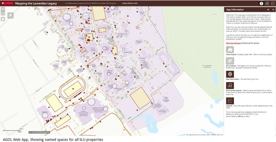
Mapping the Laurentian Legacy is a partner project between the University’s Donor Relations department and the GIS Program. The web app provides interactive and searchable access to the University’s named spaces database.

Projects and Activities:

The GIS program at SLU provides support to many local and regional geospatial efforts.  The program has a long  relationship with the St. Lawrence Land Trust having provided maps for base line and yearly evaluations of easements.  Recently, SLU GIS staff, along with Jess Rogers, Assistant Professor, Biology/Environmental Studies, SUNY Potsdam, and Alex French, Sustainability Coordinator, Clarkson University conducted a suitability analysis to find large privately owned forested properties which meet Land Trust criteria to put lands into a protected easement.  More recently, Carol’s Intro to GIS has been involved in a suitability analysis to identify non-forested properties in all of St. Lawrence County that may meet Land Trust easement criteria.  In 2013 Dakota’s predecessor, Jonathan Ignatowski, worked with the St.Lawrence County Health Department to identify houses built before the early 1970s and may contain lead paint.  This was part of a larger project to help with lead paint remediation for household owners.

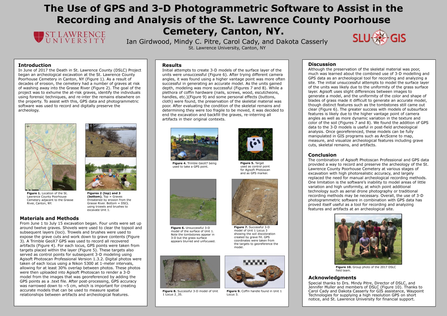
One SLU project which was of particular interest to me is the June 2017 Death in St. Lawrence County (DSLC) Project that began an archeological excavation at the St. Lawrence County Poorhouse Cemetery in Canton, NY.  As a result of decades of erosion, the cemetery had a number of graves at risk of washing away into the Grasse River.  While the original goal of the project was to identify and exhume at-risk graves, identify the individuals using forensic techniques, and re-inter the remains elsewhere on the property. Unfortunately, Mindy C. Pitre, an assistant anthropology professor at St. Lawrence University, who was overseeing the project said she and her team of students discovered that very little remained of the bones at the gravesites they dug closest to the Grasse River.  As a result, the bone could not be examined and information such as gender and age could not be determined, she said. The deteriorated bone fragments were returned to where they were found and reburied.  It was felt that continuing any further would have done more harm than good by removing it, so the project was stopped.  Nonetheless, the project did include the use of state-of-the-art geospatial tools including high resolution GPS data and 3-D photogrammetric software to record and digitally preserve the archeology. This project was presented as a poster at the Lake Placid conference.
Additional examples of student projects focusing on American Kestral nesting sites, Brook Trout spawning sites, wind turbine placement relative to hawk migrations, and the effects of St. Lawrence County land use changes on grassland bird habitat can be found on the SLU GIS landing page.

Working Partners:

Collaborating organizations in the North Country recognize SLU’s GIS contribution in regional geospatial efforts.  Notes Jason Pfotenhauer, Deputy Director. St. Lawrence County Planning Office:

“The St. Lawrence County Planning Office has had a long relationship with the GIS lab at St. Lawrence University having worked with Carol Cady for many years, as well as several of her mapping technicians.  We traveled to numerous State GIS conferences and NYS geo-spatial summits together and have had approximately 10 SLU students work with our office in various capacities.  Two recent larger scale county projects were the result of Carol’s willingness to supervise graduating seniors with strong GIS skills.  For the first, Carol took the initiative to pursue Walker Fellowship funding so that Sean Gannon could receive a paid internship and create the initial dataset for the County’s Agricultural Atlas.  The second project involved the collection of raw U.S. Census data to depict housing and socioeconomic data at the census tract level (which is not readily available on existing regional, state or federal websites).  Dylan Arpey undertook this initiative to help inform the County’s Assessment of Fair Housing.

The GIS lab staff have also provided us with valuable technical assistance that improved our capabilities in preparing maps for county constituents.  Most recently Dakota Casserly and Carol provided a tutorial on how to geoprocess tiffs in order to create digital models of hard copy flood plain maps.”

Star Carter, GIS Supervisor, Development Authority of the North Country (DANC) adds:

“The St. Lawrence County university/college GIS people are all fantastic and very worthy of recognition!  I work with the SLU crew a few times a year to get data or share data for infrastructure in the Village of Canton.  It’s a good relationship.  DANC has hired graduates and summer interns from both SLU and SUNY Potsdam.  A former DANC GIS Specialist graduated from SLU and is now in grad school in Colorado; and a current DANC GIS Technician graduated from SUNY Potsdam.  All of these graduates came out of their programs with enough GIS skills and practical experience to hit the ground running and be valuable employees right away.  So, from the hiring perspective of a local employer, having these GIS programs available at local universities is very important to keeping me supplied with a competent workforce”.

Summary

The St. Lawrence University GIS program illustrates the growing presence – and importance – of the New York statewide network of university programs which support regional and local GIS initiatives.   In absence of paid consultant assistance, University programs can often provide a certain level of geospatial support to governments and organizations with limited funding or geospatial capacity.  While several Empire State college programs offer both B.S. and advanced degrees in geospatial technologies, non-degree academic programs such as SLU offer high quality geospatial academic training, combined with applied field experience that adequately prepares students for a variety of geospatial workforce occupations.

For more information on the St. Lawrence University GIS Program, contact Carol Cady at ccady@stlawu.edu.

 

Best of the Show: New York Giant Traveling Map

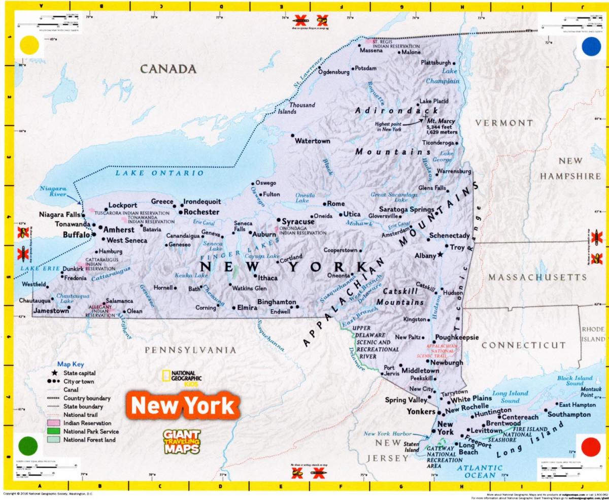
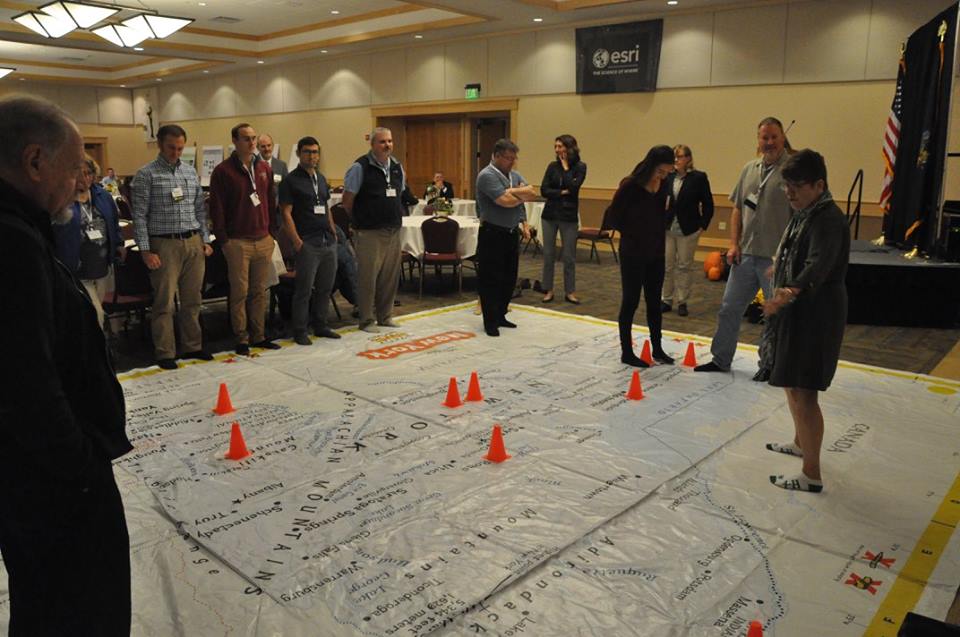
While the recent statewide GIS conference in Lake Placid featured several presentations and vendor displays in emerging  areas of geospatial development across the Empire State, one presentation –  and an interactive one no less –  was certainly one of the most refreshing and welcomed.  Why’s that, you ask?  Well, consider the following:   (1) it contains  no technical jargon or  software programming speak,  fancy charts or diagrams, (2) has connections to the  educational community, (3) applicable anywhere in the Empire State,  (4) absolutely and completely different, and  (5) suitable for all ages –  Rated “G”!  Yes, the New York Giant Traveling Map which was presented by Susan B. Hoskins, Senior Extension Associate at Cornell University.

Susan B. Hoskins demonstrates use of the NYS Giant Traveling Map to conference attendees during 2017 GeoCon in Lake Placid. Note: No shoes allowed – the geoenabled version of the game Twister?

The Map

In celebration of the 30th anniversary of state geographic alliances, National Geographic produced a Giant Traveling Map for each state.  Two copies were gifted to the New York Geographic Alliance in 2016 headed by Timothy McDonnell, geosciences faculty at Monroe Community College in Rochester.  Since then the New York 4-H Geospatial Sciences program has gotten involved to help promote the map in 4-H programs and classrooms statewide.  The 4-H Geospatial Science and Technology Program, within Cornell Cooperative Extension, provides educator professional development in GPS, GIS and the tools of remote sensing.  The geography lessons learned on the Giant Traveling Map are fundamental to using technology in map making.  Many youth and adult mentors take these skills and technology lending library and apply them to community mapping projects.

The Giant Traveling Map of New York, measures 15 X 20 feet and includes major cities, water bodies, mountains, Indian Reservations and National Parks.

The map “kit” comes complete with a curriculum of six activities that help youth explore map features and symbols, grids, map scale, orientation and direction, and the basics of Geographic Information Systems.  Props included in the kit are orange cones for marking points, yellow plastic chain, blue yarn and a ball of string to map “linear features, a compass rose and map legends.  Teachers and users of the map can determine how far is it from New York City to Albany by comparing one’s foot to the scale bar and walk along the Hudson River.  Or finding the Erie Canal?  Follow the canal path from Albany to B-uf-fa-lo-ooo, just like the song.

To date, the following schools and organizations have hosted the Map:

Additionally, McDonnell states: “The Map can be used in middle schools to support 7th Grade curriculums for social studies which includes New York history and geography”.  The Geographic  Alliance  maintains other resources specifically designed for middle school including  The Atlas of New York: Legacies of the Erie Canal and Lessons for the Atlas of New York.  More information can be found under the Resources link on their website.

The Map Travels to Westchester County

After  the Lake Placid conference, the Map traveled to Solomon Schechter elementary school in White Plains where it was used by 4th grade teacher  Amy Sroka who expressed accolades after having used the map..  After a week in the classroom, one of Ms. Sroka’s students commented:

I learned a bunch of names of different towns and cities. It was really fun trying to find the locations of a lot of the places. While I was studying the map, I discovered that there are actually so many more mountains in New York State than I had thought there were…I really enjoyed the map!”

If your school, family gathering, or organization is interested in using the Map, contact Tim McDowell at the New York Geographic Alliance.  It is also available for sale through National Geographic for $750.

Geospatial Science Education at the U.S. Military Academy

While academic institutions across the State of New York offer rich and diverse geospatial educations at the graduate, undergraduate, associate, and increasingly certificate programs levels, one location offers a unique and phenomenally different perspective on application of GIS and geospatial technology:  The U.S. Military Academy at West Point, New York.

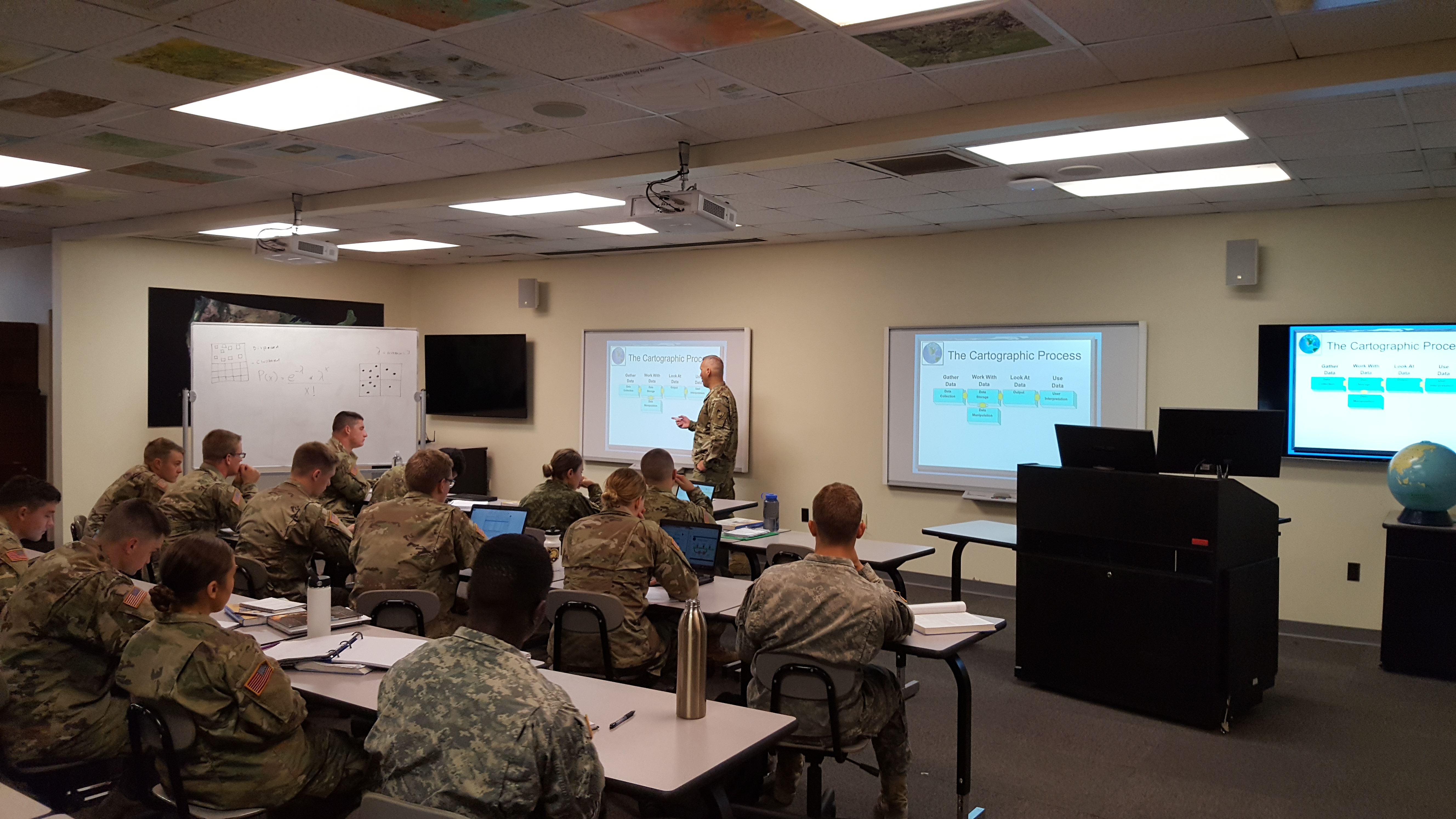
Over the past several years I’ve had ancillary introductions to the geospatial program at the U.S. Military Academy, albeit it was greatly broaden after a presentation by West Point instructors at our May 2016 Westchester GIS User Group meeting at Purchase College.  It was here conference attendees were fortunate enough to see a video – accompanied by the display of an actual device  – on how drone technology was being introduced and taught in the Military Academy classroom environment.  Since then I continued conversation with staff from the Geospatial Science Program in the Department of Geography and Environmental Engineering and was recently invited to attend a Computer Cartography classroom lecture earlier this month with instructor  Lieutenant Colonel (LTC) Jared L. Ware.

Instructor LTC Jared Ware leading a classroom lecture in his Fall 2017 Computer Cartography class

Teaching and Classroom Environment

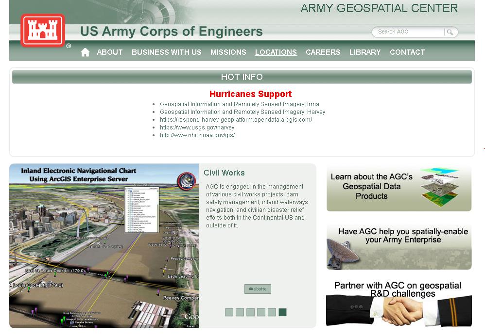
The U.S. Military Academy is an internationally recognized institution for combined academic and military excellence. West Point offers cadets a bachelor of science degree in GIS, and the graduates go on to serve in the armed services as well as various positions in the public and private sectors.  Graduates are posted to installations across the USA and the world.  There is no specific place graduates specializing in geospatial technology move on to as they have a choice based on their preferences for a military branch or a priority installation.  Some will have the opportunity as junior officers to serve at the National Geospatial-Intelligence Agency focusing on military intelligence while others will apply the technology in more traditional applications with the U.S. Army Corps of Engineers.  Understandably, the program also focuses on the utilization of geospatial technologies – including GPS, satellite imagery, real-time force tracking, sensor integration, and massive geographic databases – for use on the military battlefield.  The Army also provides geospatial support in a wide range of humanitarian relief efforts such as those currently ongoing in response to Hurricanes Harvey, Irma, and Maria.  The efforts, as well as other Army geospatial products and services are highlighted on the Army Geospatial Center website:

GIS instructors at the Military Academy use a suite of software including  ESRI, ENVI and ERDAS as the primary GIS software, along with Socet Set and Trimble for survey and photogrammetry.  There are plans to begin building additional capacity with Open Source software such as QGIS as the Army is increasingly seeing this software being used in developing countries.  And as a result, needs military personnel trained in the software to collaborate and work with local users.  For Fall2017, the Geospatial Program has 60 declared GIS Majors which includes sophomores, juniors, and seniors.  This major requires the completion of a 26-core course  curriculum augmented with a wide range of electives many of which are similar to other traditional academic coursework offerings such as Urban Geography, Water Resources Planning and Design, and Principles of Land Use Planning and Management.  There are additional 80 students taking GIS-related courses from other academic majors from the Department of Geography and Environmental Engineering including Environmental Science, Environmental Engineering, and Geography which use GIS coursework as an elective.  The newly created Space Science major is anticipated to have a significant GIS/geospatial focus as well.

With regard to their approach in teaching geospatial science at the Academy, Instructor LTC Ware notes:

“We want cadets to understand the theoretical and applied aspects of geospatial information science.  Our program provides a comprehensive grounding in the theory of academic disciplines such as geographic information systems, photogrammetry, remote sensing, and surveying.  Our program also challenges cadets to understand applications that are developed and derived from the theory, and we use systems (mainly hardware and software) to allow cadets to create their own products and learn from a hand’s on approach.  We want our students to be intelligent in the science so they can solve problems should applications not exist, or they can easily troubleshoot existing systems and reach a solution.  As an example, we want cadets to understand the hardware and software, how the hardware and software works, and the theoretical underpinnings so as technology changes, they can adapt with it.  We also adapt our academic courses as theories and applications evolve, and we are currently exploring data visualization so we can be at the forefront of new ideas and new technologies.”

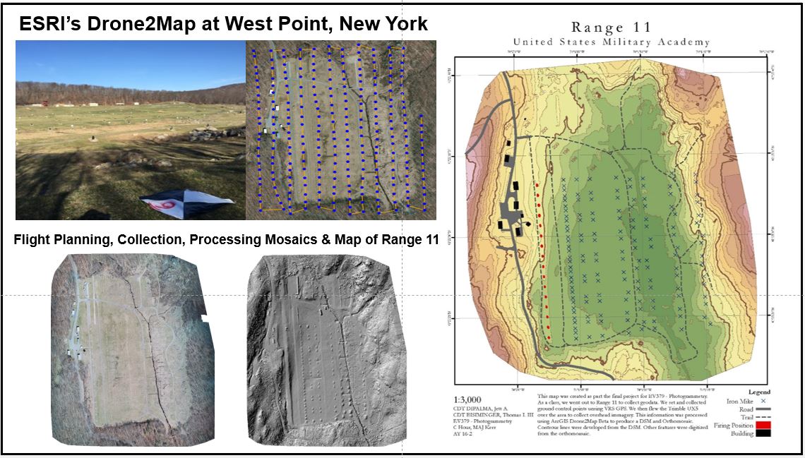
Drone technology is becoming an important teaching tool in many areas of the Military Academy curriculum and LTC Ware and his colleagues have been very proactive in utilizing drone technology in the Geospatial Science Program.  An excellent overview of the development of drones at West Point appears in the November 2016 edition of the Commercial UAV News.

Drone map products developed by cadets for Range 11 at the U.S. Military Academy

The Military Academy’s Geospatial Information Science major is accredited by the United States Geospatial-Intelligence Foundation (USGIF) which developed the GEOINT Certification Program.  The GEOINT certificate provides a foundation on which GEOINT professionals can certify the knowledge, skills, and abilities necessary for successfully meeting the duties and responsibilities within the multi-faceted GEOINT tradecraft.  With this accreditation from USGIF, the Military Academy can offer students GEOINT certificates accompanying their college degree.  (In previous blog posts I’ve referenced in the head-to-head GISP vs. GEOINT certificate match-up, i.e., which might be better for the NYS GIS professional, my vote goes to GEOINT due to the large – and growing – drone research and development industry here in the Empire State.)   Additionally, in 2015, the National Geospatial-Intelligence Agency (NGA) and United States Geological Survey (USGS) selected the US Military Academy to be one of the academic institutions included in the Centers of Academic Excellence in Geospatial Sciences program.

Hudson Highlands Land Trust (HHLT)

Its always interesting to learn about an organization’s work outside of the day-to-day norm.  Maybe, and often, in context of a contribution to the larger good.  Such was the case as I was exiting my time on campus with LTC Ware when he mentioned a cadet’s volunteer summer work with the Hudson Highlands Land Trust (HHLT) across the Hudson River in Putnam County.  I reached out to HHLT Conservation Stewardship Manager, Nicole Wooten to find out more about the project and its outcome.  She replied:

“Working with West Point LTC Ware and Cadet John Stabler to map the current trail system on Hudson Highlands Land Trust’s new Granite Mountain Preserve was a great experience and partnership that benefited both the Land Trust and the community of Putnam Valley.  Under LTC Ware’s guidance, Cadet Stabler gained real, immediately-applicable GIS skills.  His work took place both in the computer lab and in the field, combining aerial imagery and prediction with on-the-ground proofing.  He really dedicated himself to the project, going above and beyond to generate data on not only existing recreational trails, but also historic stonewalls and important natural features.  The Land Trust is now using that data to plan the best possible trail system for Granite Mountain Preserve.  We are grateful for LTC Ware’s and Cadet Stabler’s work, and look forward to continuing this great partnership.”

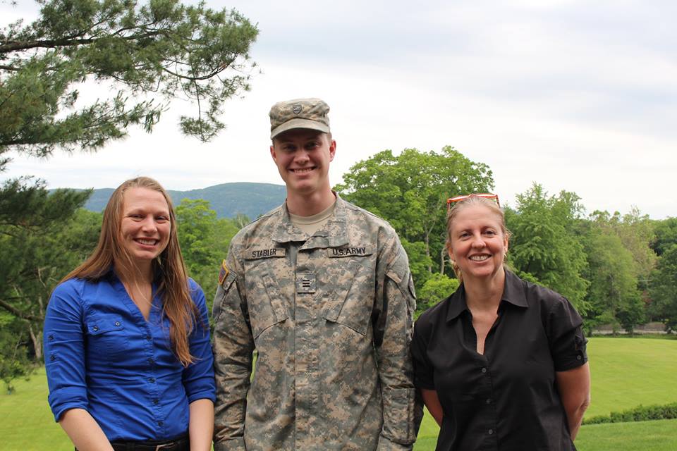
U.S. Military Academy cadet John Stabler with Nicole Wooten (L) and Hudson Highland Land Trust Executive Director, Michelle Smith (R).

Summary

While the theoretical geospatial concepts are similar to that in civilian applications, the final applied use of geospatial technology, as taught at the U.S. Military Academy, is often uniquely different.  Most notably is in the defense of our country and allies.   The Empire State’s higher education academic geospatial offerings are indeed very diverse and continue to contribute to the development and evolution of the technology.

For information contact Lieutenant Colonel Jared Ware, Assistant Professor in the Geospatial Information Science Program, at Jared.Ware@usma.edu.


2017 GeoCon Wish List: Part II

In January of this year, I published my first 2017 GeoCon wish list relative to geospatial mapping applications and topics I’d like to see as part of the Lake Placid October 17-19 conference.  Since January, writing and publishing eSpatiallyNewYork has enabled me to communicate with a wide range of individuals and organizations involved in geospatial programs across the state  – some of which are included in the list below.  Others itemized on the list are new business start-ups,  government and nonprofit initiatives, and programs involved in the emerging drone technology.

So without any further adieu, here is Part II itemizing geospatial topics and program areas I’m advocating for 2017 GeoCon in Lake Placid.  Speakers, presentations, and ideas to mix things up and start some new discussion – and why.

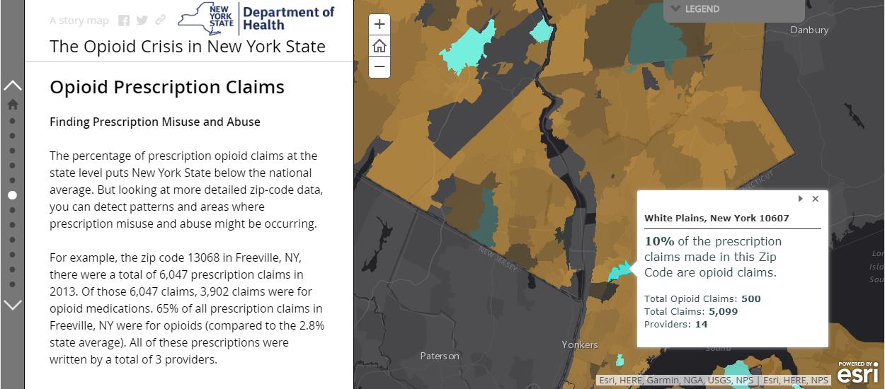
Opioid Crisis Mapping

With the opioid crisis well documented in New York State, Story Mapping and data visualization help further detail the magnitude of this public health issue to a much wider audience.  Story Maps also enable authors with much greater flexibility in developing a narrative to accompany the data which might be otherwise be difficult to interpret or understand with just a map by itself.  Here in New York, it’s the hope to see greater use of Story Mapping (not just ESRI’s solution – all platforms) by agencies and organizations which historically have been reluctant to publish maps due to concerns of data which might be sensitive or misinterpreted.  This Opioid Story Map provides a powerful message and can prove to be a catalyst in seeing other statewide public health data being published in a similar geographic format.  It would be interesting to hear more from this Story Map author(s) about the datasets used (availability, sensitive/non-sensitive, sources, etc.) and possible collaboration with other GIS programs and agencies at the federal, state, and local level.  See also the Northern Kentucky Story Map:  The GEOStory of Opioid Addiction and The Urban Observatory: The Opioid Epidemic.

Story Maps provide an easy and powerful framework to combine narrative and maps which is often very helpful when publishing sensitive or “difficult” to interpret data. Publishing agencies have can better help how data is interpreted and read.

New York State Wildland Fire Mapping

Nothing special or cutting edge here geospatial, but I’ve always had a soft spot for wildland fire maps having served on U.S. Forest Service interregional fire crews back in the day in both Idaho and Montana.   Though in context of publishing fire data, it’s unfortunate how little capacity New York State Department of Environmental Conservation (DEC) has built in context of publishing their data and products as services. Not that statewide wildland fire data and map services would be a top seller for DEC, but the image below (scrapped from the DEC website) speaks to the continued reliance on static maps and other enterprise map applications  which cannot be consumed by other viewers.  The map is actually interesting in showing how there are more fires per square mile closer to urban areas (red) than in the more forested areas such as the Adirondacks – where most would think wildland fires occur and with more frequency.   Publishing this type of data as some type of map service would Continue reading

GPS Telematics for Fleet and Mobile Workforce Management

Several of my posts over past 18 months have focused on a core set of applications which I have seen evolve over the past three decades that serve as the cornerstones for many New York State local and county government geospatial programs.  Increasingly and central to many of these geospatial program areas is the “mobile” component albeit much of the attention to date has been on “field/handheld” hardware and software components for both spatial data collection and updates.

Increasingly  it is becoming recognized  another mobile collection technology can add value to  an organization’s work force and business systems productivity.  Originally referred to as Automated Vehicle Locator (AVL) systems, this technology got its start decades ago focusing on the capture (mapping) of a vehicle’s location and display in a GIS or similar digital mapping system. These early systems were expensive and not widely used outside of business and industry.

Over the last five or more years,  fleet managers have increasingly adopted “AVL” technology to assist in the management of  fleet assets especially with availability of lower cost hardware components which connect  to vehicle On Board Diagnostic (OBD) ports.  This capability supports fleet managers with a wide range of metrics  providing  odometer/mileage readings, engine idling, vehicle usage and a variety of other vehicle related information.  Now recognized as “GPS Telematics”, this technology has become more affordable and accessible to a larger range of government agencies and organizations.  This modern use of the technology centers around the use of M2M (machine to machine) and telematics technologies.

Benefits of GPS Telematics

To date, much of the work focusing on capturing and analyzing data associated with field resources has been done the “old way”, i.e., capturing and recording the data by human fingers.  Historically, this method is fraught with inconsistencies. Machine-to-machine (M2M) data capture on average is far more accurate and consistent.

Fleet telematics monitor the location, movement, status and behavior of a vehicle and associated field resources.  This is achieved through a combination of the  GPS telematics device which is installed in each vehicle transmitting  location based data via wireless networks to web servers for near real time availability.  Users access location, movement and status information and metrics of vehicles via special web-based software applications or through existing in-house “vehicle tracking enabled”  business applications.  In essence, GPS telematics systems become platforms to collection and transport valuable mobile resource field information and activities.  In addition to locational data,  fleet telematics solutions provide the status of each vehicle and by extension the corresponding crew an inference of  ongoing work accomplishments and assignments to field resources.  Managers know how each vehicle is being used as well as mileage, idling status, location and speed.  Such systems can be extended to be connected to onboard systems and sensors which log activities such as street sweeping, plowing, spreading, and spraying – workflows which are particularly challenging to capture and document by hand during the normal course of business.  While Return-on-Investments (ROI) can and will vary greatly, calculating the benefits of investing in fleet telematics technology can now be  based on factual metrics such as improved routing and dispatching, reducing labor costs, improved fuel and vehicle usage, and newer more cost-effective system architecture (Cloud). Continue reading

Orbitist: Storytelling on the Western Front

It’s always refreshing discovering new startups and firms mixing geospatial concepts with other technology and media platforms.  Not necessarily true geospatial firms which we’ve come to label as such, but clearly operating on the fringe and providing selected products and services mainstream geospatial consultants market and provide.  One such relatively new firm is Orbitist based out of Fredonia, New York.

Orbitist is led by Nick Gunner who has been filming and directing video productions since 2007 when he began pursuing his Bachelor of Science Degree in TV/Digital Film, Audio/Radio production, and Earth Science at the State University of New York at Fredonia. During that time, Nick started building content management systems and digital mapping technology which he continued while serving four years as the university’s New Media Manager.   On the side, he continued to pursue freelance work as a public radio producer, freelance documentary filmmaker, and web developer. In the Summer of 2015, Nick launched Orbitist LLC as part of the Fredonia Technology Incubator with the idea of using digital storytelling and technology to make important information as accessible as possible.

Initial Work

The Roger Tory Peterson Institute (RTPI) of Natural History was Orbitist’s first client.   In the Summer of 2015 they commissioned a short documentary on the Chadakoin River in Jamestown, as well as map three tours about various natural history topics.  Representative examples of RTPI products can be viewed on YouTube and the bottom three links on this Orbitist web page.  During this same time period – and ongoing today – Orbitist also performed work for the Chautauqua County Visitors Bureau.

Other recent products and services include:

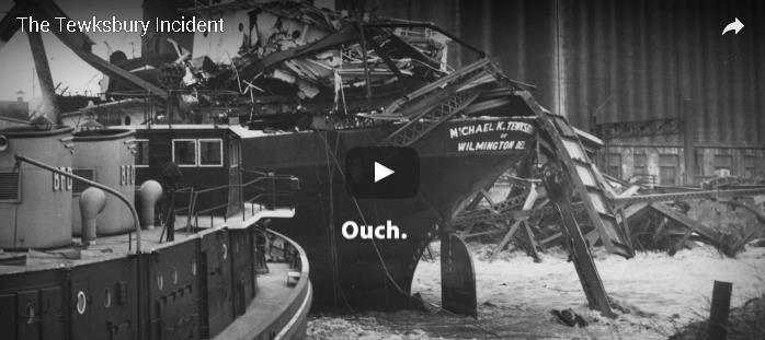
A Story Map documenting the Winter 1929 Tewksbury boat and bridge crash on the Buffalo River resulting in the flooding of a 18 neighborhood blocks in South Buffalo.

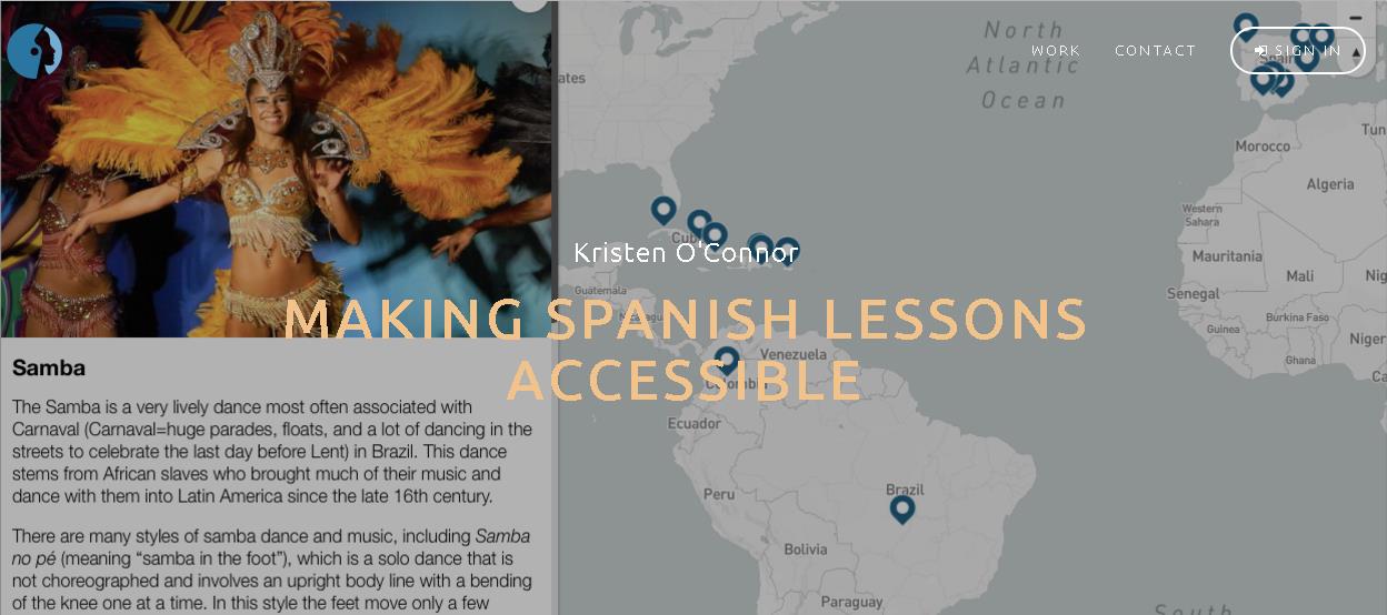
This Story Map uses a variety of multimedia which pinpoints cultural and historical features from different Spanish-speaking countries, including architectural feats, traditional dances, and tipping customs, among others. Each map utilizes Spanish phrases with English translations to bridge the gap between languages.

Software Suite

Relying on the experience he gained building systems for the last 10 years, software products used at Orbitist reflects Nick’s commitment to combining content management with interactive mapping – much of which is accomplished by integrating and combining leading Open Source components.   Currently the Orbitist mapping platform is a simple content management system which associates posts (internally called “points”) with latitude/longitude values.  The Orbitist team often uses Mapbox GL as a primary front-end mapping library but behind that everything in their system is API-driven, meaning story maps are created top of products such as Leaflet and Google Maps.  They also use Carto as a stand-alone product for building real-time analytics maps.  All combined, the Orbitist “system” also manages images and a variety of data (icon type, time of day, external links, etc.) and provides access to YouTube, Vimeo, and even Facebook for video hosting. GitHub is leveraged to host static web projects. Continue reading

2017 NYS Spring GIS Conference Specials

The last couple weeks I’ve been engaged in the following cutting-edge enterprise geospatial issues:  (1) staring at the sky on a daily basis,  (2) monitoring the temperature, and (3)  hoping the remaining snow to melt and the leaves to hold off in budding – both at the same time.  After nearly 33 years in County government and its boiled down to this! Why?  So we can get our aerial photography flown over the next 10-days to support our 2017 countywide base map update.  The heavy snow March 14th really set us back and the window to capture the photography is closing quickly.

So at any rate, its been easy to lose track of upcoming Spring 2017 regional one-day GIS conferences and meetings over the next 4-6 weeks.  Most of the Spring 2017 shows are held in locations accessible via a maximum 2-4 hour drive from furthermost parts of the Empire State, offer a wide range of geospatial topics and presentations, provide excellent networking opportunities among colleagues and industry representatives, and are generally light on the wallet.    For those unable to make or justify the big lift of getting to the uber ESRI conference in San Diego later on in the summer and/or chasing GISP certification credits these venues are for you.

Sounds sweet, right? So consider the following and get your travel approvals in order:

GIS-SIG 26rd Annual Conference, April 11th, Burgundy Basin, Pittsford, NY.  Unfortunately I cannot make GIS-SIG this year as it is one of my most favorite statewide one-day shows.  GIS/SIG provides the premier geospatial professional forum in the Rochester/Genesee Finger Lakes/Western New York region for GIS practitioners focusing on trends and policies relating to new geospatial technologies and current projects.  With a loyal following, the size and content of the GIS/SIG conference is broad enough to often substitute as an annual state conference for many GIS practitioners in the western half of the state. This year’s conference again includes vendor displays and an agenda covering topics such as mobile data collection, drones, 3D GIS, and ESRI software updates, as well as a keynote address from Dr. John R. Schott, founder of the Digital Imaging and Remote Sensing Lab at the Rochester Institute of Technology (RIT).  Corporate sponsorship keeps the price tag of an individual registration at under $100 for the day which also includes lunch. Online registration is still available and while you are at the GIS/SIG website you can also see the many resources and links GIS/SIG provides to its user community.  This is a great show and if you have the opportunity to attend. Highly recommended.

Long Island GIS (LIGIS)  2017 Spring User Conference, April 26th, SUNY Farmingdale, Farmingdale, NY.  LIGIS meetings and conferences have grown in structure and content over the last few years and this spring’s April 26th meeting will continue to illustrate the improvement among the Long Island GIS stakeholder user community.  Scheduled presentations from government, academia, and industry are on the agenda including topics covering mobile applications, MS4 data collection, 2020 Census Bureau update, and GIS & hydrofracking among others. Located in central Long Island on the SUNY Farmingdale campus, this is a not-to-miss conference on “the Island” for those with limited travel budgets.  Make plans to attend.  Those interested in attending can monitor conference specifics at the LIGIS homepage.

Northeast Arc User Group (NEARC) Meeting, May 15th, University of Massachusetts, Amherst, MA.  Spring NEARC meetings are conveniently located in Amherst, MA which is easily accessible to the Albany Capital District and GIS professionals in eastern New York State.  Unlike GIS – SIG, which is software vendor independent, this show is very much ESRI centric and packed with high quality user presentations. Even though only one day, the show has grown to be so popular that it now competes with the larger multi-day GIS shows and conferences across New England.   Price tag for attending:  $65 which includes lunch.  If you can afford an overnight, activities the evening before downtown Amherst and a hotel room at the UMass conference center make it even more worth your while. (As of the day of this blog post 4/4 the May 15th agenda was still in development; I did submit an abstract!).  Registration will open mid-April.  If your organization is an ESRI shop – this is a Spring show not to miss.

Westchester GIS User Group Meeting, May 11th, Purchase College, Purchase New York. As one of the largest geospatial meetings in New York State, the Westchester GIS User Group Meeting is a free one-day conference held at Purchase College. Made possible by financial support from exhibiting vendors and conference facilities provided by the college, the draft 2017 agenda  features user presentations from County government,  Westchester County municipalities, nonprofits including the Goodlands Project, and ESRI. There is also free conference training: At lunch “Leveraging Suvey123 for Mobile Data Collection” with instructor Larry Spraker and post-conference “Getting Started with How to Build Great Web Apps” with ESRI’s Mark Scott.   Also, sponsors get to present 5-minute “Lightning” talks over the course of the day.  The Purchase College location provides easy one-day access across the metropolitan NYC area, as well as the broader lower Hudson River Valley and southeastern Connecticut. Agenda and other meeting  specifics – including registration – are available from the Westchester County GIS website.

Other Venues:  If you are in the Metro NYC area don’t forget to check the GeoNYC Meetup calendar for ongoing meetings across the city. Subject matter and participation is pretty amazing.  And/or the many other geospatial related Meetups in the region covering big data, data visualization, agriculture mapping, and everything inbetween including drones. A little further removed geographically from the Empire State is the Northeast Geographic Information Society (NEGIS) conference on April 27th in Ashland, MA. You can follow and learn more about NEGIS via their blog.

The entire Empire State GIS community is fortunate enough to be close enough to a range of regional geospatial meetings and conferences which are accessible from most areas of the state and provide many of the same benefits of larger shows and not nearly as expensive.

Safe travels!

GIS Common Core Part 3: Health and Human Services (HHS)

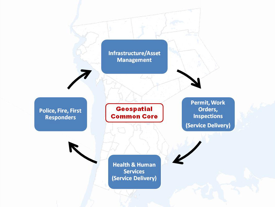
Through a sequence of articles posted in eSpatiallyNewYork, I have proposed a series of GIS applications which provide a framework for establishing and maintaining  GIS/geospatial programs in local  governments (villages, towns, cities, and counties) across  New York State.  These applications areas are referred to as the Geospatial Common Core, many of which are integrated with local government office and administrative business systems.  Others are utilized in the support of regulatory reporting programs.    Together, the Geospatial Common Core contribute towards building sustainable geospatial capacity for local governments.   This is the third installment of the series.

“GIS Common Core” application areas in New York State local governments

The first article entitled Part 1:  Infrastructure and Asset Management focused on the growing and critical role local government GIS geospatial programs continue to serve in rehabilitating and maintaining the decaying and outdated New York State – and national – public infrastructure.  The second article Part 2:  Work Orders, Permitting, and Inspections (WOPI) published in March 2016 focused on geocentric software packages which are ubiquitous in government programs supporting work flows in areas such public works, health, planning, clerk, assessment, buildings/code enforcement and inspections.  Organizations investing and integrating WOPI systems with GIS will continue to help build long-term sustainable geospatial programs in local governments.

Part 3:  Health and Human Services (HHS)

Health and human services can often be broadly defined from one location to another but for the purposes of this article it includes a wide-range of government programs including, but limited to, public health services, social services, public assistance, youth and veterans programs, disability programs, housing and homeless services, child protection services, as well as the important network of contracted service providers governments rely upon in providing counseling and related support services.  I have long been an advocate of building geospatial capacity in these local government program areas.

Why?

Statewide local government HHS budgets typically dwarf other local government operational program areas with regard to annual appropriations.  While I am not a budget analyst and admittedly it’s sometimes difficult to follow the money trail of appropriations vs. revenues vs. actual tax payer costs in county budgets, here are a few examples to illustrate the size and magnitude of HHS programs in a selected 2017 NYS county budgets (Data/information from County webpages as noted):

  1. Stuben County 2017 Budget. (Page 3).  Pie chart indicates nearly 47% of the appropriated budget dedicated to Health and  Economic Assistance/Opportunity (includes Social Service disciplines) program areas
  2. Ulster County 2017 Budget. (Pages 1 & 2). Table and pie chart indicate nearly 42% of the appropriated budget dedicated to Public Health and Economic Assistance/Opportunity program areas
  3. Erie County 2017 Budget. (Pages 93, 159, and 174). Appropriations (rounded in millions) in Health ($86M), Mental Health ($47M) and Social Services ($591M) account for almost 50% of the $1,455,000,000 recommended general fund budget.  (Note:  There are other references to the 2017 budget being closer to $1.7B). Either way, HHS budgets are a significant portion of the overall county budget
  4. Albany County 2017 Budget. (Page 34). Employee Count table lists 657 of 2,535 County employees (26%) are in the Child, Youth, and Family Services (170), Social Services (308), Mental Health (90), and Dept. of Health (89)
  5. Suffolk County 2017 Budget. (Pages 101 and 366).   Appropriations (rounded in millions) in Health Services ($249M) and Social Services ($628M) account for nearly 30% of a recommended $2.9B budget
  6. Monroe County 2017 Budget. (Pages 157 and 275).  Appropriations (rounded in millions) in Human Services ($536M) and Public Health ($62M) account for nearly 50% of an adopted $1.2B budget
  7. Continue reading

Finger Lakes Trail Conference: The Reach of Digital Mapping

As a hiker myself, I first visited the Finger Lakes Trail Conference (FLTC) website in search of information about the trail system with little knowledge of the incredible structure the organization has in place for creating and publishing hardcopy and digital maps. Thus, the genesis of this article and an overview of how FLTC makes all of the digital content come together.

Background

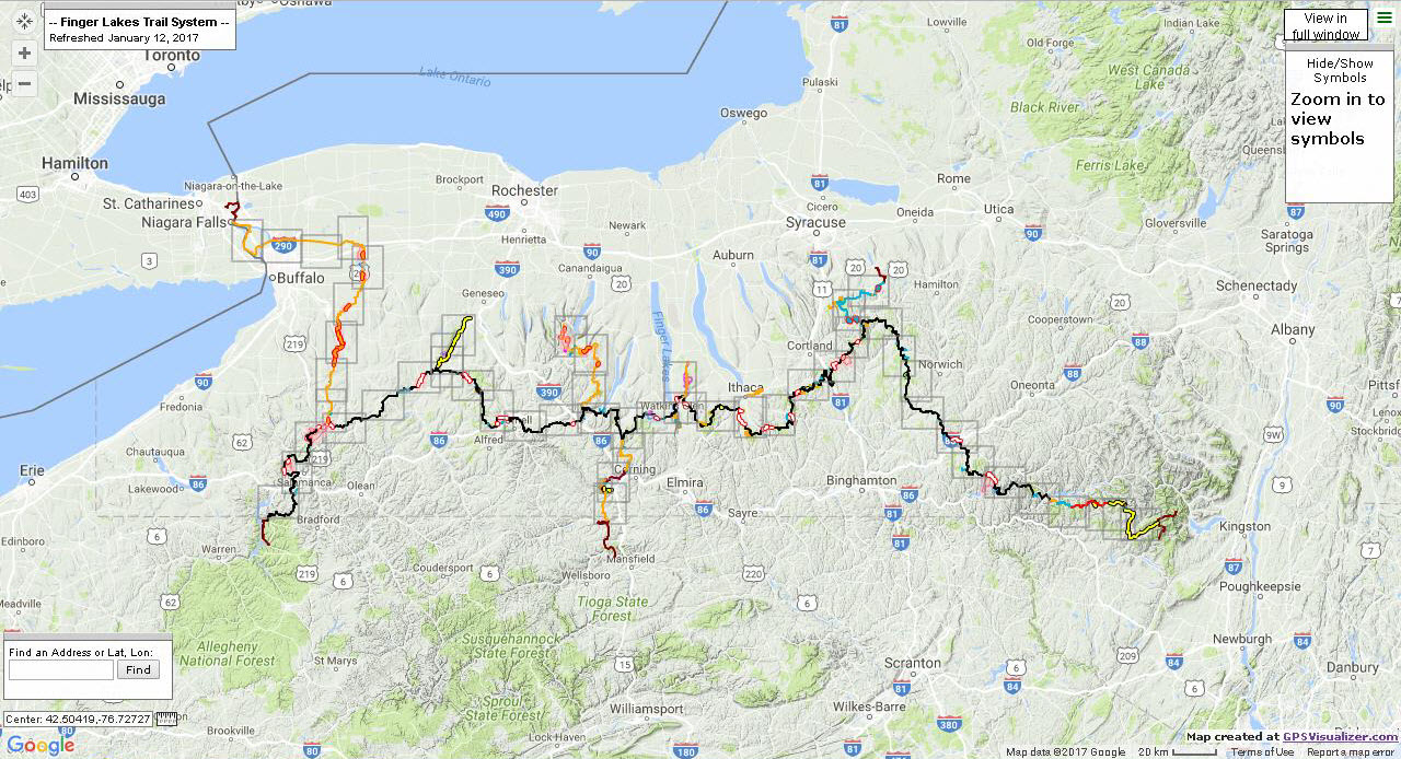
Established in 1962, the Finger Lakes Trail Conference (FLTC) mission is to “… to build, protect, enhance, and promote a continuous footpath across New York State. Forever!”  With administrative offices near the Mt. Morris Dam Visitor Center in Mt. Morris, New York, FLTC is a 501(c)3 non-profit organization which works in cooperation with its members and various organizations to develop and maintain the premier hiking trail system in New York.   The Finger Lakes Trail System includes the main Finger Lakes Trail (FLT) from the Pennsylvania-New York border in Allegany State Park to the Long Path in the Catskill Forest Preserve. The main FLT is 580 miles long. There are six branch trails and 29 loop trails and spur trails that extend from the main FLT. These branch, loop and spur trails currently total 412 miles. Including the Main Trail and all branch, loop, and side trails, the Finger Lakes Trail System offers 1,000 miles of hiking.    Today, more than 1,400 individual and family memberships currently support the FLTC  of which approximately one fourth actively volunteer to operate the organization and its programs.  The sale of maps and GPS track data help  build and maintain the trail system.

FLTC also recognizes Sponsors which are individuals or organizations which formally accept responsibility for maintaining a length of trail in the FLT System and Affiliates which are hiking clubs and Scout troops that operate their own local hiking program and sponsor (maintain) their section of the trail system. The FLTC is a Partner of the North Country Trail Association (NCTA) and cooperates with that organization and the National Park Service in maintaining and promoting that portion of the FLT that carries the North Country National Scenic Trail.  The FLTC is also a member of the Great Eastern Trail Association (GETA) and is constructing a branch trail of the FLT system (the Crystal Hills Trail) that will carry the New York portion of the Great Eastern Trail.

The Finger Lakes Trail System main trail from its eastern terminus in the Catskills to Allegany State Park in western New York State. From their interactive web application this image also show outlines of section maps which provide detail at larger scales.

Mapping and Cartography

Since the early 2000s with advancements in GPS technology and digital data collection, trail mapping responsibilities within the FLTC have been increasingly assigned to the Trail System Management program within the organization.   Within this structure, the mapping of new and/or changes to trails fall on the responsibilities of volunteers trained in use of  GPS devices – either their own Garmin device or an FLTC-owned Garmin Montana.  FLTC maintains  detailed specifications on what GPS devices are acceptable and how they are to be configured.  The GPX file from the walk is emailed to the mapping team which is currently under the direction of Greg Farnham and Jo Taylor).    Following a very detailed process document, the mapping team uses Garmin Basecamp to edit the official, unfiltered GPX track, which is referred to as the “trail centerline”.    There is adequate iteration with the person who walked the trail and the  Regional Trail Coordinator (RTC) overseeing that section of the trail where the data is being collected to ensure an accurate rendition of the (trail) data has been collected.  Regional Trail Coordinators and other FLTC administrative positions are highlighted on the organizational chart on their website. Continue reading

2017 GeoCon Wish List: Part 1

I first wanted to publish this article initially as a wish list to the GIS Santa Claus in early December, but the holidays came and went so I am now submitting it as a New Year’s wish list (Part 1) for the 2017 GeoCon  in Lake Placid.  There will  be other suggestions over the next several months and I’ll remain cognizant  what I wish for as I may be submitting an abstract to present myself.  Maybe.

So to start the discussion, here is an initial list of  ten geospatial mapping applications and program areas I’d like to send a speaker invite to for the 2017 GeoCon – and why.

NYS Office of the Attorney General:  New York Crime Gun Analysis https://targettrafficking.ag.ny.gov/tool/

While mapping continues to be one of the primary end products of GIS analysis, geospatial data is increasingly being used in a wide range of data visualization platforms such as Tableau.    I’d welcome the opportunity to attend a presentation by the Office of the Attorney on the Crime Gun Analysis report outlining data collection, data analysis, and the rendering of the data through maps, tables, and charts.  Not the normal GIS menu.

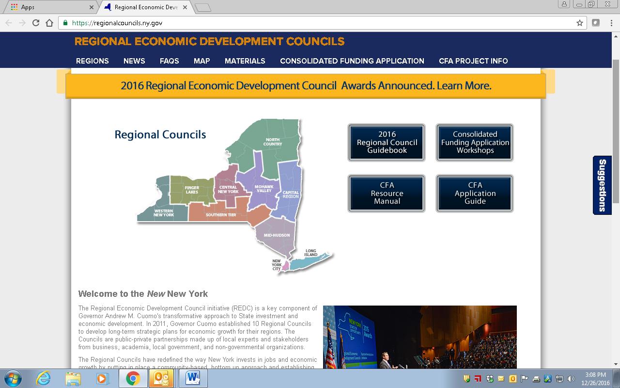
New York State Regional Economic Development Councils (REDC) http://regionalcouncils.ny.gov/

In context of geospatial, this program reference isn’t so much about “what it is”, as opposed to more about “what it isn’t”.  Or at least I think.  From my level, the REDC framework has always been somewhat of a mystery since current state administration created the 10 Regional Councils in 2011.  And even more confusing that the geography of the REDCs do not coincide with the statewide Regional Planning Commission boundaries. That said, there is an incredible amount of geospatial information and analysis in the Council’s underlying mission.  Everything happens somewhere.  And there is a ton of money coming through the Consolidated Funding Application (CFA) process which I believe the GIS community should be more engaged and recipients of to some degree. Uber opportunities for web mapping applications, Story Maps, and GIS-produced maps for publications though one would be hard pressed to see any real evidence of a professional GIS touch in any of the Council products and services.   I looked through four regional 2016 “progress” reports (Hudson Valley, Finger Lakes, Capital Region and Southern Tier and found very limited reference to GIS/geospatial technologies.   Some kind of presentation by one of the REDCs and/or regional GIS personnel involved in this program would be most informative for the statewide GIS community.  Otherwise I doubt we’re going to hear anything through the state GIS program office on this.

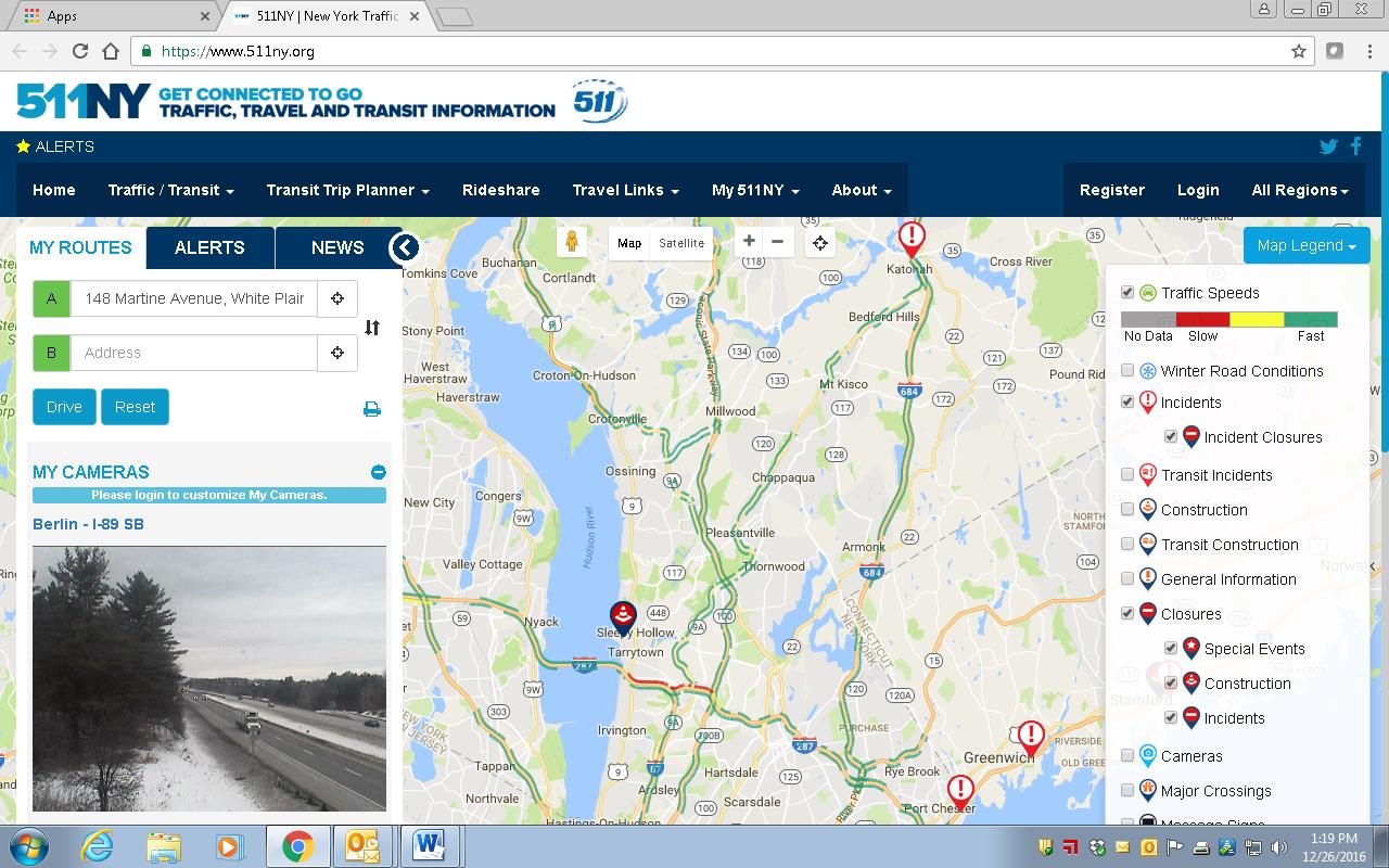
511NY
https://www.511ny.org/

This is more of a selfish request than anything because I really don’t fully understand the makings and how 511NY operates in context of GIS/geospatial data collection, sources, work flows, or even development of their applications including the online mapping stuff.  I do know it’s big, visible, seemingly growing in functionality, supported by a mess of New York State transportation agencies -even though it has its own .org web address.  It also creates a lot of data which would be useful to consume and use in local government web mapping applications.   I’d be the first one to sign up to hear how it all comes together, funding, sources of the data (including what is being taken from and/or generated at the local level), opportunities for collaboration with local GIS programs, and what’s next.  How long before we see an Uber icon on the 511NY homepage to help support trip planning?

Continue reading