
Cattaraugus County and Allegany State Park Share Resources and Vision
While GIS as a shared service as part of Governor Cuomo’s County-Wide Shared Services Initiative (CWSSI) has yet to take hold in a broad context across local governments in the Empire State, the statewide GIS community does have a great example to highlight how local governments can collaborate with a state agency in sharing geospatial technology. Case in point: The Allegany State Park Interactive Map viewer.
Located in Cattaraugus County in western New York abutting the Pennsylvania state line and north of the Allegheny National Forest, Allegany State Park was created in 1921 and encompasses nearly 64,800 acres. A major western New York State tourist attraction – the park averages 1.5 million annually – the park offers a wide range of four-reason recreation activities and lies within the Alleghany Highlands Forests ecoregion. The idea of a joint effort between Cattaraugus County and Allegany State Park online map viewer idea goes back as far as 2010 as part of a discussion between Daniel T. Martonis, who at the time was GIS Manager for the County and Tom Livak who was then Director of Economic Development, Planning & Tourism.
The initial viewer was more emergency services focused with the collection of infrastructure data and intended for use by park staff only – nothing external. Most of the data was collected by Dan and Tom, including Chris Holewinski – the current Cattaraugus GIS Manager – using various Trimble GPS units as well as utilizing old engineering maps. The trio even brought out metal detectors to pick up the locations of pipes. At the time, Dan was building web mapping applications with ArcIMS that Dan mentions was not “people friendly” and was ultimately discontinued by ESRI. Along the way, though, both Dan and Tom knew they were beginning to frame a web mapping product which would be of great value to both the County and ASP. ArcGIS Online began to emerge as a more functional and adaptable web mapping platform providing additional opportunities for the two government programs to build upon what had been started.
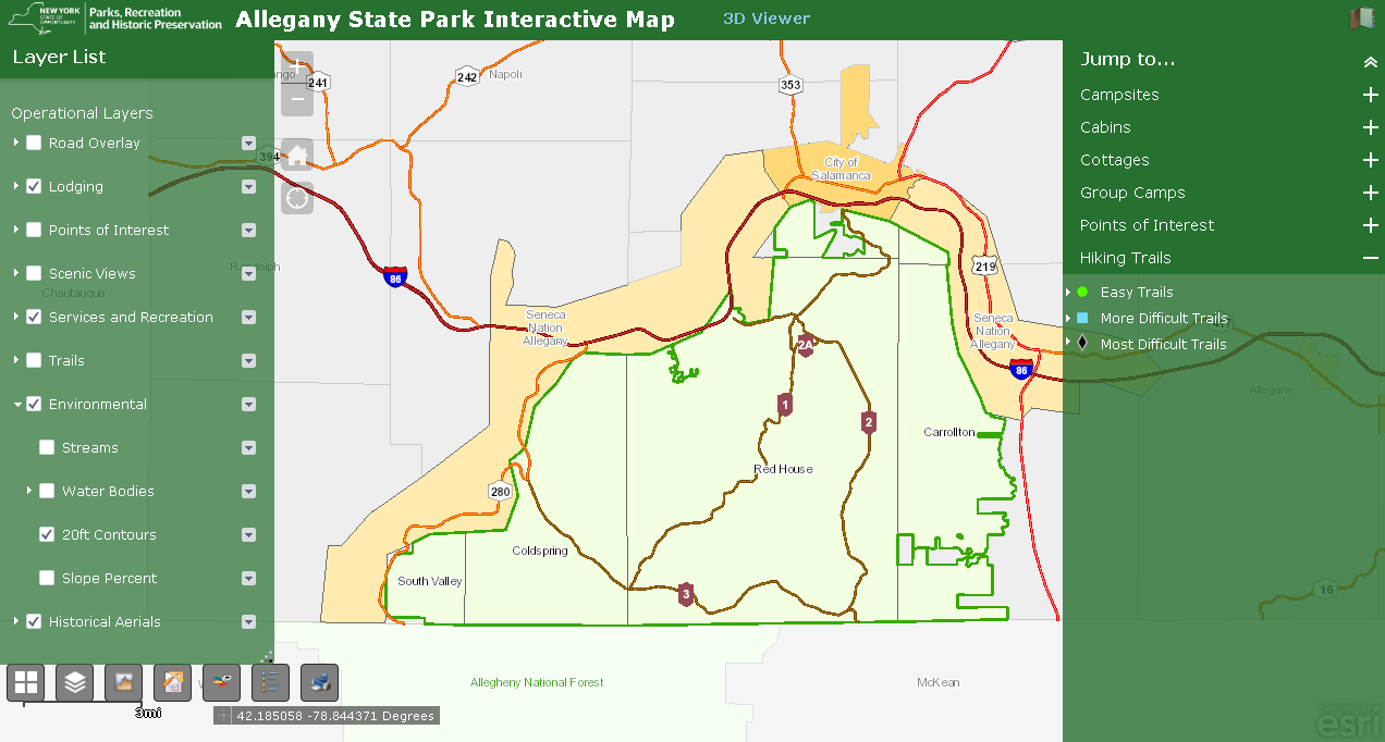
The ASP viewer represents the ongoing collaboration between Cattaraugus County and Allegany State Park. It provides easy to use access to a facility, environmental, and cultural data including historic aerial photography.